

LOIS ANN L MORAN
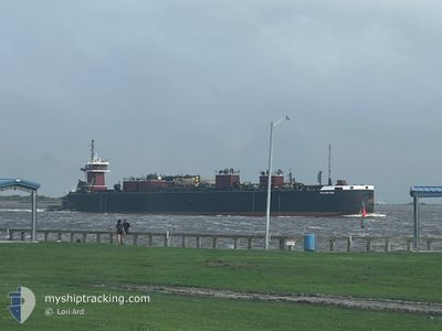
Articulated Pusher Tug

Current Trip
US SNJ
| Time Travelled | 6 h, 26 mins |
|---|---|
| Remaining Time | --- |
| Distance Travelled | 22.78 nm |
| Remaining Distance | --- |
| AVG Speed | 9.3 Knots |
| MAX Speed | 10.6 Knots |
| AVG Wind | 11.1 knots |
| MAX Wind | 12.8 knots |
| MIN Temp | 20°C / 68°F |
| MAX Temp | 23.8°C / 74.84°F |
| Draught | 5.2 m |
| Position Received | 1 d ago |
Current Position
| Longitude | --- |
|---|---|
| Latitude | --- |
| Status | Pushing Ahead - Towing |
| Speed | |
| Course | 345° |
| Area | Gulf of Mexico |
| Station | T-AIS |
| Position Received | 1 d ago |
Information
The current position of LOIS ANN L MORAN is in Gulf of Mexico with coordinates 30.71457° / -88.03767° as reported on 2025-03-26 21:32 by AIS to our vessel tracker app. The vessel's current speed is 0 Knots
The vessel LOIS ANN L MORAN (IMO: 9415777, MMSI: 368468000) is a Articulated Pusher Tug that was built in 2009 ( 16 years old ). It's sailing under the flag of [US] USA.
In this page you can find informations about the vessels current position, last detected port calls, and current voyage information. If the vessels is not in coverage by AIS you will find the latest position.
The current position of LOIS ANN L MORAN is detected by our AIS receivers and we are not responsible for the reliability of the data. The last position was recorded while the vessel was in Coverage by the Ais receivers of our vessel tracking app.
The current draught of LOIS ANN L MORAN as reported by AIS is 5.2 meters
Weather
| Temperature | 20.3°C / 68.54°F |
|---|---|
| Wind Speed | 12 knots |
| Direction | 118° ESE |
| Pressure | 1022.1 hPa |
| Humidity | 76.3 % |
| Cloud Coverage | 100 % |


Featured Company
Last Port Calls
| Port | Arrival | Departure | Time In Port |
|---|---|---|---|
| 2025-03-26 14:12 | 2025-03-27 12:56 | 22 h | |
| 2025-03-23 14:23 | 2025-03-24 12:39 | 22 h | |
| 2025-03-18 01:48 | 2025-03-18 17:35 | 15 h | |
| 2025-03-17 00:56 | 2025-03-17 02:20 | 1 h | |
| 2025-03-16 04:52 | 2025-03-16 20:20 | 15 h | |
| 2025-03-14 20:31 | 2025-03-16 00:24 | 1 d | |
| 2025-03-12 17:35 | 2025-03-13 15:52 | 22 h | |
| 2025-03-09 16:08 | 2025-03-09 16:20 | 11 m | |
| 2025-03-02 18:32 | 2025-03-05 09:35 | 2 d | |
| 2025-02-28 18:35 | 2025-03-01 11:20 | 16 h |
Most Visited Ports (Last year)
| Port | Arrivals | |
|---|---|---|
| 48 | ||
| 43 | ||
| 34 | ||
| 28 | ||
| 12 | ||
| 2 |
Last Trips
| Origin | Departure | Destination | Arrival | Distance | |
|---|---|---|---|---|---|
| 2025-03-24 12:39 | 2025-03-26 14:12 | 503.95 nm | |||
| 2025-03-18 17:35 | 2025-03-23 14:23 | 506.95 nm | |||
| 2025-03-17 02:20 | 2025-03-18 01:48 | 233.47 nm | |||
| 2025-03-16 20:20 | 2025-03-17 00:56 | 59.59 nm | |||
| 2025-03-16 00:24 | 2025-03-16 04:52 | 29.39 nm | |||
| 2025-03-13 15:52 | 2025-03-14 20:31 | 250.63 nm | |||
| 2025-03-09 16:20 | 2025-03-12 17:35 | 505.94 nm | |||
| 2025-03-05 09:35 | 2025-03-09 16:08 | 434.78 nm | |||
| 2025-03-01 11:20 | 2025-03-02 18:32 | 233.33 nm | |||
| 2025-02-24 18:23 | 2025-02-28 18:35 | 508.33 nm |
Events
| Time | Event | Details | Position / Dest | Info |
|---|---|---|---|---|
| 2025-03-27 20:32 | STOP Moving | 2.73 nm, East of DAUPHIN ISLAND |
30.23639 / -88.03171
US SNJ
|
Speed: 0.2 kn Course: 144° |
| 2025-03-27 17:56 | PORT DEPARTURE |
|
30.62138 / -88.03298
US SNJ
|
Speed: 10.9 kn Course: 182° |
| 2025-03-27 17:12 | START Moving |
30.71256 / -88.03909
[US] MOBILE
|
Speed: 4.6 kn Course: 177° |
|
| 2025-03-26 22:22 | Destination Changed | US SNJ US MOBILE |
30.71458 / -88.03769
[US] MOBILE
|
Speed: Course: 346° |
| 2025-03-26 22:22 | ETA Changed | 2025/03/29 07:00 |
30.71458 / -88.03769
[US] MOBILE
|
Speed: Course: 346° |
| 2025-03-26 21:42 | Status Changed | Default Pushing Ahead - Towing |
30.71461 / -88.03772
[US] MOBILE
|
Speed: Course: 345° |
| 2025-03-26 21:32 | OUT of Coverage |
30.71457 / -88.03767
Gulf of Mexico
[US] MOBILE
|
Speed: Course: 31.4° |
|
| 2025-03-26 21:18 | Status Changed | Pushing Ahead - Towing Default |
30.71463 / -88.03769
[US] MOBILE
|
Speed: Course: 345° |
| 2025-03-26 21:16 | Status Changed | Default Pushing Ahead - Towing |
30.71462 / -88.03770
[US] MOBILE
|
Speed: Course: 345° |
| 2025-03-26 20:05 | STOP Moving |
30.71428 / -88.03804
[US] MOBILE
|
Speed: 0.1 kn Course: 353° |