

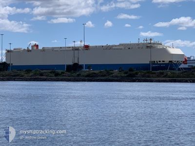
LIBERTY ACE
Vehicles Carrier

Current Trip
| Time Travelled | 1 day |
|---|---|
| Remaining Time | --- |
| Distance Travelled | 755.41 nm |
| Remaining Distance | --- |
| AVG Speed | 15.5 Knots |
| MAX Speed | 19.6 Knots |
| AVG Wind | 10 knots |
| MAX Wind | 20.5 knots |
| MIN Temp | 14.4°C / 57.92°F |
| MAX Temp | 23°C / 73.4°F |
| Draught | 9.2 m |
| Position Received | 1 d ago |
Current Position
| Longitude | --- |
|---|---|
| Latitude | --- |
| Status | Under way using engine |
| Speed | 17 Knots |
| Course | 120.4° |
| Area | North Atlantic Ocean |
| Station | T-AIS |
| Position Received | 1 d ago |
Information
The current position of LIBERTY ACE is in North Atlantic Ocean with coordinates 30.52298° / -80.02388° as reported on 2025-03-26 10:03 by AIS to our vessel tracker app. The vessel's current speed is 17 Knots and is heading at the port of DURBAN. The estimated time of arrival as calculated by MyShipTracking vessel tracking app is 2025-04-12 10:00 LT
The vessel LIBERTY ACE (IMO: 9293650, MMSI: 431554000) is a Vehicles Carrier that was built in 2004 ( 21 years old ). It's sailing under the flag of [JP] Japan.
In this page you can find informations about the vessels current position, last detected port calls, and current voyage information. If the vessels is not in coverage by AIS you will find the latest position.
The current position of LIBERTY ACE is detected by our AIS receivers and we are not responsible for the reliability of the data. The last position was recorded while the vessel was in Coverage by the Ais receivers of our vessel tracking app.
The current draught of LIBERTY ACE as reported by AIS is 9.2 meters
Weather
| Temperature | 22.1°C / 71.78°F |
|---|---|
| Wind Speed | 20 knots |
| Direction | 35° NE |
| Pressure | 1020.1 hPa |
| Humidity | 78 % |
| Cloud Coverage | 41 % |


Featured Company
Last Port Calls
| Port | Arrival | Departure | Time In Port |
|---|---|---|---|
| 2025-03-25 06:00 | 2025-03-25 23:48 | 17 h | |
| 2025-03-23 17:30 | 2025-03-24 17:32 | 1 d | |
| 2025-03-18 19:43 | 2025-03-20 14:09 | 1 d | |
| 2025-03-17 14:42 | 2025-03-18 19:25 | 1 d | |
| 2025-03-15 20:35 | 2025-03-16 17:26 | 20 h | |
| 2025-03-13 10:34 | 2025-03-13 18:27 | 7 h | |
| 2025-02-28 05:08 | 2025-02-28 21:35 | 16 h | |
| 2025-02-11 06:29 | 2025-02-11 16:01 | 9 h | |
| 2025-02-10 07:09 | 2025-02-10 17:13 | 10 h | |
| 2025-02-08 06:49 | 2025-02-09 06:57 | 1 d |
Most Visited Ports (Last year)
| Port | Arrivals | |
|---|---|---|
| 3 | ||
| 3 | ||
| 3 | ||
| 2 | ||
| 2 | ||
| 2 |
Last Trips
| Origin | Departure | Destination | Arrival | Distance | |
|---|---|---|---|---|---|
| 2025-03-24 17:32 | 2025-03-25 06:00 | 163.58 nm | |||
| 2025-03-20 14:09 | 2025-03-23 17:30 | 675.19 nm | |||
| 2025-03-18 19:25 | 2025-03-18 19:43 | 0.95 nm | |||
| 2025-03-16 17:26 | 2025-03-17 14:42 | 259.39 nm | |||
| 2025-03-13 18:27 | 2025-03-15 20:35 | 781.89 nm | |||
| 2025-02-28 21:35 | 2025-03-13 10:34 | 3280.72 nm | |||
| 2025-02-11 16:01 | 2025-02-28 05:08 | 7343.89 nm | |||
| 2025-02-10 17:13 | 2025-02-11 06:29 | 114.22 nm | |||
| 2025-02-09 06:57 | 2025-02-10 07:09 | 223.58 nm | |||
| 2025-02-08 00:13 | 2025-02-08 06:49 | 95.42 nm |
Events
| Time | Event | Details | Position / Dest | Info |
|---|---|---|---|---|
| 2025-03-26 10:08 | Status Changed | Default Under way using engine |
30.51116 / -80.00081
US SSI>ZA DUR
|
Speed: 17 kn Course: 120.4° |
| 2025-03-26 10:03 | OUT of Coverage |
30.52298 / -80.02388
North Atlantic Ocean
US SSI>ZA DUR
|
Speed: 17 kn Course: 120.4° |
|
| 2025-03-26 10:00 | Status Changed | Under way using engine Default |
30.53099 / -80.03946
US SSI>ZA DUR
|
Speed: 17.1 kn Course: 121° |
| 2025-03-26 09:52 | Status Changed | Default Under way using engine |
30.55042 / -80.07693
US SSI>ZA DUR
|
Speed: 18 kn Course: 111.8° |
| 2025-03-26 08:58 | Status Changed | Under way using engine Default |
30.67783 / -80.35452
US SSI>ZA DUR
|
Speed: 18.1 kn Course: 117° |
| 2025-03-26 08:56 | Status Changed | Default Under way using engine |
30.68259 / -80.36547
US SSI>ZA DUR
|
Speed: 18 kn Course: 112.8° |
| 2025-03-26 08:34 | Destination Changed | US SSI>ZA DUR ZADUR |
30.72616 / -80.48149
US SSI>ZA DUR
|
Speed: 18 kn Course: 113.8° |
| 2025-03-26 04:59 | ETA Changed | 2025/04/12 08:00 2025/04/12 10:00 |
31.03411 / -81.22558
ZADUR
|
Speed: 7.3 kn Course: 138.3° |
| 2025-03-26 03:48 | PORT DEPARTURE |
|
31.10893 / -81.46472
ZADUR
|
Speed: 12.8 kn Course: 113° |
| 2025-03-26 03:27 | START Moving |
31.13184 / -81.53325
[US] BRUNSWICK
|
Speed: 4.1 kn Course: 113° |