

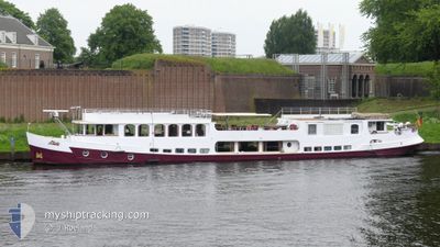
LIBERTE
Passenger

Current Trip
| Time Travelled | 5 h, 52 mins |
|---|---|
| Remaining Time | --- |
| Distance Travelled | 18.87 nm |
| Remaining Distance | --- |
| AVG Speed | 5.7 Knots |
| MAX Speed | 7.3 Knots |
| AVG Wind | 6.6 knots |
| MAX Wind | 8 knots |
| MIN Temp | 4.8°C / 40.64°F |
| MAX Temp | 14.9°C / 58.82°F |
| Draught | 1.2 m |
| Position Received | 2 m ago |
Current Position
| Longitude | --- |
|---|---|
| Latitude | --- |
| Status | Under way using engine |
| Speed | 6.5 Knots |
| Course | 73.3° |
| Area | North Sea |
| Station | T-AIS |
| Position Received | 2 m ago |
Information
The current position of LIBERTE is in North Sea with coordinates 52.33470° / 11.80455° as reported on 2025-04-26 11:00 by AIS to our vessel tracker app. The vessel's current speed is 6.5 Knots and is heading at the port of BERLIN. The estimated time of arrival as calculated by MyShipTracking vessel tracking app is 2025-04-29 18:00 LT
The vessel LIBERTE (MMSI: 211553550) is a Passenger It's sailing under the flag of [DE] Germany.
In this page you can find informations about the vessels current position, last detected port calls, and current voyage information. If the vessels is not in coverage by AIS you will find the latest position.
The current position of LIBERTE is detected by our AIS receivers and we are not responsible for the reliability of the data. The last position was recorded while the vessel was in Coverage by the Ais receivers of our vessel tracking app.
The current draught of LIBERTE as reported by AIS is 1.2 meters
Weather
| Temperature | 14.1°C / 57.38°F |
|---|---|
| Wind Speed | 8 knots |
| Direction | 98° E |
| Pressure | 1025.1 hPa |
| Humidity | 52.2 % |
| Cloud Coverage | 3 % |


Featured Company
Last Port Calls
Last Trips
| Origin | Departure | Destination | Arrival | Distance | |
|---|---|---|---|---|---|
| 2025-04-17 10:16 | 2025-04-25 14:24 | 166.36 nm | |||
| 2025-04-09 07:47 | 2025-04-16 14:53 | 107.72 nm | |||
| 2025-03-31 11:00 | 2025-04-08 14:12 | 121.46 nm | |||
| 2025-03-27 08:17 | 2025-03-30 14:43 | 76.14 nm |
Events
| Time | Event | Details | Position / Dest | Info |
|---|---|---|---|---|
| 2025-04-26 10:01 | START Moving | 8.4 nm, North East of MAGDEBURG |
52.25019 / 11.73762
BERLIN
|
Speed: 3.8 kn Course: 306° |
| 2025-04-26 09:54 | STOP Moving | 8.39 nm, North East of MAGDEBURG |
52.24928 / 11.74027
BERLIN
|
Speed: Course: 511° |
| 2025-04-26 09:42 | START Moving | 8.09 nm, North East of MAGDEBURG |
52.24306 / 11.74231
BERLIN
|
Speed: 4.1 kn Course: 55.1° |
| 2025-04-26 09:15 | STOP Moving | 7.95 nm, North East of MAGDEBURG |
52.24150 / 11.73899
BERLIN
|
Speed: 0.3 kn Course: 511° |
| 2025-04-26 08:55 | START Moving | 6.92 nm, North of MAGDEBURG |
52.23150 / 11.70767
BERLIN
|
Speed: 3.3 kn Course: 82.4° |
| 2025-04-26 07:41 | STOP Moving | 6.87 nm, North of MAGDEBURG |
52.23122 / 11.70458
BERLIN
|
Speed: 0.3 kn Course: 511° |
| 2025-04-26 07:24 | START Moving | 7.84 nm, North East of MAGDEBURG |
52.24026 / 11.73630
BERLIN
|
Speed: 4.3 kn Course: 229.3° |
| 2025-04-26 07:03 | STOP Moving | 7.95 nm, North East of MAGDEBURG |
52.24144 / 11.73877
BERLIN
|
Speed: 0.2 kn Course: 511° |
| 2025-04-26 05:11 | PORT DEPARTURE |
|
52.15069 / 11.66809
BERLIN
|
Speed: 7.9 kn Course: 36.7° |
| 2025-04-26 05:01 | START Moving |
52.13516 / 11.65293
[DE] MAGDEBURG
|
Speed: 5.2 kn Course: 33.9° |