
LIBERA
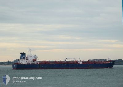
Oil/Chemical Tanker
Current Trip
| Time Travelled | 13 days |
|---|---|
| Remaining Time | 11 h, 26 mins |
| Distance Travelled | 2552.59 nm |
| Remaining Distance | 139.33 nm |
| AVG Speed | 10.3 Knots |
| MAX Speed | 15.5 Knots |
| AVG Wind | 14.1 knots |
| MAX Wind | 25 knots |
| MIN Temp | 11.8°C / 53.24°F |
| MAX Temp | 31.8°C / 89.24°F |
| Draught | 7.3 m |
| Position Received | Now |
Current Position
| Longitude | --- |
|---|---|
| Latitude | --- |
| Status | Under way using engine |
| Speed | 12.3 Knots |
| Course | 34° |
| Area | Mediterranean Sea - Western Basin |
| Station | T-AIS |
| Position Received | Now |
Info
Information
The current position of LIBERA is in Mediterranean Sea - Western Basin with coordinates 37.90795° / -0.20097° as reported on 2025-12-08 19:36 by AIS to our vessel tracker app. The vessel's current speed is 12.3 Knots and is heading at the port of CASTELLON. The estimated time of arrival as calculated by MyShipTracking vessel tracking app is 2025-12-09 08:03 LT
The vessel LIBERA (IMO: 9293973, MMSI: 256209000) is a Oil/Chemical Tanker that was built in 2006 ( 19 years old ). It's sailing under the flag of [MT] Malta.
In this page you can find informations about the vessels current position, last detected port calls, and current voyage information. If the vessels is not in coverage by AIS you will find the latest position.
The current position of LIBERA is detected by our AIS receivers and we are not responsible for the reliability of the data. The last position was recorded while the vessel was in Coverage by the Ais receivers of our vessel tracking app.
The current draught of LIBERA as reported by AIS is 7.3 meters
Weather
| Temperature | 17°C / 62.6°F |
|---|---|
| Wind Speed | 10 knots |
| Direction | 216° SW |
| Pressure | 1022 hPa |
| Humidity | 78.5 % |
| Cloud Coverage | --- |
Featured Company
Events
| Time | Event | Details | Position / Dest | Info |
|---|---|---|---|---|
| 2025-12-08 16:25 | ETA Changed | 2025/12/09 07:00 2025/12/09 05:00 |
37.41328 / -.68708
ESCAS
|
Speed: 11.6 kn Course: 46° |
| 2025-12-08 14:18 | Status Changed | Under way using engine Default |
37.13893 / -1.07447
ESCAS
|
Speed: 11.7 kn Course: 47° |
| 2025-12-08 13:39 | Status Changed | Default Under way using engine |
37.05179 / -1.19433
ESCAS
|
Speed: 11.8 kn Course: 46° |
| 2025-12-08 13:02 | Status Changed | Under way using engine Default |
36.96153 / -1.31662
ESCAS
|
Speed: 13.6 kn Course: 47° |
| 2025-12-08 12:57 | Status Changed | Default Under way using engine |
36.94847 / -1.33493
ESCAS
|
Speed: 13.3 kn Course: 47° |
| 2025-12-08 12:52 | Status Changed | Under way using engine Default |
36.93680 / -1.35130
ESCAS
|
Speed: 12.4 kn Course: 49° |
| 2025-12-08 12:25 | Status Changed | Default Under way using engine |
36.87736 / -1.43642
ESCAS
|
Speed: 11.2 kn Course: 49° |
| 2025-12-08 12:18 | Status Changed | Under way using engine Default |
36.86372 / -1.45668
ESCAS
|
Speed: 11.1 kn Course: 50° |
| 2025-12-08 11:54 | Status Changed | Default Under way using engine |
36.81580 / -1.52737
ESCAS
|
Speed: 11 kn Course: 49° |
| 2025-12-08 11:40 | Status Changed | Under way using engine Default |
36.78693 / -1.56970
ESCAS
|
Speed: 11.1 kn Course: 49° |