
LEA
Tanker D
Current Trip
| Time Travelled | 18 mins |
|---|---|
| Remaining Time | --- |
| Distance Travelled | 0.17 nm |
| Remaining Distance | --- |
| AVG Speed | 6.7 Knots |
| MAX Speed | 7.1 Knots |
| AVG Wind | 1 knots |
| MAX Wind | 1 knots |
| MIN Temp | 1.8°C / 35.24°F |
| MAX Temp | 1.8°C / 35.24°F |
| Draught | 2.1 m |
| Position Received | 1 m ago |
Current Position
| Longitude | --- |
|---|---|
| Latitude | --- |
| Status | Under way using engine |
| Speed | 7.3 Knots |
| Course | 322.2° |
| Area | North Sea |
| Station | T-AIS |
| Position Received | 1 m ago |
Info
Information
The current position of LEA is in North Sea with coordinates 49.99776° / 8.28638° as reported on 2025-12-29 10:23 by AIS to our vessel tracker app. The vessel's current speed is 7.3 Knots
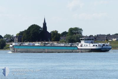
The vessel LEA (MMSI: 211472260) is a Tanker D It's sailing under the flag of [DE] Germany.
In this page you can find informations about the vessels current position, last detected port calls, and current voyage information. If the vessels is not in coverage by AIS you will find the latest position.
The current position of LEA is detected by our AIS receivers and we are not responsible for the reliability of the data. The last position was recorded while the vessel was in Coverage by the Ais receivers of our vessel tracking app.
The current draught of LEA as reported by AIS is 2.1 meters
Weather
| Temperature | 1.7°C / 35.06°F |
|---|---|
| Wind Speed | 1 knots |
| Direction | 271° W |
| Pressure | 1024.7 hPa |
| Humidity | 42.1 % |
| Cloud Coverage | 8 % |
Featured Company
Last Port Calls
| Port | Arrival | Departure | Time In Port |
|---|---|---|---|
| 2025-12-29 10:35 | 2025-12-29 11:06 | 31 m | |
| 2025-12-28 16:20 | 2025-12-29 08:58 | 16 h | |
| 2025-12-28 13:53 | 2025-12-28 14:29 | 35 m | |
| 2025-12-23 18:42 | 2025-12-24 06:46 | 12 h | |
| 2025-12-23 11:00 | 2025-12-23 14:04 | 3 h | |
| 2025-12-22 21:25 | 2025-12-23 07:38 | 10 h | |
| 2025-12-22 10:45 | 2025-12-22 12:05 | 1 h | |
| 2025-12-20 22:18 | 2025-12-21 13:40 | 15 h | |
| 2025-12-19 20:17 | 2025-12-20 22:16 | 1 d | |
| 2025-12-19 17:22 | 2025-12-19 18:07 | 45 m |
Most Visited Ports (Last year)
| Port | Arrivals | |
|---|---|---|
| 25 | ||
| 18 | ||
| 9 | ||
| 8 | ||
| 8 | ||
| 8 |
Last Trips
| Origin | Departure | Destination | Arrival | Distance | |
|---|---|---|---|---|---|
| 2025-12-29 08:58 | 2025-12-29 10:35 | 2.67 nm | |||
| 2025-12-28 14:29 | 2025-12-28 16:20 | 9.18 nm | |||
| 2025-12-24 06:46 | 2025-12-28 13:53 | 209.07 nm | |||
| 2025-12-23 14:04 | 2025-12-23 18:42 | 22.15 nm | |||
| 2025-12-23 07:38 | 2025-12-23 11:00 | 18.54 nm | |||
| 2025-12-22 12:05 | 2025-12-22 21:25 | 56.10 nm | |||
| 2025-12-21 13:40 | 2025-12-22 10:45 | 63.79 nm | |||
| 2025-12-20 22:16 | 2025-12-20 22:18 | 0.53 nm | |||
| 2025-12-19 18:07 | 2025-12-19 20:17 | 18.34 nm | |||
| 2025-12-19 06:56 | 2025-12-19 17:22 | 119.08 nm |
Events
| Time | Event | Details | Position / Dest | Info |
|---|---|---|---|---|
| 2025-12-29 10:19 | Draught Changed | 2.1 1.3 |
49.99417 / 8.29464
GENT
|
Speed: 6.4 kn Course: 270° |
| 2025-12-29 10:19 | Destination Changed | GENT HOECHST |
49.99417 / 8.29464
GENT
|
Speed: 6.4 kn Course: 270° |
| 2025-12-29 10:19 | ETA Changed | 2026/01/01 18:00 2025/12/28 18:00 |
49.99417 / 8.29464
GENT
|
Speed: 6.4 kn Course: 270° |
| 2025-12-29 10:06 | PORT DEPARTURE |
|
49.99417 / 8.29464
HOECHST
|
Speed: 4.1 kn Course: 280.5° |
| 2025-12-29 09:35 | PORT ARRIVAL |
|
49.99855 / 8.34571
[DE] BISCHOFSHEIM
|
Speed: 6.4 kn Course: 228.7° |
| 2025-12-29 09:06 | IN Coverage |
49.99900 / 8.41380
North Sea
|
Speed: 6.4 kn Course: 228.7° |
|
| 2025-12-29 07:58 | PORT DEPARTURE |
|
49.99936 / 8.41442
HOECHST
|
Speed: Course: -1° |
| 2025-12-29 07:19 | Status Changed | Default Moored |
50.09049 / 8.53601
[DE] HOCHST
|
Speed: Course: 511° |
| 2025-12-29 07:16 | OUT of Coverage |
50.09048 / 8.53601
North Sea
[DE] HOCHST
|
Speed: Course: 47.6° |
|
| 2025-12-29 05:52 | IN Coverage |
50.09048 / 8.53601
North Sea
[DE] HOCHST
|
Speed: Course: 47.6° |