

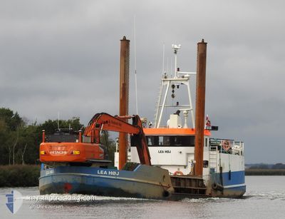
LEA HOEJ
Dredging or underwater ops

Current Trip
| Trip Time | 3 h, 36 mins |
|---|---|
| Trip Distance | 3.05 nm |
| AVG Speed | 4.5 Knots |
| MAX Speed | 5.7 Knots |
| Draught | 1.8 m |
| AVG Wind | 6.4 knots |
| MAX Wind | 7.1 knots |
| MIN Temp | -1.6°C / 29.12°F |
| MAX Temp | -0.6°C / 30.92°F |
| Position Received | 1 m ago |
Current Position
| Longitude | --- |
|---|---|
| Latitude | --- |
| Status | Under way using engine |
| Speed | |
| Course | 356° |
| Area | Kattegat |
| Station | T-AIS |
| Position Received | 1 m ago |
Information
The current position of LEA HOEJ is in Kattegat with coordinates 56.11652° / 12.60351° as reported on 2025-02-18 21:24 by AIS to our vessel tracker app. The vessel's current speed is 0 Knots and is currently inside the port of DOMSTEN.
The vessel LEA HOEJ (MMSI: 219007572) is a Dredging or underwater ops It's sailing under the flag of [DK] Denmark.
In this page you can find informations about the vessels current position, last detected port calls, and current voyage information. If the vessels is not in coverage by AIS you will find the latest position.
The current position of LEA HOEJ is detected by our AIS receivers and we are not responsible for the reliability of the data. The last position was recorded while the vessel was in Coverage by the Ais receivers of our vessel tracking app.
The current draught of LEA HOEJ as reported by AIS is 1.8 meters
Weather
| Temperature | -1.6°C / 29.12°F |
|---|---|
| Wind Speed | 5 knots |
| Direction | 306° NW |
| Pressure | 1030.7 hPa |
| Humidity | 88 % |
| Cloud Coverage | 5 % |


Featured Company
Last Port Calls
| Port | Arrival | Departure | Time In Port |
|---|---|---|---|
| 2025-02-18 20:39 | |||
| 2025-02-18 11:29 | 2025-02-18 17:03 | 5 h | |
| 2025-02-17 10:07 | 2025-02-18 06:57 | 20 h | |
| 2025-02-16 21:04 | 2025-02-16 21:18 | 14 m | |
| 2025-02-16 19:24 | 2025-02-16 19:42 | 17 m | |
| 2025-02-15 20:55 | 2025-02-15 21:08 | 13 m | |
| 2025-02-15 20:01 | 2025-02-15 20:20 | 18 m | |
| 2025-02-15 15:36 | 2025-02-15 15:49 | 12 m | |
| 2025-02-15 14:46 | 2025-02-15 15:05 | 18 m | |
| 2025-02-15 10:15 | 2025-02-15 10:29 | 13 m |
Most Visited Ports (Last year)
| Port | Arrivals | |
|---|---|---|
| 160 | ||
| 60 | ||
| 18 | ||
| 9 | ||
| 7 | ||
| 5 |
Last Trips
| Origin | Departure | Destination | Arrival | Distance | |
|---|---|---|---|---|---|
| 2025-02-18 17:03 | 2025-02-18 20:39 | 3.05 nm | |||
| 2025-02-18 06:57 | 2025-02-18 11:29 | 6.00 nm | |||
| 2025-02-16 21:18 | 2025-02-17 10:07 | 18.21 nm | |||
| 2025-02-16 19:42 | 2025-02-16 21:04 | 1.28 nm | |||
| 2025-02-15 21:08 | 2025-02-16 19:24 | 4.93 nm | |||
| 2025-02-15 20:20 | 2025-02-15 20:55 | 1.14 nm | |||
| 2025-02-15 15:49 | 2025-02-15 20:01 | 4.49 nm | |||
| 2025-02-15 15:05 | 2025-02-15 15:36 | 1.25 nm | |||
| 2025-02-15 10:29 | 2025-02-15 14:46 | 4.75 nm | |||
| 2025-02-15 09:38 | 2025-02-15 10:15 | 1.10 nm |
Events
| Time | Event | Details | Position / Dest | Info |
|---|---|---|---|---|
| 2025-02-18 19:41 | STOP Moving |
56.11652 / 12.60353
[SE] DOMSTEN
|
Speed: Course: 355° |
|
| 2025-02-18 19:39 | PORT ARRIVAL |
|
56.11614 / 12.60341
[SE] DOMSTEN
|
Speed: 2.6 kn Course: 34° |
| 2025-02-18 19:31 | START Moving | 0.44 nm, South of DOMSTEN |
56.10965 / 12.60040
DOMSTEN
|
Speed: 5.4 kn Course: 252.7° |
| 2025-02-18 19:17 | STOP Moving | 0.4 nm, South of DOMSTEN |
56.11003 / 12.60401
DOMSTEN
|
Speed: 0.3 kn Course: 102° |
| 2025-02-18 19:08 | START Moving | 0.15 nm, West of DOMSTEN |
56.11641 / 12.59980
DOMSTEN
|
Speed: 3.5 kn Course: 266° |
| 2025-02-18 16:33 | STOP Moving | 0.06 nm, South West of DOMSTEN |
56.11604 / 12.60305
DOMSTEN
|
Speed: 0.3 kn Course: 64° |
| 2025-02-18 16:23 | START Moving | 0.45 nm, South of DOMSTEN |
56.10937 / 12.60145
DOMSTEN
|
Speed: 3.9 kn Course: 293° |
| 2025-02-18 16:12 | STOP Moving | 0.45 nm, South of DOMSTEN |
56.10927 / 12.60484
DOMSTEN
|
Speed: 0.1 kn Course: 3° |
| 2025-02-18 16:03 | START Moving |
56.11632 / 12.60022
[SE] DOMSTEN
|
Speed: 3.3 kn Course: 287° |
|
| 2025-02-18 16:03 | PORT DEPARTURE |
|
56.11636 / 12.60001
DOMSTEN
|
Speed: 3.3 kn Course: 287° |