

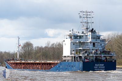
LAZURITE
General Cargo

Current Trip
| Time Travelled | 2 days |
|---|---|
| Remaining Time | 23 h, 27 mins |
| Distance Travelled | 232.29 nm |
| Remaining Distance | 335.38 nm |
| AVG Speed | 7.9 Knots |
| MAX Speed | 10 Knots |
| AVG Wind | 4 knots |
| MAX Wind | 8 knots |
| MIN Temp | 8°C / 46.4°F |
| MAX Temp | 14.4°C / 57.92°F |
| Draught | 4.4 m |
| Position Received | 11 h, 31 m ago |
Current Position
| Longitude | --- |
|---|---|
| Latitude | --- |
| Status | Under way using engine |
| Speed | 9.1 Knots |
| Course | 70.3° |
| Area | Black Sea |
| Station | T-AIS |
| Position Received | 11 h, 31 m ago |
Information
The current position of LAZURITE is in Black Sea with coordinates 42.07303° / 32.16895° as reported on 2025-03-24 19:16 by AIS to our vessel tracker app. The vessel's current speed is 9.1 Knots and is heading at the port of TEMRYUK. The estimated time of arrival as calculated by MyShipTracking vessel tracking app is 2025-03-26 06:14 LT
The vessel LAZURITE (IMO: 9549633, MMSI: 273338540) is a General Cargo that was built in 2011 ( 14 years old ). It's sailing under the flag of [RU] Russia.
In this page you can find informations about the vessels current position, last detected port calls, and current voyage information. If the vessels is not in coverage by AIS you will find the latest position.
The current position of LAZURITE is detected by our AIS receivers and we are not responsible for the reliability of the data. The last position was recorded while the vessel was in Coverage by the Ais receivers of our vessel tracking app.
The current draught of LAZURITE as reported by AIS is 4.4 meters
Weather
| Temperature | 10°C / 50°F |
|---|---|
| Wind Speed | 8 knots |
| Direction | 171° S |
| Pressure | 1021.3 hPa |
| Humidity | 84.4 % |
| Cloud Coverage | 99 % |


Featured Company
Events
| Time | Event | Details | Position / Dest | Info |
|---|---|---|---|---|
| 2025-03-24 19:16 | OUT of Coverage |
42.07303 / 32.16895
Black Sea
RU TMR
|
Speed: 9.1 kn Course: 70.3° |
|
| 2025-03-24 14:50 | Status Changed | Under way using engine Default |
41.83230 / 31.28116
RU TMR
|
Speed: 9.3 kn Course: 69° |
| 2025-03-24 14:50 | IN Coverage |
41.83263 / 31.28221
Black Sea
RU TMR
|
Speed: 9.5 kn Course: 66.4° |
|
| 2025-03-24 06:39 | Status Changed | Default Under way using engine |
41.39926 / 29.70702
RU TMR
|
Speed: 8.6 kn Course: 70.8° |
| 2025-03-24 06:28 | Status Changed | Under way using engine Default |
41.39054 / 29.67190
RU TMR
|
Speed: 8.6 kn Course: 68° |
| 2025-03-24 06:28 | OUT of Coverage |
41.39054 / 29.67190
Black Sea
RU TMR
|
Speed: 8.6 kn Course: 70.8° |
|
| 2025-03-24 06:24 | Status Changed | Default Under way using engine |
41.38728 / 29.66045
RU TMR
|
Speed: 8.7 kn Course: 69° |
| 2025-03-24 03:38 | Change Sea Area | Turkish part of the Black Sea Turkish part of the Sea of Marmara |
41.23087 / 29.14983
Black Sea
RU TMR
|
Speed: 9.7 kn Course: 43.6° |
| 2025-03-24 00:25 | START Moving | 1.52 nm, South East of ZEYTINBURNU |
40.96578 / 28.92143
RU TMR
|
Speed: 4.4 kn Course: 134° |
| 2025-03-24 00:18 | Status Changed | Under way using engine At anchor |
40.96696 / 28.92004
RU TMR
|
Speed: 0.3 kn Course: 183° |