
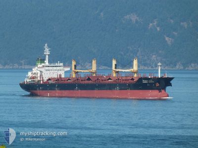
LANNA NAREE
Bulk Carrier
Current Trip
| Time Travelled | 4 days |
|---|---|
| Remaining Time | --- |
| Distance Travelled | 797.70 nm |
| Remaining Distance | --- |
| AVG Speed | 9.1 Knots |
| MAX Speed | 11.1 Knots |
| AVG Wind | 7.2 knots |
| MAX Wind | 21 knots |
| MIN Temp | 9.5°C / 49.1°F |
| MAX Temp | 17.7°C / 63.86°F |
| Draught | 8.4 m |
| Position Received | 2 d ago |
Current Position
| Longitude | --- |
|---|---|
| Latitude | --- |
| Status | Under way using engine |
| Speed | 8.9 Knots |
| Course | 267° |
| Area | North Atlantic Ocean |
| Station | T-AIS |
| Position Received | 2 d ago |
Information
The current position of LANNA NAREE is in North Atlantic Ocean with coordinates 35.94977° / -6.26614° as reported on 2025-02-18 20:18 by AIS to our vessel tracker app. The vessel's current speed is 8.9 Knots and is heading at the port of PALM BEACH. The estimated time of arrival as calculated by MyShipTracking vessel tracking app is 2025-03-05 07:00 LT
The vessel LANNA NAREE (IMO: 9496939, MMSI: 567104000) is a Bulk Carrier that was built in 2012 ( 13 years old ). It's sailing under the flag of [TH] Thailand.
In this page you can find informations about the vessels current position, last detected port calls, and current voyage information. If the vessels is not in coverage by AIS you will find the latest position.
The current position of LANNA NAREE is detected by our AIS receivers and we are not responsible for the reliability of the data. The last position was recorded while the vessel was in Coverage by the Ais receivers of our vessel tracking app.
The current draught of LANNA NAREE as reported by AIS is 8.4 meters
Weather
| Temperature | 17.7°C / 63.86°F |
|---|---|
| Wind Speed | 15 knots |
| Direction | 222° SW |
| Pressure | 1023.4 hPa |
| Humidity | 83.2 % |
| Cloud Coverage | 79 % |
Featured Company
Most Visited Ports (Last year)
| Port | Arrivals | |
|---|---|---|
| 2 | ||
| 2 | ||
| 2 | ||
| 1 | ||
| 1 | ||
| 1 |
Last Trips
| Origin | Departure | Destination | Arrival | Distance | |
|---|---|---|---|---|---|
| 2025-01-16 18:20 | 2025-01-26 07:50 | 388.57 nm | |||
| 2024-12-15 20:09 | 2025-01-04 23:31 | 1791.83 nm | |||
| 2024-12-09 08:17 | 2024-12-12 03:44 | 257.40 nm | |||
| 2024-12-08 06:07 | 2024-12-09 06:58 | 64.09 nm | |||
| 2024-11-19 21:48 | 2024-12-03 16:42 | 3291.67 nm |
Events
| Time | Event | Details | Position / Dest | Info |
|---|---|---|---|---|
| 2025-02-18 20:23 | Status Changed | Default Under way using engine |
35.94941 / -6.28238
PALM BEACH
|
Speed: 8.9 kn Course: 267° |
| 2025-02-18 20:18 | Status Changed | Under way using engine Default |
35.94977 / -6.26614
PALM BEACH
|
Speed: 9 kn Course: 268° |
| 2025-02-18 20:18 | OUT of Coverage |
35.94977 / -6.26614
North Atlantic Ocean
PALM BEACH
|
Speed: 8.9 kn Course: 267° |
|
| 2025-02-18 19:32 | Status Changed | Default Under way using engine |
35.95687 / -6.12684
PALM BEACH
|
Speed: 9 kn Course: 266° |
| 2025-02-18 19:23 | Status Changed | Under way using engine Default |
35.95849 / -6.09730
PALM BEACH
|
Speed: 9 kn Course: 266° |
| 2025-02-18 19:19 | Status Changed | Default Under way using engine |
35.95908 / -6.08605
PALM BEACH
|
Speed: 9 kn Course: 269.9° |
| 2025-02-18 19:00 | Change Sea Area | Spanish part of the North Atlantic Ocean Moroccan part of the North Atlantic Ocean |
35.96045 / -6.02836
North Atlantic Ocean
PALM BEACH
|
Speed: 8.9 kn Course: 269.7° |
| 2025-02-18 19:00 | Status Changed | Under way using engine Default |
35.96045 / -6.02836
PALM BEACH
|
Speed: 9.3 kn Course: 285° |
| 2025-02-18 18:56 | Status Changed | Default Under way using engine |
35.95882 / -6.01335
PALM BEACH
|
Speed: 9.2 kn Course: 282.7° |
| 2025-02-18 18:53 | Status Changed | Under way using engine Default |
35.95751 / -6.00721
PALM BEACH
|
Speed: 8.9 kn Course: 271° |