
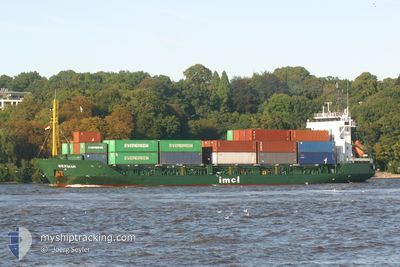
LADY NURAY
General Cargo
Current Trip
| Time Travelled | 8 days |
|---|---|
| Remaining Time | --- |
| Distance Travelled | 261.92 nm |
| Remaining Distance | --- |
| AVG Speed | 8.1 Knots |
| MAX Speed | 12 Knots |
| AVG Wind | 10.7 knots |
| MAX Wind | 27.6 knots |
| MIN Temp | 2.8°C / 37.04°F |
| MAX Temp | 18°C / 64.4°F |
| Draught | 3.4 m |
| Position Received | 3 m ago |
Current Position
| Longitude | --- |
|---|---|
| Latitude | --- |
| Status | Under way using engine |
| Speed | 8.7 Knots |
| Course | 272.7° |
| Area | Black Sea |
| Station | T-AIS |
| Position Received | 3 m ago |
Info
Information
The current position of LADY NURAY is in Black Sea with coordinates 41.26924° / 29.38286° as reported on 2024-11-26 01:51 by AIS to our vessel tracker app. The vessel's current speed is 8.7 Knots and is heading at the port of BARTIN. The estimated time of arrival as calculated by MyShipTracking vessel tracking app is 2024-11-26 10:00 LT
The vessel LADY NURAY (IMO: 9038373, MMSI: 312101000) is a General Cargo that was built in 1992 ( 32 years old ). It's sailing under the flag of [BZ] Belize.
In this page you can find informations about the vessels current position, last detected port calls, and current voyage information. If the vessels is not in coverage by AIS you will find the latest position.
The current position of LADY NURAY is detected by our AIS receivers and we are not responsible for the reliability of the data. The last position was recorded while the vessel was in Coverage by the Ais receivers of our vessel tracking app.
The current draught of LADY NURAY as reported by AIS is 3.4 meters
Weather
| Temperature | 9.4°C / 48.92°F |
|---|---|
| Wind Speed | 10 knots |
| Direction | 7° N |
| Pressure | 1025.3 hPa |
| Humidity | 58.5 % |
| Cloud Coverage | 30 % |
Featured Company
Last Port Calls
| Port | Arrival | Departure | Time In Port |
|---|---|---|---|
| 2024-11-15 13:48 | 2024-11-17 09:56 | 1 d | |
| 2024-11-10 05:32 | 2024-11-13 17:16 | 3 d | |
| 2024-11-04 12:05 | 2024-11-06 00:26 | 1 d | |
| 2024-10-21 04:48 | 2024-10-29 11:55 | 8 d | |
| 2024-10-10 07:26 | 2024-10-15 13:09 | 5 d | |
| 2024-10-02 22:41 | 2024-10-05 12:33 | 2 d | |
| 2024-09-26 02:54 | 2024-09-28 02:26 | 1 d | |
| 2024-09-12 20:02 | 2024-09-20 19:55 | 7 d | |
| 2024-09-07 02:20 | 2024-09-07 19:47 | 17 h | |
| 2024-09-04 13:47 |
Last Trips
| Origin | Departure | Destination | Arrival | Distance | |
|---|---|---|---|---|---|
| 2024-11-13 20:16 | 2024-11-15 15:48 | 423.24 nm | |||
| 2024-11-06 03:26 | 2024-11-10 08:32 | 654.54 nm | |||
| 2024-10-29 12:55 | 2024-11-04 15:05 | 1002.58 nm | |||
| 2024-10-15 15:09 | 2024-10-21 06:48 | 340.11 nm | |||
| 2024-10-05 15:33 | 2024-10-10 09:26 | 980.50 nm | |||
| 2024-09-28 05:26 | 2024-10-03 01:41 | 426.01 nm | |||
| 2024-09-20 21:55 | 2024-09-26 05:54 | 622.35 nm | |||
| 2024-09-07 21:47 | 2024-09-12 22:02 | 1049.95 nm | |||
| 2024-09-04 15:47 | 2024-09-07 04:20 | 467.07 nm |
Events
| Time | Event | Details | Position / Dest | Info |
|---|---|---|---|---|
| 2024-11-26 00:07 | Change Sea Area | Turkish part of the Black Sea Turkish part of the Sea of Marmara |
41.22858 / 29.15018
Black Sea
TRBTN
|
Speed: 8.7 kn Course: 50.7° |
| 2024-11-25 19:40 | START Moving | 1.55 nm, South West of KARTAL |
40.85936 / 29.18655
TRBTN
|
Speed: 4.4 kn Course: 227° |
| 2024-11-25 19:21 | Status Changed | Under way using engine Default |
40.85975 / 29.18834
TRBTN
|
Speed: Course: 335° |
| 2024-11-25 19:16 | Status Changed | Default At anchor |
40.85967 / 29.18839
TRBTN
|
Speed: Course: 335° |
| 2024-11-25 19:01 | Status Changed | At anchor Default |
40.85969 / 29.18836
TRBTN
|
Speed: Course: 339° |
| 2024-11-25 18:52 | Status Changed | Default At anchor |
40.85976 / 29.18844
TRBTN
|
Speed: Course: 336° |
| 2024-11-25 15:37 | Status Changed | At anchor Default |
40.85979 / 29.18842
TRBTN
|
Speed: Course: 9° |
| 2024-11-25 15:31 | Status Changed | Default At anchor |
40.85965 / 29.18792
TRBTN
|
Speed: Course: 1° |
| 2024-11-25 14:37 | Status Changed | At anchor Default |
40.85956 / 29.18811
TRBTN
|
Speed: 0.1 kn Course: 333° |
| 2024-11-25 14:31 | Status Changed | Default At anchor |
40.85965 / 29.18843
TRBTN
|
Speed: 0.1 kn Course: 355° |