
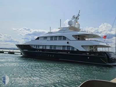
LADY LUCY
Yacht
Current Trip
GR VAI
| Time Travelled | 9 days |
|---|---|
| Remaining Time | --- |
| Distance Travelled | 152.82 nm |
| Remaining Distance | --- |
| AVG Speed | 7 Knots |
| MAX Speed | 10.2 Knots |
| AVG Wind | 8 knots |
| MAX Wind | 23 knots |
| MIN Temp | 15.6°C / 60.08°F |
| MAX Temp | 27.3°C / 81.14°F |
| Draught | 2.7 m |
| Position Received | 1 d ago |
Current Position
| Longitude | 26.14244° |
|---|---|
| Latitude | 34.96418° |
| Status | Under way using engine |
| Speed | 8.2 Knots |
| Course | 349.6° |
| Area | Mediterranean Sea - Eastern Basin |
| Station | T-AIS |
| Position Received | 1 d ago |
Info
Information
The current position of LADY LUCY is in Mediterranean Sea - Eastern Basin with coordinates 34.96418° / 26.14244° as reported on 2024-05-31 09:14 by AIS to our vessel tracker app. The vessel's current speed is 8.2 Knots
The vessel LADY LUCY (IMO: 8653384, MMSI: 319152600) is a Yacht that was built in 2001 ( 23 years old ). It's sailing under the flag of [KY] Cayman Is.
In this page you can find informations about the vessels current position, last detected port calls, and current voyage information. If the vessels is not in coverage by AIS you will find the latest position.
The current position of LADY LUCY is detected by our AIS receivers and we are not responsible for the reliability of the data. The last position was recorded while the vessel was in Coverage by the Ais receivers of our vessel tracking app.
The current draught of LADY LUCY as reported by AIS is 2.7 meters
Weather
| Temperature | 21.9°C / 71.42°F |
|---|---|
| Wind Speed | 8 knots |
| Direction | 158° SSE |
| Pressure | 1015.3 hPa |
| Humidity | 70.7 % |
| Cloud Coverage | 25 % |
Featured Company
Last Trips
| Origin | Departure | Destination | Arrival | Distance | |
|---|---|---|---|---|---|
| 2024-04-23 17:38 | 2024-04-29 14:51 | 60.41 nm | |||
| 2024-04-15 09:52 | 2024-04-21 10:07 | 1137.88 nm | |||
| 2024-04-14 10:01 | 2024-04-14 12:30 | 0.91 nm |
Events
| Time | Event | Details | Position / Dest | Info |
|---|---|---|---|---|
| 2024-05-31 09:14 | OUT of Coverage |
34.96418 / 26.14244
Mediterranean Sea - Eastern Basin
|
Speed: 8.2 kn Course: 349.6° |
|
| 2024-05-31 09:07 | START Moving | 3.26 nm, South of ATHERINOLAKOS |
34.95224 / 26.14623
GR VAI
|
Speed: 5.2 kn Course: 351.2° |
| 2024-05-31 08:49 | Status Changed | Under way using engine At anchor |
34.94864 / 26.14487
GR VAI
|
Speed: Course: 70° |
| 2024-05-31 04:00 | IN Coverage |
34.94850 / 26.14573
Mediterranean Sea - Eastern Basin
|
Speed: Course: 234.2° |
|
| 2024-05-30 22:51 | OUT of Coverage |
34.94899 / 26.14549
Mediterranean Sea - Eastern Basin
|
Speed: Course: 125.2° |
|
| 2024-05-30 21:36 | IN Coverage |
34.94888 / 26.14568
Mediterranean Sea - Eastern Basin
|
Speed: Course: 163.5° |
|
| 2024-05-30 09:04 | OUT of Coverage |
35.20032 / 26.32210
Mediterranean Sea - Eastern Basin
|
Speed: 7.9 kn Course: 142.6° |
|
| 2024-05-30 08:55 | START Moving | 9.33 nm, East of SITIA |
35.20363 / 26.30248
GR VAI
|
Speed: 5.1 kn Course: 58.2° |
| 2024-05-30 08:45 | Status Changed | Under way using engine At anchor |
35.20350 / 26.29891
GR VAI
|
Speed: 0.6 kn Course: 193° |
| 2024-05-30 00:15 | IN Coverage |
35.20307 / 26.29994
Mediterranean Sea - Eastern Basin
|
Speed: Course: 202.3° |