
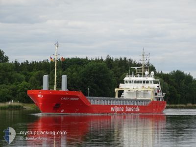
LADY HEDWIG
Cargo
Current Trip
| Time Travelled | 22 h, 4 mins |
|---|---|
| Remaining Time | --- |
| Distance Travelled | 226.15 nm |
| Remaining Distance | --- |
| AVG Speed | 10.7 Knots |
| MAX Speed | 11.1 Knots |
| AVG Wind | 4.9 knots |
| MAX Wind | 17 knots |
| MIN Temp | 0.4°C / 32.72°F |
| MAX Temp | 4°C / 39.2°F |
| Draught | 4.6 m |
| Position Received | 1 h, 8 m ago |
Current Position
| Longitude | 19.53636° |
|---|---|
| Latitude | 59.15923° |
| Status | Under way using engine |
| Speed | 10.7 Knots |
| Course | 211.6° |
| Area | Baltic Sea |
| Station | T-AIS |
| Position Received | 1 h, 8 m ago |
Info
Information
The current position of LADY HEDWIG is in Baltic Sea with coordinates 59.15923° / 19.53636° as reported on 2024-04-28 11:22 by AIS to our vessel tracker app. The vessel's current speed is 10.7 Knots and is heading at the port of AMSTERDAM. The estimated time of arrival as calculated by MyShipTracking vessel tracking app is 2024-04-30 16:00 LT
The vessel LADY HEDWIG (IMO: 9834985, MMSI: 244010873) is a Cargo It's sailing under the flag of [NL] Netherlands.
In this page you can find informations about the vessels current position, last detected port calls, and current voyage information. If the vessels is not in coverage by AIS you will find the latest position.
The current position of LADY HEDWIG is detected by our AIS receivers and we are not responsible for the reliability of the data. The last position was recorded while the vessel was in Coverage by the Ais receivers of our vessel tracking app.
The current draught of LADY HEDWIG as reported by AIS is 4.6 meters
Weather
| Temperature | 4.1°C / 39.38°F |
|---|---|
| Wind Speed | 17 knots |
| Direction | 106° ESE |
| Pressure | 1022.6 hPa |
| Humidity | 87.9 % |
| Cloud Coverage | 99 % |
Featured Company
Last Port Calls
| Port | Arrival | Departure | Time In Port |
|---|---|---|---|
| 2024-04-26 13:57 | 2024-04-27 14:27 | 1 d | |
| 2024-04-25 05:50 | 2024-04-25 19:45 | 13 h | |
| 2024-04-16 21:18 | 2024-04-18 20:31 | 1 d | |
| 2024-04-16 19:36 | 2024-04-16 20:36 | 1 h | |
| 2024-04-09 09:49 | 2024-04-11 05:02 | 1 d | |
| 2024-04-07 20:26 | 2024-04-07 20:29 | 3 m | |
| 2024-04-05 13:48 | 2024-04-05 14:10 | 21 m | |
| 2024-04-04 01:05 | 2024-04-04 01:31 | 26 m | |
| 2024-04-02 12:33 | 2024-04-02 22:07 | 9 h | |
| 2024-04-01 19:30 | 2024-04-02 12:11 | 16 h |
Last Trips
| Origin | Departure | Destination | Arrival | Distance | |
|---|---|---|---|---|---|
| 2024-04-25 21:45 | 2024-04-26 16:57 | 165.03 nm | |||
| 2024-04-18 22:31 | 2024-04-25 07:50 | 1175.69 nm | |||
| 2024-04-16 22:36 | 2024-04-16 23:18 | 4.55 nm | |||
| 2024-04-11 07:02 | 2024-04-16 21:36 | 1053.23 nm | |||
| 2024-04-07 22:29 | 2024-04-09 11:49 | 402.55 nm | |||
| 2024-04-05 15:10 | 2024-04-07 22:26 | 535.31 nm | |||
| 2024-04-04 02:31 | 2024-04-05 14:48 | 1.47 nm | |||
| 2024-04-03 00:07 | 2024-04-04 02:05 | 198.51 nm | |||
| 2024-04-02 14:11 | 2024-04-02 14:33 | 1.29 nm | |||
| 2024-03-28 22:02 | 2024-04-01 21:30 | 917.88 nm |
Events
| Time | Event | Details | Position / Dest | Info |
|---|---|---|---|---|
| 2024-04-28 11:28 | Status Changed | Default Under way using engine |
59.14391 / 19.51780
NLAMS
|
Speed: 10.7 kn Course: 211.6° |
| 2024-04-28 11:22 | OUT of Coverage |
59.15923 / 19.53636
Baltic Sea
NLAMS
|
Speed: 10.7 kn Course: 211.6° |
|
| 2024-04-28 11:11 | Status Changed | Under way using engine Default |
59.18785 / 19.57019
NLAMS
|
Speed: 10.6 kn Course: 211° |
| 2024-04-28 11:08 | Status Changed | Default Under way using engine |
59.19466 / 19.57818
NLAMS
|
Speed: 10.7 kn Course: 211.2° |
| 2024-04-28 11:01 | Status Changed | Under way using engine Default |
59.21278 / 19.59948
NLAMS
|
Speed: 10.7 kn Course: 210° |
| 2024-04-28 10:44 | Status Changed | Default Under way using engine |
59.25712 / 19.65026
NLAMS
|
Speed: 11 kn Course: 211.6° |
| 2024-04-28 10:25 | Status Changed | Under way using engine Default |
59.30894 / 19.70990
NLAMS
|
Speed: 10.8 kn Course: 210° |
| 2024-04-28 10:21 | Status Changed | Default Under way using engine |
59.31896 / 19.72140
NLAMS
|
Speed: 10.7 kn Course: 211.5° |
| 2024-04-28 08:46 | Change Sea Area | Swedish part of the Baltic Sea Finnish part of the Baltic Sea |
59.56889 / 19.96676
Baltic Sea
NLAMS
|
Speed: 10.5 kn Course: 204° |
| 2024-04-28 07:07 | Change Sea Area | Finnish part of the Baltic Sea Swedish part of the Gulf of Bothnia |
59.80061 / 19.64575
Baltic Sea
NLAMS
|
Speed: 10.7 kn Course: 141.8° |