

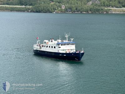
LADY ELISABETH
Passenger

Current Trip
GUDVANGEN FLAAM GUDV
| Time Travelled | 16 h, 51 mins |
|---|---|
| Remaining Time | --- |
| Distance Travelled | 14.58 nm |
| Remaining Distance | --- |
| AVG Speed | 10.7 Knots |
| MAX Speed | 11.2 Knots |
| AVG Wind | 3.5 knots |
| MAX Wind | 4 knots |
| MIN Temp | -1.8°C / 28.76°F |
| MAX Temp | 3.5°C / 38.3°F |
| Draught | 2.3 m |
| Position Received | 1 m ago |
Current Position
| Longitude | --- |
|---|---|
| Latitude | --- |
| Status | Moored |
| Speed | |
| Course | --- |
| Area | Norwegian Sea |
| Station | T-AIS |
| Position Received | 1 m ago |
Information
The current position of LADY ELISABETH is in Norwegian Sea with coordinates 61.30166° / 7.24896° as reported on 2025-03-29 07:21 by AIS to our vessel tracker app. The vessel's current speed is 0 Knots
The vessel LADY ELISABETH (IMO: 7742695, MMSI: 257227600) is a Passenger It's sailing under the flag of [NO] Norway.
In this page you can find informations about the vessels current position, last detected port calls, and current voyage information. If the vessels is not in coverage by AIS you will find the latest position.
The current position of LADY ELISABETH is detected by our AIS receivers and we are not responsible for the reliability of the data. The last position was recorded while the vessel was in Coverage by the Ais receivers of our vessel tracking app.
The current draught of LADY ELISABETH as reported by AIS is 2.3 meters
Weather
| Temperature | -1.2°C / 29.84°F |
|---|---|
| Wind Speed | 3 knots |
| Direction | 157° SSE |
| Pressure | 1003.9 hPa |
| Humidity | 94.8 % |
| Cloud Coverage | 100 % |


Featured Company
Last Trips
| Origin | Departure | Destination | Arrival | Distance |
|---|
Events
| Time | Event | Details | Position / Dest | Info |
|---|---|---|---|---|
| 2025-03-28 16:00 | Status Changed | Moored Under way using engine |
61.30168 / 7.24902
GUDVANGEN FLAAM GUDV
|
Speed: Course: 511° |
| 2025-03-28 15:56 | STOP Moving | 6.07 nm, North East of SOGNDAL |
61.30168 / 7.24899
GUDVANGEN FLAAM GUDV
|
Speed: 0.2 kn Course: 511° |
| 2025-03-28 14:31 | PORT DEPARTURE |
|
61.17147 / 7.24991
GUDVANGEN FLAAM GUDV
|
Speed: 10.4 kn Course: 155.6° |
| 2025-03-28 14:29 | START Moving |
61.17743 / 7.24675
[NO] KAUPANGER
|
Speed: 10.4 kn Course: 155.6° |
|
| 2025-03-28 14:00 | Status Changed | Under way using engine Moored |
61.18038 / 7.24005
[NO] KAUPANGER
|
Speed: Course: 511° |
| 2025-03-25 20:40 | Status Changed | Moored Engaged in Fishing |
61.18038 / 7.24004
[NO] KAUPANGER
|
Speed: Course: 511° |
| 2025-03-25 20:36 | Status Changed | Engaged in Fishing Moored |
61.18037 / 7.24002
[NO] KAUPANGER
|
Speed: Course: 511° |