
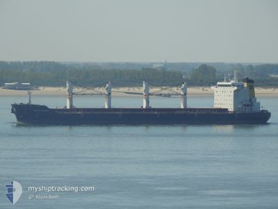
KSL RUNYANG
Bulk Carrier
Current Trip
| Time Travelled | 13 h, 6 mins |
|---|---|
| Remaining Time | 3 h, 13 mins |
| Distance Travelled | 105.53 nm |
| Remaining Distance | 36.35 nm |
| AVG Speed | 9.9 Knots |
| MAX Speed | 11.5 Knots |
| AVG Wind | 11.8 knots |
| MAX Wind | 16.3 knots |
| MIN Temp | 18°C / 64.4°F |
| MAX Temp | 19.1°C / 66.38°F |
| Draught | 10.4 m |
| Position Received | 1 m ago |
Current Position
| Longitude | --- |
|---|---|
| Latitude | --- |
| Status | Under way using engine |
| Speed | 4.4 Knots |
| Course | 305° |
| Area | Persian Gulf |
| Station | T-AIS |
| Position Received | 1 m ago |
Info
Information
The current position of KSL RUNYANG is in Persian Gulf with coordinates 29.80964° / 48.47955° as reported on 2025-12-11 22:34 by AIS to our vessel tracker app. The vessel's current speed is 4.4 Knots and is heading at the port of UMM QASR. The estimated time of arrival as calculated by MyShipTracking vessel tracking app is 2025-12-12 04:48 LT
The vessel KSL RUNYANG (IMO: 9331696, MMSI: 538003716) is a Bulk Carrier that was built in 2009 ( 16 years old ). It's sailing under the flag of [MH] Marshall Is.
In this page you can find informations about the vessels current position, last detected port calls, and current voyage information. If the vessels is not in coverage by AIS you will find the latest position.
The current position of KSL RUNYANG is detected by our AIS receivers and we are not responsible for the reliability of the data. The last position was recorded while the vessel was in Coverage by the Ais receivers of our vessel tracking app.
The current draught of KSL RUNYANG as reported by AIS is 10.4 meters
Weather
| Temperature | 18°C / 64.4°F |
|---|---|
| Wind Speed | 7 knots |
| Direction | 8° N |
| Pressure | 1016.9 hPa |
| Humidity | 65.6 % |
| Cloud Coverage | 35 % |
Featured Company
Most Visited Ports (Last year)
| Port | Arrivals | |
|---|---|---|
| 1 | ||
| 1 | ||
| 1 | ||
| 1 | ||
| 1 | ||
| 1 |
Events
| Time | Event | Details | Position / Dest | Info |
|---|---|---|---|---|
| 2025-12-11 22:09 | Change Sea Area | Kuwaiti part of the Persian Gulf Iraqi part of the Persian Gulf |
29.78834 / 48.52183
Persian Gulf
UMM_QASR;:_
|
Speed: 9.1 kn Course: 300.8° |
| 2025-12-11 21:07 | ETA Changed | 2025/12/12 01:30 2025/12/11 21:30 |
29.69201 / 48.68910
UMM_QASR;:_
|
Speed: 9.7 kn Course: 336.1° |
| 2025-12-11 20:49 | Change Sea Area | Iraqi part of the Persian Gulf Kuwaiti part of the Persian Gulf |
29.64753 / 48.70821
Persian Gulf
UMM_QASR;:_
|
Speed: 9.3 kn Course: 340.5° |
| 2025-12-11 20:44 | Status Changed | Under way using engine Default |
29.63625 / 48.71313
UMM_QASR;:_
|
Speed: 3.8 kn Course: 340° |
| 2025-12-11 20:33 | Status Changed | Default Under way using engine |
29.61691 / 48.72062
UMM_QASR;:_
|
Speed: 2 kn Course: 337° |
| 2025-12-11 20:33 | START Moving |
29.61691 / 48.72062
UMM_QASR;:_
|
Speed: 3.8 kn Course: 340° |
|
| 2025-12-11 20:29 | Status Changed | Under way using engine Default |
29.61389 / 48.72223
UMM_QASR;:_
|
Speed: Course: -1° |
| 2025-12-11 19:36 | Status Changed | Default Under way using engine |
29.61167 / 48.72167
UMM_QASR;:_
|
Speed: Course: 1° |
| 2025-12-11 19:29 | Status Changed | Under way using engine Default |
29.61155 / 48.72251
UMM_QASR;:_
|
Speed: Course: 352° |
| 2025-12-11 19:05 | Status Changed | Default Under way using engine |
29.61158 / 48.72315
UMM_QASR;:_
|
Speed: Course: 343° |