
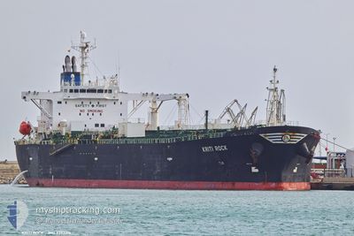
KRITI ROCK
Oil Products Tanker
Current Trip
| Time Travelled | 7 days |
|---|---|
| Remaining Time | 1 day |
| Distance Travelled | 1978.69 nm |
| Remaining Distance | 490.15 nm |
| AVG Speed | 11.4 Knots |
| MAX Speed | 15.5 Knots |
| AVG Wind | 12.8 knots |
| MAX Wind | 37 knots |
| MIN Temp | 8°C / 46.4°F |
| MAX Temp | 17.8°C / 64.04°F |
| Draught | 12 m |
| Position Received | 6 h, 2 m ago |
Current Position
| Longitude | --- |
|---|---|
| Latitude | --- |
| Status | Under way using engine |
| Speed | 13.9 Knots |
| Course | 80° |
| Area | Mediterranean Sea - Western Basin |
| Station | T-AIS |
| Position Received | 6 h, 2 m ago |
Info
Information
The current position of KRITI ROCK is in Mediterranean Sea - Western Basin with coordinates 37.13225° / 3.44778° as reported on 2025-12-09 23:41 by AIS to our vessel tracker app. The vessel's current speed is 13.9 Knots and is heading at the port of MARSAXLOKK. The estimated time of arrival as calculated by MyShipTracking vessel tracking app is 2025-12-11 19:16 LT
The vessel KRITI ROCK (IMO: 9392315, MMSI: 636019277) is a Oil Products Tanker that was built in 2008 ( 17 years old ). It's sailing under the flag of [LR] Liberia.
In this page you can find informations about the vessels current position, last detected port calls, and current voyage information. If the vessels is not in coverage by AIS you will find the latest position.
The current position of KRITI ROCK is detected by our AIS receivers and we are not responsible for the reliability of the data. The last position was recorded while the vessel was in Coverage by the Ais receivers of our vessel tracking app.
The current draught of KRITI ROCK as reported by AIS is 12 meters
Weather
| Temperature | 17.6°C / 63.68°F |
|---|---|
| Wind Speed | 3 knots |
| Direction | 122° ESE |
| Pressure | 1020.8 hPa |
| Humidity | 69.9 % |
| Cloud Coverage | 18 % |
Featured Company
Last Port Calls
| Port | Arrival | Departure | Time In Port |
|---|---|---|---|
| 2025-11-29 16:17 | 2025-12-02 21:43 | 3 d | |
| 2025-11-17 19:14 | 2025-11-19 16:05 | 1 d | |
| 2025-11-04 13:37 | 2025-11-08 09:23 | 3 d | |
| 2025-10-25 13:28 | 2025-10-27 18:56 | 2 d | |
| 2025-10-14 14:42 | 2025-10-17 04:32 | 2 d | |
| 2025-10-10 11:27 | 2025-10-12 13:25 | 2 d | |
| 2025-10-02 06:20 |
Most Visited Ports (Last year)
| Port | Arrivals | |
|---|---|---|
| 3 | ||
| 3 | ||
| 3 | ||
| 3 | ||
| 2 | ||
| 2 |
Last Trips
| Origin | Departure | Destination | Arrival | Distance | |
|---|---|---|---|---|---|
| 2025-11-19 16:05 | 2025-11-29 16:17 | 1634.92 nm | |||
| 2025-11-08 09:23 | 2025-11-17 19:14 | 2032.05 nm | |||
| 2025-10-27 18:56 | 2025-11-04 13:37 | 660.06 nm | |||
| 2025-10-17 04:32 | 2025-10-25 13:28 | 1024.89 nm | |||
| 2025-10-12 13:25 | 2025-10-14 14:42 | 349.24 nm | |||
| 2025-10-02 06:20 | 2025-10-10 11:27 | 388.40 nm |
Events
| Time | Event | Details | Position / Dest | Info |
|---|---|---|---|---|
| 2025-12-09 23:49 | Status Changed | Default Under way using engine |
37.13747 / 3.48542
MTMAR
|
Speed: 13.9 kn Course: 80° |
| 2025-12-09 23:41 | OUT of Coverage |
37.13225 / 3.44778
Mediterranean Sea - Western Basin
MTMAR
|
Speed: 13.9 kn Course: 80° |
|
| 2025-12-09 23:39 | Status Changed | Under way using engine Default |
37.13098 / 3.43823
MTMAR
|
Speed: 13.9 kn Course: 80° |
| 2025-12-09 23:33 | Status Changed | Default Under way using engine |
37.12718 / 3.40887
MTMAR
|
Speed: 13.8 kn Course: 80° |
| 2025-12-09 23:32 | Status Changed | Under way using engine Default |
37.12663 / 3.40482
MTMAR
|
Speed: 13.8 kn Course: 79° |
| 2025-12-09 23:25 | IN Coverage |
37.12663 / 3.40482
Mediterranean Sea - Western Basin
MTMAR
|
Speed: 13.8 kn Course: 80° |
|
| 2025-12-09 22:05 | Status Changed | Default Under way using engine |
37.06168 / 2.98810
MTMAR
|
Speed: 13.8 kn Course: 78° |
| 2025-12-09 21:59 | Status Changed | Under way using engine Default |
37.05750 / 2.96245
MTMAR
|
Speed: 13.9 kn Course: 78° |
| 2025-12-09 21:59 | OUT of Coverage |
37.05750 / 2.96245
Mediterranean Sea - Western Basin
MTMAR
|
Speed: 13.8 kn Course: 78° |
|
| 2025-12-09 21:53 | Status Changed | Default Under way using engine |
37.05300 / 2.93267
MTMAR
|
Speed: 13.8 kn Course: 79° |