

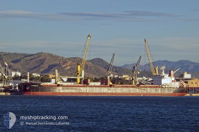
KOSMAN
Bulk Carrier

Current Trip
| Time Travelled | 35 days |
|---|---|
| Remaining Time | 15 days |
| Distance Travelled | 8922.60 nm |
| Remaining Distance | 4454.31 nm |
| AVG Speed | 11 Knots |
| MAX Speed | 15 Knots |
| AVG Wind | 10.3 knots |
| MAX Wind | 25.3 knots |
| MIN Temp | 16.2°C / 61.16°F |
| MAX Temp | 29.2°C / 84.56°F |
| Draught | 11.7 m |
| Position Received | 8 h, 50 m ago |
Current Position
| Longitude | --- |
|---|---|
| Latitude | --- |
| Status | Under way using engine |
| Speed | 12 Knots |
| Course | 307.4° |
| Area | South Atlantic Ocean |
| Station | T-AIS |
| Position Received | 8 h, 50 m ago |
Information
The current position of KOSMAN is in South Atlantic Ocean with coordinates -7.78134° / -30.97828° as reported on 2025-03-25 15:48 by AIS to our vessel tracker app. The vessel's current speed is 12 Knots and is heading at the port of BROWNSVILLE. The estimated time of arrival as calculated by MyShipTracking vessel tracking app is 2025-04-10 04:22 LT
The vessel KOSMAN (IMO: 9630731, MMSI: 538007629) is a Bulk Carrier that was built in 2013 ( 12 years old ). It's sailing under the flag of [MH] Marshall Is.
In this page you can find informations about the vessels current position, last detected port calls, and current voyage information. If the vessels is not in coverage by AIS you will find the latest position.
The current position of KOSMAN is detected by our AIS receivers and we are not responsible for the reliability of the data. The last position was recorded while the vessel was in Coverage by the Ais receivers of our vessel tracking app.
The current draught of KOSMAN as reported by AIS is 11.7 meters
Weather
| Temperature | 27.8°C / 82.04°F |
|---|---|
| Wind Speed | 9 knots |
| Direction | 130° SE |
| Pressure | 1013.1 hPa |
| Humidity | 71.2 % |
| Cloud Coverage | 54 % |


Featured Company
Last Trips
| Origin | Departure | Destination | Arrival | Distance | |
|---|---|---|---|---|---|
| 2024-12-18 15:37 | 2025-02-12 00:17 | 7436.43 nm |
Events
| Time | Event | Details | Position / Dest | Info |
|---|---|---|---|---|
| 2025-03-25 15:51 | Status Changed | Default Under way using engine |
-7.77445 / -30.98716
US_BRO
|
Speed: 12 kn Course: 307.4° |
| 2025-03-25 15:48 | Status Changed | Under way using engine Default |
-7.78134 / -30.97828
US_BRO
|
Speed: 12 kn Course: 308° |
| 2025-03-25 15:48 | OUT of Coverage |
-7.78134 / -30.97828
South Atlantic Ocean
US_BRO
|
Speed: 12 kn Course: 307.4° |
|
| 2025-03-25 15:41 | Status Changed | Default Under way using engine |
-7.79501 / -30.96060
US_BRO
|
Speed: 12 kn Course: 307.5° |
| 2025-03-25 15:37 | Detected in Sea | High seas of the South Atlantic Ocean |
-7.80389 / -30.94905
South Atlantic Ocean
US_BRO
|
Speed: 12 kn Course: 307.5° |
| 2025-03-25 15:37 | Status Changed | Under way using engine Default |
-7.80389 / -30.94905
US_BRO
|
Speed: 11.9 kn Course: 307° |
| 2025-03-25 15:24 | IN Coverage |
-7.80389 / -30.94905
South Atlantic Ocean
US_BRO
|
Speed: 12 kn Course: 307.5° |