

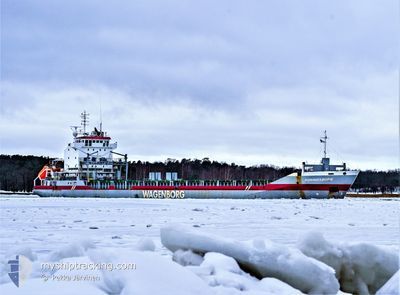
KONINGSBORG
General Cargo

Current Trip
| Time Travelled | 2 days |
|---|---|
| Remaining Time | --- |
| Distance Travelled | 449.25 nm |
| Remaining Distance | --- |
| AVG Speed | 11.3 Knots |
| MAX Speed | 13 Knots |
| AVG Wind | 9.5 knots |
| MAX Wind | 24 knots |
| MIN Temp | 14.4°C / 57.92°F |
| MAX Temp | 18.1°C / 64.58°F |
| Draught | 5 m |
| Position Received | 2 d ago |
Current Position
| Longitude | --- |
|---|---|
| Latitude | --- |
| Status | Under way using engine |
| Speed | 11.6 Knots |
| Course | 269° |
| Area | North Atlantic Ocean |
| Station | T-AIS |
| Position Received | 2 d ago |
Information
The current position of KONINGSBORG is in North Atlantic Ocean with coordinates 35.94936° / -6.13859° as reported on 2025-02-21 05:19 by AIS to our vessel tracker app. The vessel's current speed is 11.6 Knots
The vessel KONINGSBORG (IMO: 9155925, MMSI: 246388000) is a General Cargo that was built in 1998 ( 27 years old ). It's sailing under the flag of [NL] Netherlands.
In this page you can find informations about the vessels current position, last detected port calls, and current voyage information. If the vessels is not in coverage by AIS you will find the latest position.
The current position of KONINGSBORG is detected by our AIS receivers and we are not responsible for the reliability of the data. The last position was recorded while the vessel was in Coverage by the Ais receivers of our vessel tracking app.
The current draught of KONINGSBORG as reported by AIS is 5 meters
Weather
| Temperature | 13.7°C / 56.66°F |
|---|---|
| Wind Speed | 12 knots |
| Direction | 53° NE |
| Pressure | 1027.4 hPa |
| Humidity | 87 % |
| Cloud Coverage | 39 % |


Featured Company
Last Port Calls
| Port | Arrival | Departure | Time In Port |
|---|---|---|---|
| 2025-02-20 06:19 | 2025-02-20 15:40 | 9 h | |
| 2025-02-17 19:19 | 2025-02-18 21:30 | 1 d | |
| 2025-02-12 08:30 | 2025-02-12 19:52 | 11 h | |
| 2025-01-21 21:46 | 2025-01-24 16:15 | 2 d | |
| 2025-01-21 14:09 | 2025-01-21 14:11 | 2 m | |
| 2025-01-16 14:47 | 2025-01-20 13:47 | 3 d | |
| 2025-01-06 13:53 | 2025-01-09 14:37 | 3 d | |
| 2024-12-31 01:11 | 2025-01-03 21:51 | 3 d | |
| 2024-12-17 22:33 | 2024-12-19 17:10 | 1 d | |
| 2024-12-16 18:57 | 2024-12-16 20:03 | 1 h |
Most Visited Ports (Last year)
| Port | Arrivals | |
|---|---|---|
| 5 | ||
| 4 | ||
| 3 | ||
| 3 | ||
| 2 | ||
| 2 |
Last Trips
| Origin | Departure | Destination | Arrival | Distance | |
|---|---|---|---|---|---|
| 2025-02-18 21:30 | 2025-02-20 06:19 | 326.68 nm | |||
| 2025-02-12 19:52 | 2025-02-17 19:19 | 276.31 nm | |||
| 2025-01-24 16:15 | 2025-02-12 08:30 | 3529.21 nm | |||
| 2025-01-21 14:11 | 2025-01-21 21:46 | 80.79 nm | |||
| 2025-01-20 13:47 | 2025-01-21 14:09 | 169.37 nm | |||
| 2025-01-09 14:37 | 2025-01-16 14:47 | 1678.57 nm | |||
| 2025-01-03 21:51 | 2025-01-06 13:53 | 23.06 nm | |||
| 2024-12-19 17:10 | 2024-12-31 01:11 | 1561.56 nm | |||
| 2024-12-16 20:03 | 2024-12-17 22:33 | 302.97 nm | |||
| 2024-12-16 18:29 | 2024-12-16 18:57 | 0.16 nm |
Events
| Time | Event | Details | Position / Dest | Info |
|---|---|---|---|---|
| 2025-02-22 06:40 | STOP Moving | 3.04 nm, West of SAFI |
32.30632 / -9.31034
MA SFI
|
Speed: 0.1 kn Course: 358° |
| 2025-02-21 05:25 | Status Changed | Default Under way using engine |
35.94884 / -6.16177
MA SFI
|
Speed: 11.6 kn Course: 269° |
| 2025-02-21 05:19 | Detected in Sea | Spanish part of the North Atlantic Ocean |
35.94936 / -6.13859
North Atlantic Ocean
MA SFI
|
Speed: 11.6 kn Course: 269° |
| 2025-02-21 05:19 | OUT of Coverage |
35.94936 / -6.13859
North Atlantic Ocean
MA SFI
|
Speed: 11.6 kn Course: 269° |
|
| 2025-02-21 05:18 | Status Changed | Under way using engine Default |
35.94946 / -6.13255
MA SFI
|
Speed: 11.4 kn Course: 269° |
| 2025-02-21 05:00 | Status Changed | Default Under way using engine |
35.95041 / -6.06470
MA SFI
|
Speed: 11.3 kn Course: 269.6° |
| 2025-02-21 04:35 | Detected in Sea | Moroccan part of the North Atlantic Ocean |
35.95118 / -5.96599
North Atlantic Ocean
MA SFI
|
Speed: 11.8 kn Course: 270.1° |
| 2025-02-21 04:35 | Status Changed | Under way using engine Default |
35.95118 / -5.96599
MA SFI
|
Speed: 11.8 kn Course: 271° |
| 2025-02-21 04:15 | Status Changed | Default Under way using engine |
35.95013 / -5.88369
MA SFI
|
Speed: 12 kn Course: 270.2° |
| 2025-02-21 04:11 | Change Sea Area | Moroccan part of the Strait of Gibraltar Spanish part of the Strait of Gibraltar |
35.95000 / -5.86665
Strait of Gibraltar
MA SFI
|
Speed: 12 kn Course: 270.2° |