

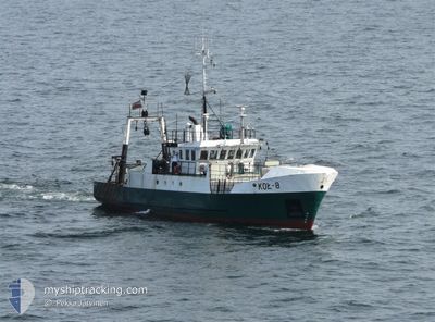
KOL-8
Trawler

Current Trip
Unknown
| Time Travelled | 2 days |
|---|---|
| Remaining Time | --- |
| Distance Travelled | 241.07 nm |
| Remaining Distance | --- |
| AVG Speed | 5.5 Knots |
| MAX Speed | 9.4 Knots |
| AVG Wind | 8.1 knots |
| MAX Wind | 15 knots |
| MIN Temp | 4.4°C / 39.92°F |
| MAX Temp | 9°C / 48.2°F |
| Draught | 0 m |
| Position Received | 1 m ago |
Current Position
| Longitude | --- |
|---|---|
| Latitude | --- |
| Status | Engaged in Fishing |
| Speed | 1.7 Knots |
| Course | 89° |
| Area | Baltic Sea |
| Station | T-AIS |
| Position Received | 1 m ago |
Information
The current position of KOL-8 is in Baltic Sea with coordinates 55.02523° / 15.80908° as reported on 2025-03-29 00:18 by AIS to our vessel tracker app. The vessel's current speed is 1.7 Knots
The vessel KOL-8 (IMO: 8107397, MMSI: 261003060) is a Trawler that was built in 1983 ( 42 years old ). It's sailing under the flag of [PL] Poland.
In this page you can find informations about the vessels current position, last detected port calls, and current voyage information. If the vessels is not in coverage by AIS you will find the latest position.
The current position of KOL-8 is detected by our AIS receivers and we are not responsible for the reliability of the data. The last position was recorded while the vessel was in Coverage by the Ais receivers of our vessel tracking app.
Weather
| Temperature | 6°C / 42.8°F |
|---|---|
| Wind Speed | 10 knots |
| Direction | 167° SSE |
| Pressure | 1011.3 hPa |
| Humidity | 81.9 % |
| Cloud Coverage | --- |


Featured Company
Most Visited Ports (Last year)
| Port | Arrivals | |
|---|---|---|
| 16 |
Events
| Time | Event | Details | Position / Dest | Info |
|---|---|---|---|---|
| 2025-03-28 11:33 | IN Coverage |
54.35244 / 15.58528
Baltic Sea
|
Speed: 9 kn Course: 9° |
|
| 2025-03-28 02:17 | OUT of Coverage |
54.18983 / 15.54892
Baltic Sea
|
Speed: 5.7 kn Course: 137.2° |
|
| 2025-03-28 02:15 | IN Coverage |
54.19122 / 15.54699
Baltic Sea
|
Speed: 6.5 kn Course: 140.4° |
|
| 2025-03-28 00:19 | OUT of Coverage |
54.46431 / 15.74113
Baltic Sea
|
Speed: 9.2 kn Course: 203.8° |
|
| 2025-03-28 00:19 | IN Coverage |
54.46431 / 15.74113
Baltic Sea
|
Speed: 9.2 kn Course: 203.8° |
|
| 2025-03-27 19:15 | OUT of Coverage |
55.16859 / 16.25345
Baltic Sea
|
Speed: 1.4 kn Course: 264.5° |
|
| 2025-03-27 18:41 | STOP Moving |
55.17197 / 16.25516
|
Speed: 0.3 kn Course: 53° |
|
| 2025-03-27 17:11 | IN Coverage |
55.10384 / 16.25346
Baltic Sea
|
Speed: 3.1 kn Course: 31.5° |
|
| 2025-03-27 16:09 | OUT of Coverage |
55.09404 / 16.16638
Baltic Sea
|
Speed: 3.4 kn Course: 45.8° |
|
| 2025-03-27 16:04 | Change Sea Area | Polish part of the Baltic Sea Danish part of the Kattegat |
55.09011 / 16.16393
Baltic Sea
|
Speed: 3.4 kn Course: 351.4° |