
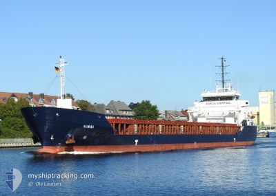
KIRSI
Cargo
Current Trip
| Time Travelled | 19 h, 25 mins |
|---|---|
| Remaining Time | 1 day |
| Distance Travelled | 203.70 nm |
| Remaining Distance | 504.79 nm |
| AVG Speed | 10.7 Knots |
| MAX Speed | 11.3 Knots |
| AVG Wind | 14.9 knots |
| MAX Wind | 20 knots |
| MIN Temp | -3°C / 26.6°F |
| MAX Temp | 0.5°C / 32.9°F |
| Draught | 3.4 m |
| Position Received | 2 h, 24 m ago |
Current Position
| Longitude | --- |
|---|---|
| Latitude | --- |
| Status | Under way using engine |
| Speed | 10.5 Knots |
| Course | 35.3° |
| Area | Baltic Sea |
| Station | T-AIS |
| Position Received | 2 h, 24 m ago |
Info
Information
The current position of KIRSI is in Baltic Sea with coordinates 55.99551° / 16.64563° as reported on 2025-02-17 09:40 by AIS to our vessel tracker app. The vessel's current speed is 10.5 Knots and is heading at the port of ST PETERSBURG. The estimated time of arrival as calculated by MyShipTracking vessel tracking app is 2025-02-19 10:43 LT
The vessel KIRSI (IMO: 9490179, MMSI: 304964000) is a Cargo It's sailing under the flag of [AG] Antigua Barbuda.
In this page you can find informations about the vessels current position, last detected port calls, and current voyage information. If the vessels is not in coverage by AIS you will find the latest position.
The current position of KIRSI is detected by our AIS receivers and we are not responsible for the reliability of the data. The last position was recorded while the vessel was in Coverage by the Ais receivers of our vessel tracking app.
The current draught of KIRSI as reported by AIS is 3.4 meters
Weather
| Temperature | 0.8°C / 33.44°F |
|---|---|
| Wind Speed | 14 knots |
| Direction | 299° WNW |
| Pressure | 1021 hPa |
| Humidity | 58.9 % |
| Cloud Coverage | 61 % |
Featured Company
Last Port Calls
| Port | Arrival | Departure | Time In Port |
|---|---|---|---|
| 2025-02-10 11:06 | 2025-02-16 16:40 | 6 d | |
| 2025-02-07 10:43 | 2025-02-07 11:16 | 32 m | |
| 2025-01-29 17:25 | 2025-02-07 09:37 | 8 d | |
| 2025-01-26 05:33 | 2025-01-27 11:34 | 1 d | |
| 2025-01-20 11:07 | 2025-01-23 08:17 | 2 d | |
| 2025-01-20 08:38 | |||
| 2025-01-20 08:00 | |||
| 2025-01-13 20:09 | 2025-01-17 19:01 | 3 d | |
| 2025-01-09 16:48 | 2025-01-09 16:51 | 3 m | |
| 2025-01-06 06:43 | 2025-01-07 18:35 | 1 d |
Most Visited Ports (Last year)
| Port | Arrivals | |
|---|---|---|
| 11 | ||
| 7 | ||
| 4 | ||
| 3 | ||
| 3 | ||
| 3 |
Last Trips
| Origin | Departure | Destination | Arrival | Distance | |
|---|---|---|---|---|---|
| 2025-02-07 14:16 | 2025-02-10 12:06 | 702.45 nm | |||
| 2025-02-07 12:37 | 2025-02-07 13:43 | 9.51 nm | |||
| 2025-01-27 12:34 | 2025-01-29 20:25 | 576.38 nm | |||
| 2025-01-23 11:17 | 2025-01-26 06:33 | 583.40 nm | |||
| 2025-01-17 21:01 | 2025-01-20 14:07 | 390.64 nm | |||
| 2025-01-17 21:01 | 2025-01-20 11:38 | 365.05 nm | |||
| 2025-01-09 17:51 | 2025-01-13 22:09 | 575.02 nm | |||
| 2025-01-07 19:35 | 2025-01-09 17:48 | 372.30 nm | |||
| 2024-12-23 17:09 | 2025-01-06 07:43 | 703.32 nm | |||
| 2024-12-22 15:40 | 2024-12-23 08:10 | 154.89 nm |
Events
| Time | Event | Details | Position / Dest | Info |
|---|---|---|---|---|
| 2025-02-17 09:45 | Status Changed | Default Under way using engine |
56.00590 / 16.66581
RULED
|
Speed: 10.5 kn Course: 35.3° |
| 2025-02-17 09:40 | OUT of Coverage |
55.99551 / 16.64563
Baltic Sea
RULED
|
Speed: 10.5 kn Course: 35.3° |
|
| 2025-02-17 06:05 | Change Sea Area | Swedish part of the Baltic Sea Danish part of the Kattegat |
55.46930 / 16.02191
Baltic Sea
RULED
|
Speed: 10.8 kn Course: 31.4° |
| 2025-02-17 01:43 | Detected in Sea | Danish part of the Kattegat |
54.81731 / 15.27419
Kattegat
RULED
|
Speed: 10.9 kn Course: 33.4° |
| 2025-02-16 23:01 | ETA Changed | 2025/02/19 06:00 2025/02/19 14:00 |
54.39974 / 14.80200
RULED
|
Speed: 10.9 kn Course: 33.4° |
| 2025-02-16 22:22 | Status Changed | Under way using engine Default |
54.30422 / 14.68451
RULED
|
Speed: 11 kn Course: 39° |
| 2025-02-16 22:09 | IN Coverage |
54.30422 / 14.68451
Baltic Sea
RULED
|
Speed: 10.9 kn Course: 39.2° |
|
| 2025-02-16 16:40 | PORT DEPARTURE |
|
53.47521 / 14.60890
RULED
|
Speed: 8.7 kn Course: 9° |
| 2025-02-16 16:31 | Status Changed | Default Under way using engine |
53.45504 / 14.59759
[PL] SZCZECIN
|
Speed: 9 kn Course: 12° |
| 2025-02-16 16:30 | OUT of Coverage |
53.45092 / 14.59616
Baltic Sea
RULED
|
Speed: 9 kn Course: 10.6° |