
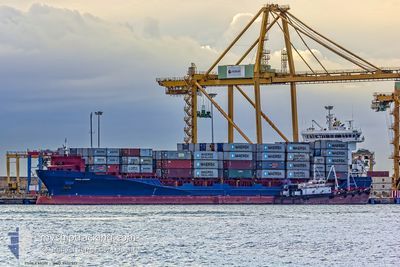
KILIA
Container Ship
Current Trip
| Trip Time | 3 days |
|---|---|
| Trip Distance | 438.09 nm |
| AVG Speed | 8.1 Knots |
| MAX Speed | 15.1 Knots |
| Draught | 8.7 m |
| AVG Wind | 5.5 knots |
| MAX Wind | 12.3 knots |
| MIN Temp | 14°C / 57.2°F |
| MAX Temp | 16.3°C / 61.34°F |
| Position Received | 1 m ago |
Current Position
| Longitude | --- |
|---|---|
| Latitude | --- |
| Status | Moored |
| Speed | |
| Course | 179° |
| Area | Strait of Gibraltar |
| Station | T-AIS |
| Position Received | 1 m ago |
Info
Information
The current position of KILIA is in Strait of Gibraltar with coordinates 36.13245° / -5.42253° as reported on 2025-02-16 13:53 by AIS to our vessel tracker app. The vessel's current speed is 0 Knots and is currently inside the port of ALGECIRAS.
The vessel KILIA (IMO: 9412517, MMSI: 255806313) is a Container Ship that was built in 2010 ( 15 years old ). It's sailing under the flag of [PT] Portugal.
In this page you can find informations about the vessels current position, last detected port calls, and current voyage information. If the vessels is not in coverage by AIS you will find the latest position.
The current position of KILIA is detected by our AIS receivers and we are not responsible for the reliability of the data. The last position was recorded while the vessel was in Coverage by the Ais receivers of our vessel tracking app.
The current draught of KILIA as reported by AIS is 8.7 meters
Weather
| Temperature | 16.2°C / 61.16°F |
|---|---|
| Wind Speed | 9 knots |
| Direction | 265° W |
| Pressure | 1016.6 hPa |
| Humidity | 59.1 % |
| Cloud Coverage | --- |
Featured Company
Last Port Calls
| Port | Arrival | Departure | Time In Port |
|---|---|---|---|
| 2025-02-16 09:37 | |||
| 2025-02-11 14:15 | 2025-02-12 13:05 | 22 h | |
| 2025-02-09 16:27 | 2025-02-10 19:23 | 1 d | |
| 2025-02-08 12:21 | 2025-02-09 07:23 | 19 h | |
| 2025-02-06 02:09 | 2025-02-06 15:02 | 12 h | |
| 2025-02-02 00:24 | 2025-02-03 01:46 | 1 d | |
| 2025-01-27 04:14 | 2025-01-27 13:47 | 9 h | |
| 2025-01-22 15:26 | 2025-01-23 00:29 | 9 h | |
| 2025-01-21 06:33 | 2025-01-21 23:24 | 16 h | |
| 2025-01-20 05:24 | 2025-01-20 20:11 | 14 h |
Most Visited Ports (Last year)
| Port | Arrivals | |
|---|---|---|
| 22 | ||
| 13 | ||
| 11 | ||
| 10 | ||
| 9 | ||
| 8 |
Last Trips
| Origin | Departure | Destination | Arrival | Distance | |
|---|---|---|---|---|---|
| 2025-02-12 13:05 | 2025-02-16 10:37 | 438.09 nm | |||
| 2025-02-10 19:23 | 2025-02-11 14:15 | 216.18 nm | |||
| 2025-02-09 08:23 | 2025-02-09 16:27 | 78.43 nm | |||
| 2025-02-06 16:02 | 2025-02-08 13:21 | 556.98 nm | |||
| 2025-02-03 02:46 | 2025-02-06 03:09 | 194.48 nm | |||
| 2025-01-27 14:47 | 2025-02-02 01:24 | 603.04 nm | |||
| 2025-01-23 00:29 | 2025-01-27 05:14 | 414.48 nm | |||
| 2025-01-21 23:24 | 2025-01-22 15:26 | 222.41 nm | |||
| 2025-01-20 21:11 | 2025-01-21 06:33 | 76.99 nm | |||
| 2025-01-18 08:39 | 2025-01-20 06:24 | 555.92 nm |
Events
| Time | Event | Details | Position / Dest | Info |
|---|---|---|---|---|
| 2025-02-16 09:50 | Status Changed | Moored Under way using engine |
36.13243 / -5.42252
[ES] ALGECIRAS
|
Speed: Course: 178° |
| 2025-02-16 09:47 | STOP Moving |
36.13239 / -5.42234
[ES] ALGECIRAS
|
Speed: 0.3 kn Course: 181° |
|
| 2025-02-16 09:37 | PORT ARRIVAL |
|
36.13735 / -5.41725
[ES] ALGECIRAS
|
Speed: 4.2 kn Course: 234° |
| 2025-02-16 09:25 | Change Sea Area | Spanish part of the Strait of Gibraltar Gibraltarian part of the Strait of Gibraltar |
36.13032 / -5.39866
Strait of Gibraltar
ESALG
|
Speed: 8.4 kn Course: 323.1° |
| 2025-02-16 08:22 | Change Sea Area | Gibraltarian part of the Strait of Gibraltar Gibraltarian part of the Alboran Sea |
36.06034 / -5.33286
Strait of Gibraltar
ESALG
|
Speed: 2.1 kn Course: 311.4° |
| 2025-02-16 06:38 | ETA Changed | 2025/02/16 07:00 2025/02/16 06:00 |
36.06675 / -5.24269
ESALG
|
Speed: 3.6 kn Course: 265° |
| 2025-02-16 04:13 | Change Sea Area | Gibraltarian part of the Alboran Sea Spanish part of the Alboran Sea |
36.11185 / -5.01563
Alboran Sea
ESALG
|
Speed: 5.2 kn Course: 240.3° |
| 2025-02-16 03:14 | START Moving |
36.18783 / -4.88201
ESALG
|
Speed: 3.3 kn Course: 172° |
|
| 2025-02-16 03:05 | ETA Changed | 2025/02/16 06:00 2025/02/13 17:00 |
36.18923 / -4.88200
ESALG
|
Speed: 0.6 kn Course: 121° |
| 2025-02-16 00:45 | Status Changed | Under way using engine Default |
36.19611 / -4.83998
ESALG
|
Speed: 0.9 kn Course: 148° |