
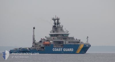
KBV 003
Salvage/Rescue Vessel
Current Trip
PATROLLING
| Time Travelled | 1 day |
|---|---|
| Remaining Time | --- |
| Distance Travelled | 179.80 nm |
| Remaining Distance | --- |
| AVG Speed | 4.1 Knots |
| MAX Speed | 6.2 Knots |
| AVG Wind | 19.4 knots |
| MAX Wind | 25.7 knots |
| MIN Temp | -3.4°C / 25.88°F |
| MAX Temp | 2.2°C / 35.96°F |
| Draught | 5.7 m |
| Position Received | Now |
Current Position
| Longitude | --- |
|---|---|
| Latitude | --- |
| Status | Under way using engine |
| Speed | 5.6 Knots |
| Course | 208.3° |
| Area | Baltic Sea |
| Station | T-AIS |
| Position Received | Now |
Info
Information
The current position of KBV 003 is in Baltic Sea with coordinates 57.59087° / 18.12653° as reported on 2026-01-09 13:34 by AIS to our vessel tracker app. The vessel's current speed is 5.6 Knots
The vessel KBV 003 (IMO: 9380465, MMSI: 266288000) is a Salvage/Rescue Vessel that was built in 2010 ( 16 years old ). It's sailing under the flag of [SE] Sweden.
In this page you can find informations about the vessels current position, last detected port calls, and current voyage information. If the vessels is not in coverage by AIS you will find the latest position.
The current position of KBV 003 is detected by our AIS receivers and we are not responsible for the reliability of the data. The last position was recorded while the vessel was in Coverage by the Ais receivers of our vessel tracking app.
The current draught of KBV 003 as reported by AIS is 5.7 meters
Weather
| Temperature | -3.3°C / 26.06°F |
|---|---|
| Wind Speed | 14 knots |
| Direction | 66° ENE |
| Pressure | 1015.1 hPa |
| Humidity | 70.5 % |
| Cloud Coverage | 100 % |
Featured Company
Last Port Calls
| Port | Arrival | Departure | Time In Port |
|---|---|---|---|
| 2026-01-07 07:23 | 2026-01-07 13:44 | 6 h | |
| 2025-12-28 12:33 | 2026-01-03 14:07 | 6 d | |
| 2025-12-27 12:11 | 2025-12-28 08:18 | 20 h | |
| 2025-12-25 18:45 | 2025-12-26 11:49 | 17 h | |
| 2025-12-24 07:47 | 2025-12-25 15:46 | 1 d | |
| 2025-12-17 10:12 | 2025-12-21 22:51 | 4 d | |
| 2025-11-30 08:52 | 2025-12-02 08:41 | 1 d | |
| 2025-11-22 17:07 | 2025-11-23 13:07 | 19 h | |
| 2025-11-04 11:13 | 2025-11-04 13:31 | 2 h | |
| 2025-11-03 15:28 | 2025-11-04 07:19 | 15 h |
Most Visited Ports (Last year)
| Port | Arrivals | |
|---|---|---|
| 25 | ||
| 8 | ||
| 8 | ||
| 7 | ||
| 4 | ||
| 3 |
Last Trips
| Origin | Departure | Destination | Arrival | Distance | |
|---|---|---|---|---|---|
| 2026-01-03 15:07 | 2026-01-07 08:23 | 282.73 nm | |||
| 2025-12-28 09:18 | 2025-12-28 13:33 | 31.04 nm | |||
| 2025-12-26 12:49 | 2025-12-27 13:11 | 97.74 nm | |||
| 2025-12-25 16:46 | 2025-12-25 19:45 | 6.88 nm | |||
| 2025-12-21 23:51 | 2025-12-24 08:47 | 138.02 nm | |||
| 2025-12-02 09:41 | 2025-12-17 11:12 | 419.91 nm | |||
| 2025-11-23 14:07 | 2025-11-30 09:52 | 199.43 nm | |||
| 2025-11-04 14:31 | 2025-11-22 18:07 | 656.23 nm | |||
| 2025-11-04 08:19 | 2025-11-04 12:13 | 33.24 nm | |||
| 2025-11-03 12:37 | 2025-11-03 16:28 | 28.72 nm |
Events
| Time | Event | Details | Position / Dest | Info |
|---|---|---|---|---|
| 2026-01-08 00:23 | IN Coverage |
57.74970 / 17.01435
Baltic Sea
|
Speed: 3.3 kn Course: 173.2° |
|
| 2026-01-07 23:15 | OUT of Coverage |
57.80042 / 17.01282
Baltic Sea
|
Speed: 2 kn Course: 52° |
|
| 2026-01-07 14:52 | IN Coverage |
57.25662 / 16.66712
Baltic Sea
|
Speed: 5.9 kn Course: 77.1° |
|
| 2026-01-07 13:44 | PORT DEPARTURE |
|
57.25643 / 16.66568
PATROLLING
|
Speed: Course: 127° |
| 2026-01-07 08:04 | OUT of Coverage |
57.26547 / 16.46105
Baltic Sea
[SE] OSKARSHAMN
|
Speed: Course: 347° |
|
| 2026-01-07 07:35 | STOP Moving |
57.26392 / 16.46523
[SE] OSKARSHAMN
|
Speed: 0.2 kn Course: 24° |
|
| 2026-01-07 07:23 | PORT ARRIVAL |
|
57.26798 / 16.49013
[SE] OSKARSHAMN
|
Speed: 8.4 kn Course: 233.1° |
| 2026-01-07 01:04 | START Moving | 11.67 nm, South East of VASTERVIK |
57.64748 / 16.96585
PATROLLING
|
Speed: 4.3 kn Course: 206° |
| 2026-01-06 20:12 | IN Coverage |
57.64928 / 16.96647
Baltic Sea
|
Speed: Course: 21.1° |
|
| 2026-01-06 17:42 | OUT of Coverage |
57.64917 / 16.96605
Baltic Sea
|
Speed: Course: 180.7° |