
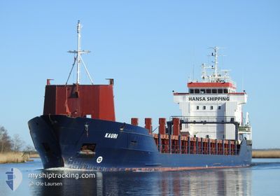
KAURI
General Cargo
Current Trip
| Time Travelled | 11 h, 18 mins |
|---|---|
| Remaining Time | 22 h, 47 mins |
| Distance Travelled | 96.25 nm |
| Remaining Distance | 163.27 nm |
| AVG Speed | 9.1 Knots |
| MAX Speed | 11.8 Knots |
| AVG Wind | 13.5 knots |
| MAX Wind | 18 knots |
| MIN Temp | 0.8°C / 33.44°F |
| MAX Temp | 7.7°C / 45.86°F |
| Draught | 4 m |
| Position Received | Now |
Current Position
| Longitude | --- |
|---|---|
| Latitude | --- |
| Status | Under way using engine |
| Speed | 7.3 Knots |
| Course | 279.5° |
| Area | Celtic Sea |
| Station | T-AIS |
| Position Received | Now |
Info
Information
The current position of KAURI is in Celtic Sea with coordinates 51.55587° / -5.23203° as reported on 2026-01-10 08:36 by AIS to our vessel tracker app. The vessel's current speed is 7.3 Knots and is heading at the port of WARRENPOINT. The estimated time of arrival as calculated by MyShipTracking vessel tracking app is 2026-01-11 07:23 LT
The vessel KAURI (IMO: 9173226, MMSI: 305633000) is a General Cargo that was built in 1998 ( 28 years old ). It's sailing under the flag of [AG] Antigua Barbuda.
In this page you can find informations about the vessels current position, last detected port calls, and current voyage information. If the vessels is not in coverage by AIS you will find the latest position.
The current position of KAURI is detected by our AIS receivers and we are not responsible for the reliability of the data. The last position was recorded while the vessel was in Coverage by the Ais receivers of our vessel tracking app.
The current draught of KAURI as reported by AIS is 4 meters
Weather
| Temperature | 7.6°C / 45.68°F |
|---|---|
| Wind Speed | 11 knots |
| Direction | 322° NW |
| Pressure | 1016.7 hPa |
| Humidity | 68.7 % |
| Cloud Coverage | 13 % |
Featured Company
Last Port Calls
| Port | Arrival | Departure | Time In Port |
|---|---|---|---|
| 2026-01-08 23:29 | 2026-01-09 21:18 | 21 h | |
| 2026-01-05 10:55 | 2026-01-06 14:25 | 1 d | |
| 2025-12-21 00:44 | 2025-12-22 17:44 | 1 d | |
| 2025-12-17 13:26 | 2025-12-20 01:41 | 2 d | |
| 2025-11-17 06:57 | 2025-12-12 06:19 | 24 d | |
| 2025-11-14 10:24 | 2025-11-15 10:38 | 1 d | |
| 2025-11-09 13:18 | 2025-11-11 13:00 | 1 d | |
| 2025-11-05 18:46 | 2025-11-06 20:26 | 1 d | |
| 2025-11-01 06:59 | 2025-11-03 12:44 | 2 d |
Last Trips
| Origin | Departure | Destination | Arrival | Distance | |
|---|---|---|---|---|---|
| 2026-01-06 14:25 | 2026-01-08 23:29 | 657.09 nm | |||
| 2025-12-22 17:44 | 2026-01-05 10:55 | 2298.80 nm | |||
| 2025-12-20 01:41 | 2025-12-21 00:44 | 278.92 nm | |||
| 2025-12-12 06:19 | 2025-12-17 13:26 | 1313.79 nm | |||
| 2025-11-15 10:38 | 2025-11-17 06:57 | 312.97 nm | |||
| 2025-11-11 13:00 | 2025-11-14 10:24 | 526.36 nm | |||
| 2025-11-06 20:26 | 2025-11-09 13:18 | 574.64 nm | |||
| 2025-11-03 12:44 | 2025-11-05 18:46 | 580.88 nm | |||
| 2025-10-28 17:33 | 2025-11-01 06:59 | 836.27 nm |
Events
| Time | Event | Details | Position / Dest | Info |
|---|---|---|---|---|
| 2026-01-10 06:40 | Detected in Sea | United Kingdom part of the Celtic Sea |
51.50273 / -4.88083
Celtic Sea
GB WPT
|
Speed: 7.2 kn Course: 272.6° |
| 2026-01-10 06:16 | Status Changed | Under way using engine Default |
51.49866 / -4.80897
GB WPT
|
Speed: 6.5 kn Course: 275° |
| 2026-01-10 06:16 | IN Coverage |
51.49866 / -4.80897
Bristol Channel
GB WPT
|
Speed: 5.7 kn Course: 276.6° |
|
| 2026-01-10 06:14 | Status Changed | Default Under way using engine |
51.49827 / -4.80375
GB WPT
|
Speed: 6.6 kn Course: 279.1° |
| 2026-01-10 06:14 | Status Changed | Under way using engine Default |
51.49820 / -4.80280
GB WPT
|
Speed: 6.8 kn Course: 272° |
| 2026-01-09 23:55 | OUT of Coverage |
51.35352 / -3.37712
Bristol Channel
GB WPT
|
Speed: 9.5 kn Course: 277.2° |
|
| 2026-01-09 21:18 | PORT DEPARTURE |
|
51.50681 / -2.72300
GB WPT
|
Speed: 9.7 kn Course: 255° |
| 2026-01-09 21:16 | START Moving |
51.50654 / -2.71585
[GB] AVONMOUTH
|
Speed: 7.1 kn Course: 288° |
|
| 2026-01-09 20:14 | Status Changed | Under way using engine Moored |
51.50846 / -2.70207
[GB] AVONMOUTH
|
Speed: Course: 28° |
| 2026-01-09 20:13 | ETA Changed | 2026/01/11 08:00 2026/01/10 18:00 |
51.50846 / -2.70207
[GB] AVONMOUTH
|
Speed: Course: 28° |