
KAOS
Pleasure Craft
Current Trip
VIRGIMNOKO
| Time Travelled | 10 days |
|---|---|
| Remaining Time | --- |
| Distance Travelled | 332.94 nm |
| Remaining Distance | --- |
| AVG Speed | 12.3 Knots |
| MAX Speed | 20.7 Knots |
| AVG Wind | 12.1 knots |
| MAX Wind | 19.8 knots |
| MIN Temp | 23.8°C / 74.84°F |
| MAX Temp | 26.4°C / 79.52°F |
| Draught | 4.4 m |
| Position Received | Now |
Current Position
| Longitude | --- |
|---|---|
| Latitude | --- |
| Status | Under way using engine |
| Speed | 14.8 Knots |
| Course | 29.9° |
| Area | Caribbean Sea |
| Station | T-AIS |
| Position Received | Now |
Info
Information
The current position of KAOS is in Caribbean Sea with coordinates 18.34992° / -64.62905° as reported on 2026-02-18 10:43 by AIS to our vessel tracker app. The vessel's current speed is 14.8 Knots
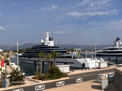
The vessel KAOS (IMO: 1012610, MMSI: 339302000) is a Pleasure Craft It's sailing under the flag of [JM] Jamaica.
In this page you can find informations about the vessels current position, last detected port calls, and current voyage information. If the vessels is not in coverage by AIS you will find the latest position.
The current position of KAOS is detected by our AIS receivers and we are not responsible for the reliability of the data. The last position was recorded while the vessel was in Coverage by the Ais receivers of our vessel tracking app.
The current draught of KAOS as reported by AIS is 4.4 meters
Weather
| Temperature | 25.7°C / 78.26°F |
|---|---|
| Wind Speed | 11 knots |
| Direction | 79° E |
| Pressure | 1016.7 hPa |
| Humidity | 73.8 % |
| Cloud Coverage | 1 % |
Featured Company
Last Trips
| Origin | Departure | Destination | Arrival | Distance |
|---|
Events
| Time | Event | Details | Position / Dest | Info |
|---|---|---|---|---|
| 2026-02-18 10:34 | START Moving | --- |
18.32287 / -64.62914
VIRGIMNOKO
|
Speed: 8.7 kn Course: 295.5° |
| 2026-02-18 10:26 | Status Changed | Under way using engine At anchor |
18.32127 / -64.62669
VIRGIMNOKO
|
Speed: 0.3 kn Course: 79° |
| 2026-02-18 10:21 | Destination Changed | VIRGIMNOKO VG, SQNG OPS |
18.32140 / -64.62697
VIRGIMNOKO
|
Speed: 0.2 kn Course: 49° |
| 2026-02-18 10:21 | ETA Changed | 2026/02/18 11:30 2026/02/17 11:30 |
18.32140 / -64.62697
VIRGIMNOKO
|
Speed: 0.2 kn Course: 49° |
| 2026-02-17 20:04 | Status Changed | At anchor Under way using engine |
18.32136 / -64.62660
VG, SQNG OPS
|
Speed: 0.4 kn Course: 118° |
| 2026-02-17 20:02 | STOP Moving | --- |
18.32128 / -64.62672
VG, SQNG OPS
|
Speed: 0.2 kn Course: 129° |
| 2026-02-17 18:38 | START Moving | --- |
18.44952 / -64.45157
VG, SQNG OPS
|
Speed: 6.4 kn Course: 242.7° |
| 2026-02-17 18:33 | Status Changed | Under way using engine At anchor |
18.45118 / -64.44979
VG, SQNG OPS
|
Speed: 0.5 kn Course: 134° |
| 2026-02-17 10:11 | Status Changed | At anchor Under way using engine |
18.45116 / -64.44994
VG, SQNG OPS
|
Speed: 0.5 kn Course: 106° |
| 2026-02-17 10:09 | STOP Moving | --- |
18.45100 / -64.44974
VG, SQNG OPS
|
Speed: 0.2 kn Course: 91° |