
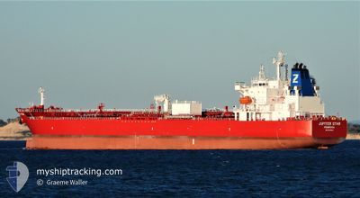
JUPITER STAR
Tanker B
Current Trip
| Time Travelled | 2 days |
|---|---|
| Remaining Time | 4 days |
| Distance Travelled | 61.93 nm |
| Remaining Distance | 693.89 nm |
| AVG Speed | 7.6 Knots |
| MAX Speed | 11.7 Knots |
| AVG Wind | 3.8 knots |
| MAX Wind | 7 knots |
| MIN Temp | 9.3°C / 48.74°F |
| MAX Temp | 12.3°C / 54.14°F |
| Draught | 7.2 m |
| Position Received | 1 h, 25 m ago |
Current Position
| Longitude | --- |
|---|---|
| Latitude | --- |
| Status | Restricted manoeuverability |
| Speed | 0.5 Knots |
| Course | 317° |
| Area | Adriatic Sea |
| Station | T-AIS |
| Position Received | 1 h, 25 m ago |
Info
Information
The current position of JUPITER STAR is in Adriatic Sea with coordinates 44.38946° / 12.91317° as reported on 2024-12-18 20:07 by AIS to our vessel tracker app. The vessel's current speed is 0.5 Knots and is heading at the port of VALLETTA. The estimated time of arrival as calculated by MyShipTracking vessel tracking app is 2024-12-23 09:06 LT
The vessel JUPITER STAR (IMO: 9919632, MMSI: 636020504) is a Tanker B It's sailing under the flag of [LR] Liberia.
In this page you can find informations about the vessels current position, last detected port calls, and current voyage information. If the vessels is not in coverage by AIS you will find the latest position.
The current position of JUPITER STAR is detected by our AIS receivers and we are not responsible for the reliability of the data. The last position was recorded while the vessel was in Coverage by the Ais receivers of our vessel tracking app.
The current draught of JUPITER STAR as reported by AIS is 7.2 meters
Weather
| Temperature | 11.5°C / 52.7°F |
|---|---|
| Wind Speed | 1 knots |
| Direction | 70° ENE |
| Pressure | 1025.1 hPa |
| Humidity | 72.4 % |
| Cloud Coverage | 51 % |
Featured Company
Last Port Calls
| Port | Arrival | Departure | Time In Port |
|---|---|---|---|
| 2024-12-13 12:29 | 2024-12-16 16:38 | 3 d | |
| 2024-12-07 02:58 | 2024-12-08 19:15 | 1 d | |
| 2024-12-05 20:34 | 2024-12-06 22:31 | 1 d | |
| 2024-12-03 10:56 | 2024-12-04 09:40 | 22 h | |
| 2024-11-14 07:44 | 2024-11-17 14:18 | 3 d | |
| 2024-11-11 10:58 | 2024-11-13 06:32 | 1 d | |
| 2024-11-09 11:58 | 2024-11-10 19:17 | 1 d | |
| 2024-11-05 05:51 | 2024-11-06 21:25 | 1 d | |
| 2024-10-02 20:50 | 2024-10-14 07:14 | 11 d |
Most Visited Ports (Last year)
| Port | Arrivals | |
|---|---|---|
| 3 | ||
| 3 | ||
| 3 | ||
| 2 | ||
| 2 | ||
| 2 |
Last Trips
| Origin | Departure | Destination | Arrival | Distance | |
|---|---|---|---|---|---|
| 2024-12-08 20:15 | 2024-12-13 13:29 | 1372.36 nm | |||
| 2024-12-06 23:31 | 2024-12-07 03:58 | 51.44 nm | |||
| 2024-12-04 10:40 | 2024-12-05 21:34 | 449.97 nm | |||
| 2024-11-17 08:18 | 2024-12-03 11:56 | 4648.01 nm | |||
| 2024-11-13 00:32 | 2024-11-14 01:44 | 64.17 nm | |||
| 2024-11-10 13:17 | 2024-11-11 04:58 | 183.25 nm | |||
| 2024-11-06 16:25 | 2024-11-09 05:58 | 800.64 nm | |||
| 2024-10-14 10:14 | 2024-11-05 00:51 | 6068.85 nm | |||
| 2024-09-27 21:54 | 2024-10-02 23:50 | 1186.71 nm |
Events
| Time | Event | Details | Position / Dest | Info |
|---|---|---|---|---|
| 2024-12-18 20:18 | Status Changed | Default Restricted manoeuverability |
44.39020 / 12.91112
MALTA
|
Speed: 0.5 kn Course: 317° |
| 2024-12-18 20:07 | OUT of Coverage |
44.38946 / 12.91317
Adriatic Sea
MALTA
|
Speed: 0.5 kn Course: 299.5° |
|
| 2024-12-18 20:03 | Status Changed | Restricted manoeuverability Default |
44.38916 / 12.91389
MALTA
|
Speed: 0.5 kn Course: 329° |
| 2024-12-18 19:53 | Status Changed | Default Restricted manoeuverability |
44.38848 / 12.91574
MALTA
|
Speed: 0.5 kn Course: 334° |
| 2024-12-18 19:47 | Status Changed | Restricted manoeuverability Default |
44.38800 / 12.91690
MALTA
|
Speed: 0.5 kn Course: 340° |
| 2024-12-18 19:04 | Status Changed | Default Restricted manoeuverability |
44.38472 / 12.92451
MALTA
|
Speed: 0.5 kn Course: 340° |
| 2024-12-18 17:45 | Status Changed | Restricted manoeuverability Default |
44.38350 / 12.93979
MALTA
|
Speed: 0.3 kn Course: 286° |
| 2024-12-18 17:35 | Status Changed | Default Restricted manoeuverability |
44.38356 / 12.94134
MALTA
|
Speed: 0.3 kn Course: 291° |
| 2024-12-18 17:06 | ETA Changed | 2024/12/22 07:00 2024/12/19 07:00 |
44.38354 / 12.94567
MALTA
|
Speed: 0.3 kn Course: 303° |
| 2024-12-18 17:03 | Status Changed | Restricted manoeuverability Default |
44.38359 / 12.94607
MALTA
|
Speed: 0.4 kn Course: 297° |