
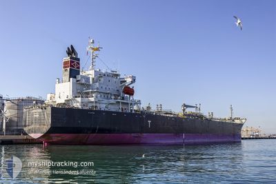
JIPRO ISIS
Oil/Chemical Tanker
Current Trip
GI GIB => USLU8
| Time Travelled | 25 days |
|---|---|
| Remaining Time | --- |
| Distance Travelled | 5763.60 nm |
| Remaining Distance | --- |
| AVG Speed | 12.1 Knots |
| MAX Speed | 15.6 Knots |
| AVG Wind | 14.5 knots |
| MAX Wind | 39.8 knots |
| MIN Temp | 9°C / 48.2°F |
| MAX Temp | 25.7°C / 78.26°F |
| Draught | 7.5 m |
| Position Received | 20 h, 58 m ago |
Current Position
| Longitude | -79.56336° |
|---|---|
| Latitude | 25.33300° |
| Status | Under way using engine |
| Speed | 12.1 Knots |
| Course | 188.2° |
| Area | North Atlantic Ocean |
| Station | T-AIS |
| Position Received | 20 h, 58 m ago |
Info
Information
The current position of JIPRO ISIS is in North Atlantic Ocean with coordinates 25.33300° / -79.56336° as reported on 2024-04-27 12:28 by AIS to our vessel tracker app. The vessel's current speed is 12.1 Knots
The vessel JIPRO ISIS (IMO: 9370719, MMSI: 370069000) is a Oil/Chemical Tanker that was built in 2008 ( 16 years old ). It's sailing under the flag of [PA] Panama.
In this page you can find informations about the vessels current position, last detected port calls, and current voyage information. If the vessels is not in coverage by AIS you will find the latest position.
The current position of JIPRO ISIS is detected by our AIS receivers and we are not responsible for the reliability of the data. The last position was recorded while the vessel was in Coverage by the Ais receivers of our vessel tracking app.
The current draught of JIPRO ISIS as reported by AIS is 7.5 meters
Weather
| Temperature | 25.5°C / 77.9°F |
|---|---|
| Wind Speed | 23 knots |
| Direction | 109° ESE |
| Pressure | 1015 hPa |
| Humidity | 73.3 % |
| Cloud Coverage | 100 % |
Featured Company
Last Port Calls
| Port | Arrival | Departure | Time In Port |
|---|---|---|---|
| 2024-03-31 22:27 | 2024-04-02 11:18 | 1 d | |
| 2024-03-28 15:24 | 2024-03-31 21:01 | 3 d | |
| 2024-03-20 04:04 | 2024-03-20 11:40 | 7 h | |
| 2024-02-16 17:02 | 2024-02-17 23:56 | 1 d | |
| 2024-02-14 21:49 | 2024-02-16 14:17 | 1 d | |
| 2024-02-09 05:08 | 2024-02-10 11:57 | 1 d |
Last Trips
| Origin | Departure | Destination | Arrival | Distance | |
|---|---|---|---|---|---|
| 2024-03-31 23:01 | 2024-04-01 00:27 | 15.96 nm | |||
| 2024-03-20 11:40 | 2024-03-28 16:24 | 1804.90 nm | |||
| 2024-02-18 00:56 | 2024-03-20 04:04 | 9122.53 nm | |||
| 2024-02-16 15:17 | 2024-02-16 18:02 | 22.38 nm | |||
| 2024-02-10 12:57 | 2024-02-14 22:49 | 803.69 nm | |||
| 2024-01-03 05:06 | 2024-02-09 06:08 | 10337.60 nm |
Events
| Time | Event | Details | Position / Dest | Info |
|---|---|---|---|---|
| 2024-04-27 12:36 | Status Changed | Default Under way using engine |
25.30732 / -79.56745
GI GIB => USLU8
|
Speed: 12.1 kn Course: 188.2° |
| 2024-04-27 12:28 | OUT of Coverage |
25.33301 / -79.56336
North Atlantic Ocean
GI GIB => USLU8
|
Speed: 12.1 kn Course: 188.2° |
|
| 2024-04-27 08:46 | Draught Changed | 7.5 6.9 |
26.08658 / -79.45651
GI GIB => USLU8
|
Speed: 12.4 kn Course: 185.4° |
| 2024-04-27 08:46 | Destination Changed | GI GIB => USLU8 GI GIB => US MSY |
26.08658 / -79.45651
GI GIB => USLU8
|
Speed: 12.4 kn Course: 185.4° |
| 2024-04-27 08:46 | ETA Changed | 2024/04/29 19:00 2024/04/29 08:00 |
26.08658 / -79.45651
GI GIB => USLU8
|
Speed: 12.4 kn Course: 185.4° |
| 2024-04-27 07:37 | Change Sea Area | Bahamas part of the North Atlantic Ocean Portuguese (Madeira) part of the North Atlantic Ocean |
26.32052 / -79.41258
North Atlantic Ocean
GI GIB => US MSY
|
Speed: 12.6 kn Course: 196.2° |
| 2024-04-27 07:37 | Status Changed | Under way using engine Default |
26.32221 / -79.41205
GI GIB => US MSY
|
Speed: 12.8 kn Course: 199° |
| 2024-04-27 07:18 | IN Coverage |
26.32052 / -79.41258
North Atlantic Ocean
GI GIB => US MSY
|
Speed: 12.6 kn Course: 196.2° |