
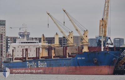
JERVIS BAY
Cargo
Current Trip
| Time Travelled | 19 days |
|---|---|
| Remaining Time | 8 days |
| Distance Travelled | 1679.87 nm |
| Remaining Distance | 2311.58 nm |
| AVG Speed | 9.6 Knots |
| MAX Speed | 14 Knots |
| AVG Wind | 14.5 knots |
| MAX Wind | 31 knots |
| MIN Temp | 12.8°C / 55.04°F |
| MAX Temp | 23.5°C / 74.3°F |
| Draught | 8.8 m |
| Position Received | 1 d ago |
Current Position
| Longitude | 134.68288° |
|---|---|
| Latitude | 33.07251° |
| Status | Under way using engine |
| Speed | 11.1 Knots |
| Course | 205.2° |
| Area | Philippine Sea |
| Station | T-AIS |
| Position Received | 1 d ago |
Info
Information
The current position of JERVIS BAY is in Philippine Sea with coordinates 33.07251° / 134.68288° as reported on 2024-05-20 09:52 by AIS to our vessel tracker app. The vessel's current speed is 11.1 Knots and is heading at the port of SINGAPORE. The estimated time of arrival as calculated by MyShipTracking vessel tracking app is 2024-05-30 17:55 LT
The vessel JERVIS BAY (IMO: 9610688, MMSI: 477652700) is a Cargo It's sailing under the flag of [HK] Hong Kong.
In this page you can find informations about the vessels current position, last detected port calls, and current voyage information. If the vessels is not in coverage by AIS you will find the latest position.
The current position of JERVIS BAY is detected by our AIS receivers and we are not responsible for the reliability of the data. The last position was recorded while the vessel was in Coverage by the Ais receivers of our vessel tracking app.
The current draught of JERVIS BAY as reported by AIS is 8.8 meters
Weather
| Temperature | 23°C / 73.4°F |
|---|---|
| Wind Speed | 15 knots |
| Direction | 95° E |
| Pressure | 1013 hPa |
| Humidity | 92.3 % |
| Cloud Coverage | 100 % |
Featured Company
Last Port Calls
| Port | Arrival | Departure | Time In Port |
|---|---|---|---|
| 2024-04-29 04:52 | 2024-05-01 21:49 | 2 d | |
| 2024-04-22 04:07 | 2024-04-24 08:29 | 2 d | |
| 2024-04-20 09:16 | |||
| 2024-03-20 03:43 | 2024-03-20 03:56 | 12 m | |
| 2024-03-17 20:07 |
Last Trips
| Origin | Departure | Destination | Arrival | Distance | |
|---|---|---|---|---|---|
| 2024-04-24 17:29 | 2024-04-29 12:52 | 983.95 nm | |||
| 2024-04-20 18:16 | 2024-04-22 13:07 | 458.10 nm | |||
| 2024-03-17 13:07 | 2024-03-19 20:43 | 696.33 nm |
Events
| Time | Event | Details | Position / Dest | Info |
|---|---|---|---|---|
| 2024-05-20 09:55 | Status Changed | Default Under way using engine |
33.06290 / 134.67755
SINGAPORE
|
Speed: 11.1 kn Course: 205.2° |
| 2024-05-20 09:52 | Status Changed | Under way using engine Default |
33.07251 / 134.68288
SINGAPORE
|
Speed: 10.9 kn Course: 205° |
| 2024-05-20 09:52 | OUT of Coverage |
33.07251 / 134.68288
Philippine Sea
SINGAPORE
|
Speed: 11.1 kn Course: 205.2° |
|
| 2024-05-20 09:32 | IN Coverage |
33.07251 / 134.68288
Philippine Sea
SINGAPORE
|
Speed: 11.1 kn Course: 205.2° |
|
| 2024-05-20 07:53 | Status Changed | Default Under way using engine |
33.41108 / 134.81520
SINGAPORE
|
Speed: 10.6 kn Course: 195.1° |
| 2024-05-20 07:47 | OUT of Coverage |
33.42782 / 134.82039
Philippine Sea
SINGAPORE
|
Speed: 10.6 kn Course: 195.1° |
|
| 2024-05-20 07:45 | Status Changed | Under way using engine Default |
33.43299 / 134.82227
SINGAPORE
|
Speed: 10.7 kn Course: 196° |
| 2024-05-20 07:32 | Status Changed | Default Under way using engine |
33.46834 / 134.83493
SINGAPORE
|
Speed: 10.7 kn Course: 197.4° |
| 2024-05-20 07:25 | Status Changed | Under way using engine Default |
33.48981 / 134.84251
SINGAPORE
|
Speed: 10.9 kn Course: 195° |
| 2024-05-20 07:04 | Status Changed | Default Under way using engine |
33.54955 / 134.86093
SINGAPORE
|
Speed: 11 kn Course: 191.5° |