
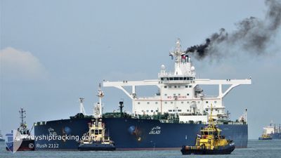
JALADI
Crude Oil Tanker
Current Trip
| Trip Time | 17 days |
|---|---|
| Trip Distance | 2962.29 nm |
| AVG Speed | 11.7 Knots |
| MAX Speed | 16.4 Knots |
| Draught | 20 m |
| AVG Wind | 9.4 knots |
| MAX Wind | 26 knots |
| MIN Temp | 25.3°C / 77.54°F |
| MAX Temp | 29.8°C / 85.64°F |
| Position Received | 9 d ago |
Current Position
| Longitude | 38.62587° |
|---|---|
| Latitude | 22.38415° |
| Status | Under way using engine |
| Speed | 12.7 Knots |
| Course | 20° |
| Area | Red Sea |
| Station | T-AIS |
| Position Received | 9 d ago |
Info
Information
The current position of JALADI is in Red Sea with coordinates 22.38415° / 38.62587° as reported on 2024-04-29 20:50 by AIS to our vessel tracker app. The vessel's current speed is 12.7 Knots and is currently inside the port of RABIGH.
The vessel JALADI (IMO: 9384227, MMSI: 403591000) is a Crude Oil Tanker that was built in 2009 ( 15 years old ). It's sailing under the flag of [SA] Saudi Arabia.
In this page you can find informations about the vessels current position, last detected port calls, and current voyage information. If the vessels is not in coverage by AIS you will find the latest position.
The current position of JALADI is detected by our AIS receivers and we are not responsible for the reliability of the data. The last position was recorded while the vessel was in Coverage by the Ais receivers of our vessel tracking app.
The current draught of JALADI as reported by AIS is 20 meters
Weather
| Temperature | 29.5°C / 85.1°F |
|---|---|
| Wind Speed | 5 knots |
| Direction | 318° NW |
| Pressure | 1007.8 hPa |
| Humidity | 49.7 % |
| Cloud Coverage | 61 % |
Featured Company
Last Port Calls
| Port | Arrival | Departure | Time In Port |
|---|---|---|---|
| 2024-05-08 12:11 | |||
| 2024-04-19 14:18 | 2024-04-21 02:34 | 1 d | |
| 2024-04-01 12:32 | 2024-04-03 01:45 | 1 d | |
| 2024-03-19 20:42 | |||
| 2024-03-09 04:12 | 2024-03-10 15:01 | 1 d |
Most Visited Ports (Last year)
| Port | Arrivals | |
|---|---|---|
| 4 | ||
| 4 | ||
| 1 | ||
| 1 | ||
| 1 |
Last Trips
| Origin | Departure | Destination | Arrival | Distance | |
|---|---|---|---|---|---|
| 2024-04-21 05:34 | 2024-05-08 15:11 | 2962.29 nm | |||
| 2024-04-03 04:45 | 2024-04-19 17:18 | 3815.22 nm | |||
| 2024-03-10 18:01 | 2024-03-19 23:42 | 1203.52 nm | |||
| 2024-02-22 18:07 | 2024-03-09 07:12 | 1385.19 nm |
Events
| Time | Event | Details | Position / Dest | Info |
|---|---|---|---|---|
| 2024-05-08 12:20 | STOP Moving |
22.74172 / 38.99792
[SA] RABIGH
|
Speed: 0.2 kn Course: 24° |
|
| 2024-05-08 12:11 | PORT ARRIVAL |
|
22.74053 / 38.99278
[SA] RABIGH
|
Speed: 5.2 kn Course: 67° |
| 2024-05-06 13:22 | STOP Moving |
22.60383 / 38.56178
SA RAB
|
Speed: 0.2 kn Course: 229° |
|
| 2024-05-06 11:16 | START Moving | 20.84 nm, West of KING ABDULLAH |
22.43010 / 38.72760
SA RAB
|
Speed: 3.1 kn Course: 328° |
| 2024-05-05 07:42 | STOP Moving |
22.58265 / 38.58083
SA RAB
|
Speed: 0.3 kn Course: 223° |
|
| 2024-05-05 05:11 | START Moving | 18.35 nm, West of KING ABDULLAH |
22.45945 / 38.76605
SA RAB
|
Speed: 4.2 kn Course: 310° |
| 2024-05-04 07:52 | STOP Moving | 21.02 nm, West of RABIGH |
22.60845 / 38.64332
SA RAB
|
Speed: 0.2 kn Course: 253° |
| 2024-05-04 05:07 | START Moving |
22.43973 / 38.37763
SA RAB
|
Speed: 3.9 kn Course: 45° |
|
| 2024-05-03 13:39 | STOP Moving |
22.50930 / 38.55760
SA RAB
|
Speed: 0.3 kn Course: 269° |
|
| 2024-05-03 11:18 | START Moving |
22.57405 / 38.43690
SA RAB
|
Speed: 5.7 kn Course: 106° |