

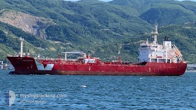
IVER BITUMEN
Asphalt/Bitumen Tanker

Current Trip
| Time Travelled | 3 days |
|---|---|
| Remaining Time | --- |
| Distance Travelled | 948.45 nm |
| Remaining Distance | --- |
| AVG Speed | 10.6 Knots |
| MAX Speed | 12.5 Knots |
| AVG Wind | 11.5 knots |
| MAX Wind | 30 knots |
| MIN Temp | 11.7°C / 53.06°F |
| MAX Temp | 15.9°C / 60.62°F |
| Draught | 7.1 m |
| Position Received | 17 h, 31 m ago |
Current Position
| Longitude | --- |
|---|---|
| Latitude | --- |
| Status | Under way using engine |
| Speed | 10.3 Knots |
| Course | 283.9° |
| Area | Mediterranean Sea - Eastern Basin |
| Station | T-AIS |
| Position Received | 17 h, 31 m ago |
Information
The current position of IVER BITUMEN is in Mediterranean Sea - Eastern Basin with coordinates 37.54362° / 12.04593° as reported on 2025-03-27 13:55 by AIS to our vessel tracker app. The vessel's current speed is 10.3 Knots and is heading at the port of GHAZAOUET. The estimated time of arrival as calculated by MyShipTracking vessel tracking app is 2025-03-30 07:00 LT
The vessel IVER BITUMEN (IMO: 9438949, MMSI: 247318400) is a Asphalt/Bitumen Tanker that was built in 2009 ( 16 years old ). It's sailing under the flag of [IT] Italy.
In this page you can find informations about the vessels current position, last detected port calls, and current voyage information. If the vessels is not in coverage by AIS you will find the latest position.
The current position of IVER BITUMEN is detected by our AIS receivers and we are not responsible for the reliability of the data. The last position was recorded while the vessel was in Coverage by the Ais receivers of our vessel tracking app.
The current draught of IVER BITUMEN as reported by AIS is 7.1 meters
Weather
| Temperature | 15°C / 59°F |
|---|---|
| Wind Speed | 23 knots |
| Direction | 310° NW |
| Pressure | 1011.8 hPa |
| Humidity | 75.3 % |
| Cloud Coverage | 3 % |


Featured Company
Last Port Calls
| Port | Arrival | Departure | Time In Port |
|---|---|---|---|
| 2025-03-23 05:53 | 2025-03-24 09:42 | 1 d | |
| 2025-03-18 05:39 | 2025-03-18 20:24 | 14 h | |
| 2025-03-13 07:13 | 2025-03-14 13:06 | 1 d | |
| 2025-03-07 14:05 | 2025-03-09 08:52 | 1 d | |
| 2025-02-21 16:19 | 2025-02-23 10:38 | 1 d | |
| 2025-02-18 02:21 | 2025-02-19 03:14 | 1 d | |
| 2025-02-10 05:51 | 2025-02-12 21:29 | 2 d | |
| 2025-02-06 15:41 | 2025-02-08 11:21 | 1 d | |
| 2025-01-31 14:51 | 2025-02-02 04:02 | 1 d | |
| 2025-01-21 21:06 | 2025-01-22 21:40 | 1 d |
Last Trips
| Origin | Departure | Destination | Arrival | Distance | |
|---|---|---|---|---|---|
| 2025-03-18 21:24 | 2025-03-23 06:53 | 1059.00 nm | |||
| 2025-03-14 14:06 | 2025-03-18 06:39 | 812.93 nm | |||
| 2025-03-09 10:52 | 2025-03-13 08:13 | 1057.77 nm | |||
| 2025-02-23 12:38 | 2025-03-07 16:05 | 362.27 nm | |||
| 2025-02-19 05:14 | 2025-02-21 18:19 | 671.25 nm | |||
| 2025-02-12 22:29 | 2025-02-18 04:21 | 911.84 nm | |||
| 2025-02-08 12:21 | 2025-02-10 06:51 | 419.84 nm | |||
| 2025-02-02 05:02 | 2025-02-06 16:41 | 1252.64 nm | |||
| 2025-01-22 23:40 | 2025-01-31 15:51 | 1802.00 nm | |||
| 2025-01-05 22:16 | 2025-01-21 23:06 | 1978.58 nm |
Events
| Time | Event | Details | Position / Dest | Info |
|---|---|---|---|---|
| 2025-03-27 13:56 | Status Changed | Default Under way using engine |
37.54458 / 12.04120
DZGHZ
|
Speed: 10.3 kn Course: 283.9° |
| 2025-03-27 13:55 | OUT of Coverage |
37.54362 / 12.04593
Mediterranean Sea - Eastern Basin
DZGHZ
|
Speed: 10.3 kn Course: 283.9° |
|
| 2025-03-27 13:53 | Status Changed | Under way using engine Default |
37.54206 / 12.05421
DZGHZ
|
Speed: 10.6 kn Course: 275° |
| 2025-03-27 13:35 | Status Changed | Default Under way using engine |
37.53816 / 12.11788
DZGHZ
|
Speed: 10.7 kn Course: 274.8° |
| 2025-03-27 13:17 | Status Changed | Under way using engine Default |
37.53374 / 12.18786
DZGHZ
|
Speed: 10.8 kn Course: 276° |
| 2025-03-27 12:56 | Status Changed | Default Under way using engine |
37.52681 / 12.26615
DZGHZ
|
Speed: 10.9 kn Course: 276.3° |
| 2025-03-27 12:47 | Status Changed | Under way using engine Default |
37.52404 / 12.29968
DZGHZ
|
Speed: 11 kn Course: 275° |
| 2025-03-27 12:20 | Status Changed | Default Under way using engine |
37.51842 / 12.40319
DZGHZ
|
Speed: 10.5 kn Course: 292.5° |
| 2025-03-27 12:08 | Status Changed | Under way using engine Default |
37.50526 / 12.44221
DZGHZ
|
Speed: 10.6 kn Course: 294° |
| 2025-03-27 12:08 | IN Coverage |
37.50526 / 12.44221
Mediterranean Sea - Eastern Basin
DZGHZ
|
Speed: 10.5 kn Course: 292.5° |