
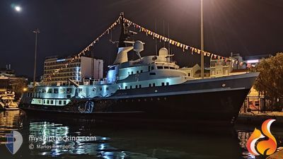
ITASCA
Yacht
Current Trip
GR ITM
| Time Travelled | 2 days |
|---|---|
| Remaining Time | --- |
| Distance Travelled | 216.45 nm |
| Remaining Distance | --- |
| AVG Speed | 7.9 Knots |
| MAX Speed | 10.6 Knots |
| AVG Wind | 10.7 knots |
| MAX Wind | 17.8 knots |
| MIN Temp | 21.9°C / 71.42°F |
| MAX Temp | 30.7°C / 87.26°F |
| Draught | 4.8 m |
| Position Received | 2 m ago |
Current Position
| Longitude | 22.96806° |
|---|---|
| Latitude | 37.97885° |
| Status | At anchor |
| Speed | |
| Course | 37° |
| Area | Ionian Sea |
| Station | T-AIS |
| Position Received | 2 m ago |
Info
Information
The current position of ITASCA is in Ionian Sea with coordinates 37.97885° / 22.96806° as reported on 2024-07-07 11:02 by AIS to our vessel tracker app. The vessel's current speed is 0 Knots
The vessel ITASCA (IMO: 1002055, MMSI: 319393000) is a Yacht that was built in 1961 ( 63 years old ). It's sailing under the flag of [KY] Cayman Is.
In this page you can find informations about the vessels current position, last detected port calls, and current voyage information. If the vessels is not in coverage by AIS you will find the latest position.
The current position of ITASCA is detected by our AIS receivers and we are not responsible for the reliability of the data. The last position was recorded while the vessel was in Coverage by the Ais receivers of our vessel tracking app.
The current draught of ITASCA as reported by AIS is 4.8 meters
Weather
| Temperature | 31°C / 87.8°F |
|---|---|
| Wind Speed | 8 knots |
| Direction | 351° N |
| Pressure | 1012.5 hPa |
| Humidity | 31.2 % |
| Cloud Coverage | --- |
Featured Company
Last Port Calls
| Port | Arrival | Departure | Time In Port |
|---|---|---|---|
| 2024-07-02 04:35 | 2024-07-04 19:45 | 2 d | |
| 2024-06-12 17:22 | 2024-06-28 09:46 | 15 d | |
| 2024-06-12 02:47 | |||
| 2024-05-21 10:19 | 2024-05-31 06:01 | 9 d | |
| 2024-05-21 05:39 | |||
| 2024-05-14 00:21 | 2024-05-16 08:22 | 2 d | |
| 2024-05-13 22:25 |
Last Trips
| Origin | Departure | Destination | Arrival | Distance | |
|---|---|---|---|---|---|
| 2024-06-28 12:46 | 2024-07-02 07:35 | 109.32 nm | |||
| 2024-06-12 05:47 | 2024-06-12 20:22 | 104.67 nm | |||
| 2024-05-21 08:39 | 2024-05-21 13:19 | 41.01 nm | |||
| 2024-05-14 01:25 | 2024-05-14 03:21 | 52.30 nm |
Events
| Time | Event | Details | Position / Dest | Info |
|---|---|---|---|---|
| 2024-07-07 09:26 | Status Changed | At anchor Under way using engine |
37.97928 / 22.96731
GR ITM
|
Speed: 0.4 kn Course: 31° |
| 2024-07-07 09:20 | STOP Moving | 0.38 nm, West of LOUTRAKI |
37.97907 / 22.96758
GR ITM
|
Speed: 0.3 kn Course: 312° |
| 2024-07-07 08:29 | START Moving | 1.34 nm, West of CORINTHOS |
37.94416 / 22.91069
GR ITM
|
Speed: 3.5 kn Course: 34° |
| 2024-07-07 07:07 | STOP Moving | 1.42 nm, West of CORINTHOS |
37.94141 / 22.90895
GR ITM
|
Speed: 0.3 kn Course: 341° |
| 2024-07-07 06:28 | Change Sea Area | Greek part of the Ionian Sea Greek part of the Aegean Sea |
37.95376 / 22.95393
Ionian Sea
GR ITM
|
Speed: 7.8 kn Course: 266.7° |
| 2024-07-06 19:51 | Destination Changed | GR ITM GR ARS |
37.02306 / 23.05638
GR ITM
|
Speed: 8 kn Course: 37° |
| 2024-07-06 19:51 | ETA Changed | 2024/07/07 06:00 2024/07/02 05:00 |
37.02306 / 23.05638
GR ITM
|
Speed: 8 kn Course: 37° |
| 2024-07-06 19:49 | IN Coverage |
37.02488 / 23.05820
Aegean Sea
GR ITM
|
Speed: 8.3 kn Course: 39.3° |
|
| 2024-07-06 14:23 | OUT of Coverage |
36.97922 / 22.99793
Aegean Sea
|
Speed: 0.1 kn Course: 1.2° |
|
| 2024-07-06 14:23 | IN Coverage |
36.97922 / 22.99793
Aegean Sea
|
Speed: 0.1 kn Course: 1.2° |