

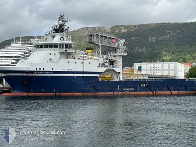
ISLAND CLIPPER
Cargo

Current Trip
HYWIND TAMPEN
| Time Travelled | 2 days |
|---|---|
| Remaining Time | --- |
| Distance Travelled | 123.65 nm |
| Remaining Distance | --- |
| AVG Speed | 9.7 Knots |
| MAX Speed | 11.5 Knots |
| AVG Wind | 10 knots |
| MAX Wind | 16.9 knots |
| MIN Temp | 1.2°C / 34.16°F |
| MAX Temp | 5.4°C / 41.72°F |
| Draught | 5.8 m |
| Position Received | 1 d ago |
Current Position
| Longitude | --- |
|---|---|
| Latitude | --- |
| Status | Under way using engine |
| Speed | 0.3 Knots |
| Course | 66° |
| Area | Norwegian Sea |
| Station | T-AIS |
| Position Received | 1 d ago |
Information
The current position of ISLAND CLIPPER is in Norwegian Sea with coordinates 61.32675° / 2.19457° as reported on 2025-02-14 18:03 by AIS to our vessel tracker app. The vessel's current speed is 0.3 Knots
The vessel ISLAND CLIPPER (IMO: 9722871, MMSI: 257346000) is a Cargo It's sailing under the flag of [NO] Norway.
In this page you can find informations about the vessels current position, last detected port calls, and current voyage information. If the vessels is not in coverage by AIS you will find the latest position.
The current position of ISLAND CLIPPER is detected by our AIS receivers and we are not responsible for the reliability of the data. The last position was recorded while the vessel was in Coverage by the Ais receivers of our vessel tracking app.
The current draught of ISLAND CLIPPER as reported by AIS is 5.8 meters
Weather
| Temperature | 4.3°C / 39.74°F |
|---|---|
| Wind Speed | 12 knots |
| Direction | 56° NE |
| Pressure | 1026.4 hPa |
| Humidity | 61.5 % |
| Cloud Coverage | 8 % |


Featured Company
Last Port Calls
| Port | Arrival | Departure | Time In Port |
|---|---|---|---|
| 2025-02-13 06:54 | 2025-02-13 17:18 | 10 h | |
| 2025-02-08 13:47 | 2025-02-09 16:22 | 1 d | |
| 2025-02-07 19:38 | 2025-02-08 09:03 | 13 h | |
| 2025-02-05 22:35 | 2025-02-06 13:33 | 14 h | |
| 2025-02-01 17:45 | 2025-02-05 13:10 | 3 d | |
| 2025-02-01 15:41 | 2025-02-01 17:43 | 2 h | |
| 2025-02-01 03:16 | 2025-02-01 10:21 | 7 h | |
| 2025-01-27 20:55 | 2025-01-28 19:20 | 22 h | |
| 2025-01-24 03:01 | 2025-01-24 09:40 | 6 h | |
| 2025-01-20 17:05 | 2025-01-21 18:19 | 1 d |
Last Trips
| Origin | Departure | Destination | Arrival | Distance | |
|---|---|---|---|---|---|
| 2025-02-09 17:22 | 2025-02-13 07:54 | 247.00 nm | |||
| 2025-02-08 10:03 | 2025-02-08 14:47 | 46.64 nm | |||
| 2025-02-06 14:33 | 2025-02-07 20:38 | 255.20 nm | |||
| 2025-02-05 14:10 | 2025-02-05 23:35 | 101.53 nm | |||
| 2025-02-01 18:43 | 2025-02-01 18:45 | 0.54 nm | |||
| 2025-02-01 11:21 | 2025-02-01 16:41 | 46.81 nm | |||
| 2025-01-28 20:20 | 2025-02-01 04:16 | 198.54 nm | |||
| 2025-01-24 10:40 | 2025-01-27 21:55 | 134.67 nm | |||
| 2025-01-21 19:19 | 2025-01-24 04:01 | 194.01 nm | |||
| 2025-01-19 09:24 | 2025-01-20 18:05 | 155.38 nm |
Events
| Time | Event | Details | Position / Dest | Info |
|---|---|---|---|---|
| 2025-02-14 18:03 | OUT of Coverage |
61.32675 / 2.19457
Norwegian Sea
|
Speed: 0.3 kn Course: 229.2° |
|
| 2025-02-14 16:51 | IN Coverage |
61.32932 / 2.19809
Norwegian Sea
|
Speed: 0.2 kn Course: 103.2° |
|
| 2025-02-14 15:28 | OUT of Coverage |
61.33361 / 2.24625
Norwegian Sea
|
Speed: 7 kn Course: 297.5° |
|
| 2025-02-14 12:36 | IN Coverage |
61.33004 / 2.24722
Norwegian Sea
|
Speed: 0.8 kn Course: 15.8° |
|
| 2025-02-14 11:33 | OUT of Coverage |
61.30289 / 2.26214
Norwegian Sea
|
Speed: 0.3 kn Course: 92.3° |
|
| 2025-02-14 11:15 | IN Coverage |
61.30288 / 2.26214
Norwegian Sea
|
Speed: 0.1 kn Course: 225.9° |
|
| 2025-02-14 10:00 | OUT of Coverage |
61.30296 / 2.26211
Norwegian Sea
|
Speed: 0.4 kn Course: 122.3° |
|
| 2025-02-14 09:48 | IN Coverage |
61.30293 / 2.26212
Norwegian Sea
|
Speed: 0.2 kn Course: 128.8° |
|
| 2025-02-14 08:27 | OUT of Coverage |
61.30294 / 2.26216
Norwegian Sea
|
Speed: 0.3 kn Course: 264.3° |
|
| 2025-02-14 05:00 | STOP Moving |
61.29879 / 2.24376
HYWIND TAMPEN
|
Speed: 0.3 kn Course: 145° |