
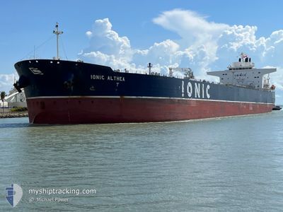
IONIC ALTHEA
Tanker
Current Trip
| Time Travelled | 3 days |
|---|---|
| Remaining Time | 2 days |
| Distance Travelled | 944.14 nm |
| Remaining Distance | 945.97 nm |
| AVG Speed | 12.7 Knots |
| MAX Speed | 15.9 Knots |
| AVG Wind | 8.8 knots |
| MAX Wind | 13.5 knots |
| MIN Temp | 10.8°C / 51.44°F |
| MAX Temp | 26.6°C / 79.88°F |
| Draught | 8.3 m |
| Position Received | 4 h, 3 m ago |
Current Position
| Longitude | -79.53931° |
|---|---|
| Latitude | 25.63295° |
| Status | Under way using engine |
| Speed | 13.4 Knots |
| Course | 186.8° |
| Area | North Atlantic Ocean |
| Station | T-AIS |
| Position Received | 4 h, 3 m ago |
Info
Information
The current position of IONIC ALTHEA is in North Atlantic Ocean with coordinates 25.63295° / -79.53931° as reported on 2024-04-19 02:05 by AIS to our vessel tracker app. The vessel's current speed is 13.4 Knots and is heading at the port of HOUSTON. The estimated time of arrival as calculated by MyShipTracking vessel tracking app is 2024-04-22 02:05 LT
The vessel IONIC ALTHEA (IMO: 9728435, MMSI: 538007953) is a Tanker It's sailing under the flag of [MH] Marshall Is.
In this page you can find informations about the vessels current position, last detected port calls, and current voyage information. If the vessels is not in coverage by AIS you will find the latest position.
The current position of IONIC ALTHEA is detected by our AIS receivers and we are not responsible for the reliability of the data. The last position was recorded while the vessel was in Coverage by the Ais receivers of our vessel tracking app.
The current draught of IONIC ALTHEA as reported by AIS is 8.3 meters
Weather
| Temperature | 24.3°C / 75.74°F |
|---|---|
| Wind Speed | 13 knots |
| Direction | 76° ENE |
| Pressure | 1018.5 hPa |
| Humidity | 78.1 % |
| Cloud Coverage | 68 % |
Featured Company
Last Port Calls
| Port | Arrival | Departure | Time In Port |
|---|---|---|---|
| 2024-04-12 23:39 | 2024-04-15 12:50 | 2 d | |
| 2024-04-09 17:27 | 2024-04-11 04:43 | 1 d | |
| 2024-03-24 04:56 | 2024-03-25 02:28 | 21 h | |
| 2024-03-16 15:09 | 2024-03-17 19:17 | 1 d | |
| 2024-02-24 22:03 | 2024-02-25 13:53 | 15 h | |
| 2024-02-03 19:56 | 2024-02-05 07:00 | 1 d |
Most Visited Ports (Last year)
| Port | Arrivals | |
|---|---|---|
| 4 | ||
| 3 | ||
| 2 | ||
| 2 | ||
| 2 | ||
| 2 |
Last Trips
| Origin | Departure | Destination | Arrival | Distance | |
|---|---|---|---|---|---|
| 2024-04-11 00:43 | 2024-04-12 19:39 | 148.55 nm | |||
| 2024-03-25 03:28 | 2024-04-09 13:27 | 3650.66 nm | |||
| 2024-03-17 20:17 | 2024-03-24 05:56 | 634.01 nm | |||
| 2024-02-25 07:53 | 2024-03-16 16:09 | 5216.82 nm | |||
| 2024-02-05 01:00 | 2024-02-24 16:03 | 3348.27 nm | |||
| 2024-01-09 15:48 | 2024-02-03 13:56 | 6339.56 nm |
Events
| Time | Event | Details | Position / Dest | Info |
|---|---|---|---|---|
| 2024-04-19 02:05 | OUT of Coverage |
25.63295 / -79.53931
North Atlantic Ocean
USHOU
|
Speed: 13.4 kn Course: 186.8° |
|
| 2024-04-18 23:16 | ETA Changed | 2024/04/22 05:00 2024/04/22 00:01 |
26.25868 / -79.46508
USHOU
|
Speed: 13.4 kn Course: 184.8° |
| 2024-04-18 22:44 | Status Changed | Under way using engine Default |
26.37421 / -79.45722
USHOU
|
Speed: 13.4 kn Course: 182° |
| 2024-04-18 22:37 | IN Coverage |
26.37421 / -79.45722
North Atlantic Ocean
USHOU
|
Speed: 13.3 kn Course: 181.4° |
|
| 2024-04-18 21:05 | Status Changed | Default Under way using engine |
26.74348 / -79.42749
USHOU
|
Speed: 13.4 kn Course: 186° |
| 2024-04-18 21:03 | OUT of Coverage |
26.75026 / -79.42670
North Atlantic Ocean
USHOU
|
Speed: 13.4 kn Course: 186° |
|
| 2024-04-18 20:55 | Status Changed | Under way using engine Default |
26.77759 / -79.42362
USHOU
|
Speed: 13.5 kn Course: 191° |
| 2024-04-18 20:38 | Status Changed | Default Under way using engine |
26.84079 / -79.41448
USHOU
|
Speed: 13.5 kn Course: 190.7° |
| 2024-04-18 19:24 | Status Changed | Under way using engine Default |
27.11837 / -79.36707
USHOU
|
Speed: 13.9 kn Course: 185° |
| 2024-04-18 19:11 | IN Coverage |
27.11837 / -79.36707
North Atlantic Ocean
USHOU
|
Speed: 13.7 kn Course: 184.7° |