
IOLE R
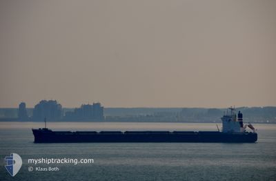
Bulk Carrier
Current Trip
| Time Travelled | 36 days |
|---|---|
| Remaining Time | 5 days |
| Distance Travelled | 9775.51 nm |
| Remaining Distance | 1545.04 nm |
| AVG Speed | 11.6 Knots |
| MAX Speed | 15.4 Knots |
| AVG Wind | 11.8 knots |
| MAX Wind | 27 knots |
| MIN Temp | 15.9°C / 60.62°F |
| MAX Temp | 29.8°C / 85.64°F |
| Draught | 7.2 m |
| Position Received | 9 d ago |
Current Position
| Longitude | 18.26477° |
|---|---|
| Latitude | -34.76215° |
| Status | Under way using engine |
| Speed | 9.3 Knots |
| Course | 279° |
| Area | South Atlantic Ocean |
| Station | T-AIS |
| Position Received | 9 d ago |
Info
Information
The current position of IOLE R is in South Atlantic Ocean with coordinates -34.76215° / 18.26477° as reported on 2024-05-07 00:03 by AIS to our vessel tracker app. The vessel's current speed is 9.3 Knots and is heading at the port of SANTOS. The estimated time of arrival as calculated by MyShipTracking vessel tracking app is 2024-05-21 08:34 LT
The vessel IOLE R (IMO: 9363132, MMSI: 538008645) is a Bulk Carrier that was built in 2008 ( 16 years old ). It's sailing under the flag of [MH] Marshall Is.
In this page you can find informations about the vessels current position, last detected port calls, and current voyage information. If the vessels is not in coverage by AIS you will find the latest position.
The current position of IOLE R is detected by our AIS receivers and we are not responsible for the reliability of the data. The last position was recorded while the vessel was in Coverage by the Ais receivers of our vessel tracking app.
The current draught of IOLE R as reported by AIS is 7.2 meters
Weather
| Temperature | 27.1°C / 80.78°F |
|---|---|
| Wind Speed | 11 knots |
| Direction | 104° ESE |
| Pressure | 1014.9 hPa |
| Humidity | 68.9 % |
| Cloud Coverage | 6 % |
Featured Company
Most Visited Ports (Last year)
| Port | Arrivals | |
|---|---|---|
| 1 | ||
| 1 | ||
| 1 | ||
| 1 | ||
| 1 | ||
| 1 |
Events
| Time | Event | Details | Position / Dest | Info |
|---|---|---|---|---|
| 2024-05-07 00:11 | Status Changed | Default Under way using engine |
-34.75960 / 18.24420
SANTOS
|
Speed: 9.3 kn Course: 279° |
| 2024-05-07 00:03 | Status Changed | Under way using engine Default |
-34.76215 / 18.26477
SANTOS
|
Speed: 9.1 kn Course: 277° |
| 2024-05-07 00:03 | OUT of Coverage |
-34.76215 / 18.26477
South Atlantic Ocean
SANTOS
|
Speed: 9.3 kn Course: 279° |
|
| 2024-05-06 23:56 | Status Changed | Default Under way using engine |
-34.76525 / 18.28875
SANTOS
|
Speed: 9.4 kn Course: 280° |
| 2024-05-06 23:50 | Status Changed | Under way using engine Default |
-34.76757 / 18.30623
SANTOS
|
Speed: 9.5 kn Course: 277° |
| 2024-05-06 23:34 | Status Changed | Default Under way using engine |
-34.77355 / 18.35333
SANTOS
|
Speed: 8.4 kn Course: 278° |
| 2024-05-06 23:23 | ETA Changed | 2024/05/18 18:30 2024/05/17 18:30 |
-34.77863 / 18.38970
SANTOS
|
Speed: 7.8 kn Course: 279° |
| 2024-05-06 23:04 | Status Changed | Under way using engine Default |
-34.78458 / 18.43548
SANTOS
|
Speed: 8.1 kn Course: 282° |
| 2024-05-06 23:01 | Status Changed | Default Under way using engine |
-34.78572 / 18.44378
SANTOS
|
Speed: 8.6 kn Course: 282° |
| 2024-05-06 22:53 | Status Changed | Under way using engine Default |
-34.78927 / 18.46757
SANTOS
|
Speed: 9 kn Course: 279° |