
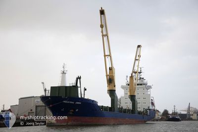
INDUSTRIAL EMMA
General Cargo
Current Trip
| Time Travelled | 9 days |
|---|---|
| Remaining Time | 17 h, 19 mins |
| Distance Travelled | 2336.78 nm |
| Remaining Distance | 226.86 nm |
| AVG Speed | 11 Knots |
| MAX Speed | 12.6 Knots |
| AVG Wind | 12.4 knots |
| MAX Wind | 25.4 knots |
| MIN Temp | 17.7°C / 63.86°F |
| MAX Temp | 29.6°C / 85.28°F |
| Draught | 7 m |
| Position Received | 1 d ago |
Current Position
| Longitude | -14.26998° |
|---|---|
| Latitude | 30.74895° |
| Status | Under way using engine |
| Speed | 10.6 Knots |
| Course | 30.7° |
| Area | North Atlantic Ocean |
| Station | T-AIS |
| Position Received | 1 d ago |
Info
Information
The current position of INDUSTRIAL EMMA is in North Atlantic Ocean with coordinates 30.74895° / -14.26998° as reported on 2024-04-25 03:15 by AIS to our vessel tracker app. The vessel's current speed is 10.6 Knots and is heading at the port of SINES. The estimated time of arrival as calculated by MyShipTracking vessel tracking app is 2024-04-27 02:57 LT
The vessel INDUSTRIAL EMMA (IMO: 9474371, MMSI: 305514000) is a General Cargo that was built in 2009 ( 15 years old ). It's sailing under the flag of [AG] Antigua Barbuda.
In this page you can find informations about the vessels current position, last detected port calls, and current voyage information. If the vessels is not in coverage by AIS you will find the latest position.
The current position of INDUSTRIAL EMMA is detected by our AIS receivers and we are not responsible for the reliability of the data. The last position was recorded while the vessel was in Coverage by the Ais receivers of our vessel tracking app.
The current draught of INDUSTRIAL EMMA as reported by AIS is 7 meters
Weather
| Temperature | 16.4°C / 61.52°F |
|---|---|
| Wind Speed | 9 knots |
| Direction | 330° NNW |
| Pressure | 1013.9 hPa |
| Humidity | 69.9 % |
| Cloud Coverage | 58 % |
Featured Company
Last Port Calls
| Port | Arrival | Departure | Time In Port |
|---|---|---|---|
| 2024-04-16 04:25 | 2024-04-16 18:29 | 14 h | |
| 2024-03-21 08:04 | 2024-04-03 10:17 | 13 d | |
| 2024-03-17 09:05 | 2024-03-17 09:10 | 5 m | |
| 2024-03-13 11:43 | 2024-03-13 11:53 | 10 m | |
| 2024-03-09 00:07 | 2024-03-10 00:00 | 23 h | |
| 2024-02-24 11:54 | 2024-02-25 06:51 | 18 h | |
| 2024-02-22 07:17 | 2024-02-22 17:21 | 10 h | |
| 2024-02-10 04:38 | 2024-02-13 05:12 | 3 d |
Most Visited Ports (Last year)
| Port | Arrivals | |
|---|---|---|
| 6 | ||
| 6 | ||
| 5 | ||
| 4 | ||
| 3 | ||
| 3 |
Last Trips
| Origin | Departure | Destination | Arrival | Distance | |
|---|---|---|---|---|---|
| 2024-04-03 07:17 | 2024-04-16 04:25 | 2954.47 nm | |||
| 2024-03-17 06:10 | 2024-03-21 05:04 | 4.31 nm | |||
| 2024-03-13 08:53 | 2024-03-17 06:05 | 406.52 nm | |||
| 2024-03-09 21:00 | 2024-03-13 08:43 | 231.00 nm | |||
| 2024-02-25 02:51 | 2024-03-08 21:07 | 3025.12 nm | |||
| 2024-02-22 13:21 | 2024-02-24 07:54 | 397.73 nm | |||
| 2024-02-12 23:12 | 2024-02-22 03:17 | 2288.80 nm | |||
| 2024-01-29 08:40 | 2024-02-09 22:38 | 2766.63 nm |
Events
| Time | Event | Details | Position / Dest | Info |
|---|---|---|---|---|
| 2024-04-25 03:32 | Status Changed | Default Under way using engine |
30.79416 / -14.24012
PTSIE
|
Speed: 10.6 kn Course: 30.7° |
| 2024-04-25 03:15 | OUT of Coverage |
30.74895 / -14.26998
North Atlantic Ocean
PTSIE
|
Speed: 10.6 kn Course: 30.7° |
|
| 2024-04-25 03:06 | Detected in Sea | Spanish (Canary Islands) part of the North Atlantic Ocean |
30.72853 / -14.28390
North Atlantic Ocean
PTSIE
|
Speed: 10.6 kn Course: 28.9° |
| 2024-04-25 03:06 | Status Changed | Under way using engine Default |
30.72853 / -14.28390
PTSIE
|
Speed: 10.6 kn Course: 28° |
| 2024-04-25 03:06 | IN Coverage |
30.72853 / -14.28390
North Atlantic Ocean
PTSIE
|
Speed: 10.6 kn Course: 28.9° |
|
| 2024-04-24 21:18 | Status Changed | Default Under way using engine |
29.82813 / -14.85810
PTSIE
|
Speed: 10.2 kn Course: 30° |
| 2024-04-24 21:10 | OUT of Coverage |
29.80864 / -14.87120
North Atlantic Ocean
PTSIE
|
Speed: 10.2 kn Course: 30° |
|
| 2024-04-24 20:57 | Status Changed | Under way using engine Default |
29.77764 / -14.89216
PTSIE
|
Speed: 10.3 kn Course: 31° |
| 2024-04-24 20:50 | Status Changed | Default Under way using engine |
29.75892 / -14.90445
PTSIE
|
Speed: 10.1 kn Course: 31.3° |
| 2024-04-24 20:41 | Status Changed | Under way using engine Default |
29.73829 / -14.91782
PTSIE
|
Speed: 10 kn Course: 26° |