

INDEPENDENCE OTS
Passengers Ship

Current Trip
CCY
| Time Travelled | 6 h, 25 mins |
|---|---|
| Remaining Time | --- |
| Distance Travelled | 54.49 nm |
| Remaining Distance | --- |
| AVG Speed | 8.4 Knots |
| MAX Speed | 10.3 Knots |
| AVG Wind | 14.1 knots |
| MAX Wind | 16 knots |
| MIN Temp | 22.5°C / 72.5°F |
| MAX Temp | 22.9°C / 73.22°F |
| Draught | 9 m |
| Position Received | 4 h, 26 m ago |
Current Position
| Longitude | --- |
|---|---|
| Latitude | --- |
| Status | Under way using engine |
| Speed | 8.2 Knots |
| Course | 64.6° |
| Area | North Atlantic Ocean |
| Station | T-AIS |
| Position Received | 4 h, 26 m ago |
Information
The current position of INDEPENDENCE OTS is in North Atlantic Ocean with coordinates 25.88083° / -79.82019° as reported on 2025-02-17 23:37 by AIS to our vessel tracker app. The vessel's current speed is 8.2 Knots
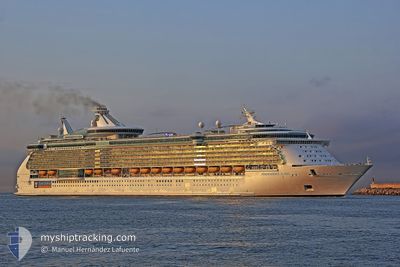
The vessel INDEPENDENCE OTS (IMO: 9349681, MMSI: 309374000) is a Passengers Ship that was built in 2008 ( 17 years old ). It's sailing under the flag of [BS] Bahamas.
In this page you can find informations about the vessels current position, last detected port calls, and current voyage information. If the vessels is not in coverage by AIS you will find the latest position.
The current position of INDEPENDENCE OTS is detected by our AIS receivers and we are not responsible for the reliability of the data. The last position was recorded while the vessel was in Coverage by the Ais receivers of our vessel tracking app.
The current draught of INDEPENDENCE OTS as reported by AIS is 9 meters
Weather
| Temperature | 22.7°C / 72.86°F |
|---|---|
| Wind Speed | 9 knots |
| Direction | 55° NE |
| Pressure | 1018.8 hPa |
| Humidity | 71.1 % |
| Cloud Coverage | 55 % |


Featured Company
Last Port Calls
| Port | Arrival | Departure | Time In Port |
|---|---|---|---|
| 2025-02-17 09:58 | 2025-02-17 21:39 | 11 h | |
| 2025-02-13 09:52 | 2025-02-13 23:20 | 13 h | |
| 2025-02-08 09:58 | 2025-02-08 22:14 | 12 h | |
| 2025-02-06 15:01 | 2025-02-07 00:40 | 9 h | |
| 2025-02-03 10:01 | 2025-02-03 21:52 | 11 h | |
| 2025-02-01 13:29 | 2025-02-01 22:06 | 8 h | |
| 2025-01-30 09:29 | 2025-01-30 22:43 | 13 h | |
| 2025-01-28 15:07 | 2025-01-29 00:41 | 9 h | |
| 2025-01-25 10:48 | 2025-01-25 21:29 | 10 h | |
| 2025-01-23 11:55 | 2025-01-23 22:52 | 10 h |
Last Trips
| Origin | Departure | Destination | Arrival | Distance | |
|---|---|---|---|---|---|
| 2025-02-13 18:20 | 2025-02-17 04:58 | 572.87 nm | |||
| 2025-02-08 17:14 | 2025-02-13 04:52 | 1633.49 nm | |||
| 2025-02-06 19:40 | 2025-02-08 04:58 | 534.07 nm | |||
| 2025-02-03 16:52 | 2025-02-06 10:01 | 990.81 nm | |||
| 2025-02-01 17:06 | 2025-02-03 05:01 | 734.90 nm | |||
| 2025-01-30 17:43 | 2025-02-01 08:29 | 739.96 nm | |||
| 2025-01-28 19:41 | 2025-01-30 04:29 | 526.85 nm | |||
| 2025-01-25 16:29 | 2025-01-28 10:07 | 990.31 nm | |||
| 2025-01-23 17:52 | 2025-01-25 05:48 | 495.26 nm | |||
| 2025-01-20 16:31 | 2025-01-23 06:55 | 755.52 nm |
Events
| Time | Event | Details | Position / Dest | Info |
|---|---|---|---|---|
| 2025-02-17 23:57 | Status Changed | Default Under way using engine |
25.90002 / -79.77404
CCY
|
Speed: 8.2 kn Course: 64.6° |
| 2025-02-17 23:37 | OUT of Coverage |
25.88083 / -79.82019
North Atlantic Ocean
CCY
|
Speed: 8.2 kn Course: 64.6° |
|
| 2025-02-17 21:39 | PORT DEPARTURE |
|
25.76131 / -80.12714
CCY
|
Speed: 12.1 kn Course: 114° |
| 2025-02-17 21:17 | START Moving |
25.78034 / -80.17510
[US] MIAMI
|
Speed: 3.6 kn Course: 105° |
|
| 2025-02-17 21:10 | Destination Changed | CCY CCA |
25.78027 / -80.17736
[US] MIAMI
|
Speed: Course: 115° |
| 2025-02-17 21:10 | Status Changed | Under way using engine Moored |
25.78027 / -80.17736
[US] MIAMI
|
Speed: Course: 115° |
| 2025-02-17 21:08 | Status Changed | Moored Default |
25.78027 / -80.17736
[US] MIAMI
|
Speed: Course: 115° |
| 2025-02-17 21:02 | Status Changed | Default Moored |
25.78027 / -80.17735
[US] MIAMI
|
Speed: Course: 115° |
| 2025-02-17 19:22 | Destination Changed | CCA US MIA |
25.78027 / -80.17735
[US] MIAMI
|
Speed: Course: 115° |
| 2025-02-17 19:22 | ETA Changed | 2025/02/18 11:30 2025/02/17 09:30 |
25.78027 / -80.17735
[US] MIAMI
|
Speed: Course: 115° |