
INCEPTION
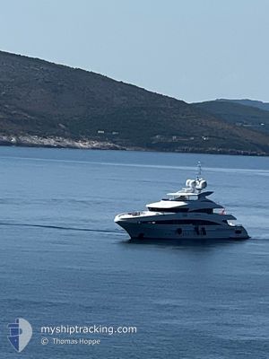
Yacht
Current Trip
| Trip Time | 3 days |
|---|---|
| Trip Distance | 361.09 nm |
| AVG Speed | 8.1 Knots |
| MAX Speed | 11.7 Knots |
| Draught | 3.4 m |
| AVG Wind | 6.7 knots |
| MAX Wind | 19.8 knots |
| MIN Temp | 16.7°C / 62.06°F |
| MAX Temp | 23.8°C / 74.84°F |
| Position Received | 1 m ago |
Current Position
| Longitude | --- |
|---|---|
| Latitude | --- |
| Status | Moored |
| Speed | |
| Course | 327° |
| Area | Balearic Sea |
| Station | T-AIS |
| Position Received | 1 m ago |
Info
Information
The current position of INCEPTION is in Balearic Sea with coordinates 39.56483° / 2.64012° as reported on 2024-10-05 14:17 by AIS to our vessel tracker app. The vessel's current speed is 0 Knots and is currently inside the port of PALMA DE MALLORCA.
The vessel INCEPTION (IMO: 1009704, MMSI: 232034192) is a Yacht that was built in 2008 ( 16 years old ). It's sailing under the flag of [GB] United Kingdom.
In this page you can find informations about the vessels current position, last detected port calls, and current voyage information. If the vessels is not in coverage by AIS you will find the latest position.
The current position of INCEPTION is detected by our AIS receivers and we are not responsible for the reliability of the data. The last position was recorded while the vessel was in Coverage by the Ais receivers of our vessel tracking app.
The current draught of INCEPTION as reported by AIS is 3.4 meters
Weather
| Temperature | 22.7°C / 72.86°F |
|---|---|
| Wind Speed | 10 knots |
| Direction | 215° SW |
| Pressure | 1012.7 hPa |
| Humidity | 56.7 % |
| Cloud Coverage | 10 % |
Featured Company
Most Visited Ports (Last year)
| Port | Arrivals | |
|---|---|---|
| 2 | ||
| 2 | ||
| 2 | ||
| 1 | ||
| 1 | ||
| 1 |
Last Trips
Events
| Time | Event | Details | Position / Dest | Info |
|---|---|---|---|---|
| 2024-10-02 09:20 | Status Changed | Moored Under way using engine |
39.56487 / 2.64027
[ES] PALMA DE MALLORCA
|
Speed: Course: 328° |
| 2024-10-02 08:44 | STOP Moving |
39.56564 / 2.63949
[ES] PALMA DE MALLORCA
|
Speed: 0.2 kn Course: 48° |
|
| 2024-10-02 08:29 | PORT ARRIVAL |
|
39.55719 / 2.64200
[ES] PALMA DE MALLORCA
|
Speed: 6.7 kn Course: 280.1° |
| 2024-10-02 07:19 | START Moving | 1.02 nm, South West of PORTALS NOUS |
39.51960 / 2.55102
PALMA
|
Speed: 6.3 kn Course: 92.2° |
| 2024-10-02 07:18 | Status Changed | Under way using engine At anchor |
39.52016 / 2.54825
PALMA
|
Speed: 4.2 kn Course: 157° |
| 2024-10-02 00:23 | Status Changed | At anchor Under way using engine |
39.52101 / 2.54885
PALMA
|
Speed: 0.6 kn Course: 242° |
| 2024-10-02 00:21 | STOP Moving | 1.07 nm, South West of PORTALS NOUS |
39.52077 / 2.54844
PALMA
|
Speed: Course: 245° |
| 2024-10-02 00:05 | START Moving | 1.2 nm, South West of PORTALS NOUS |
39.51415 / 2.55245
PALMA
|
Speed: 3.7 kn Course: 323° |
| 2024-10-01 23:57 | STOP Moving | 1.24 nm, South West of PORTALS NOUS |
39.51254 / 2.55397
PALMA
|
Speed: 0.2 kn Course: 320° |
| 2024-10-01 17:22 | Change Sea Area | Spanish part of the Balearic Sea Spanish part of the Mediterranean Sea - Western Basin |
40.10924 / 3.09898
Balearic Sea
PALMA
|
Speed: 10.7 kn Course: 231.8° |