
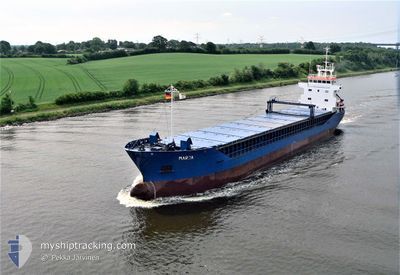
IMI
General Cargo
Current Trip
TN SUQNG
| Time Travelled | 1 day |
|---|---|
| Remaining Time | --- |
| Distance Travelled | 8.17 nm |
| Remaining Distance | --- |
| AVG Speed | 5.3 Knots |
| MAX Speed | 6.5 Knots |
| AVG Wind | 12.4 knots |
| MAX Wind | 19 knots |
| MIN Temp | 14.5°C / 58.1°F |
| MAX Temp | 19.9°C / 67.82°F |
| Draught | 3.5 m |
| Position Received | 1 m ago |
Current Position
| Longitude | --- |
|---|---|
| Latitude | --- |
| Status | At anchor |
| Speed | 0.3 Knots |
| Course | 77° |
| Area | Mediterranean Sea - Eastern Basin |
| Station | T-AIS |
| Position Received | 1 m ago |
Info
Information
The current position of IMI is in Mediterranean Sea - Eastern Basin with coordinates 35.84103° / 10.67505° as reported on 2026-03-06 17:43 by AIS to our vessel tracker app. The vessel's current speed is 0.3 Knots
The vessel IMI (IMO: 9063873, MMSI: 308192000) is a General Cargo that was built in 1993 ( 33 years old ). It's sailing under the flag of [BS] Bahamas.
In this page you can find informations about the vessels current position, last detected port calls, and current voyage information. If the vessels is not in coverage by AIS you will find the latest position.
The current position of IMI is detected by our AIS receivers and we are not responsible for the reliability of the data. The last position was recorded while the vessel was in Coverage by the Ais receivers of our vessel tracking app.
The current draught of IMI as reported by AIS is 3.5 meters
Weather
| Temperature | 17.8°C / 64.04°F |
|---|---|
| Wind Speed | 15 knots |
| Direction | 132° SE |
| Pressure | 1015 hPa |
| Humidity | 65.1 % |
| Cloud Coverage | 1 % |
Featured Company
Last Port Calls
| Port | Arrival | Departure | Time In Port |
|---|---|---|---|
| 2026-03-01 14:16 | 2026-03-05 06:40 | 3 d | |
| 2026-02-19 01:12 | 2026-02-22 12:33 | 3 d | |
| 2026-02-12 15:50 | 2026-02-16 12:11 | 3 d | |
| 2026-01-29 13:06 | 2026-02-04 16:41 | 6 d | |
| 2026-01-23 07:16 | 2026-01-28 15:40 | 5 d | |
| 2026-01-10 07:58 | 2026-01-12 18:25 | 2 d | |
| 2026-01-02 11:15 | 2026-01-06 13:58 | 4 d |
Last Trips
| Origin | Departure | Destination | Arrival | Distance | |
|---|---|---|---|---|---|
| 2026-02-22 12:33 | 2026-03-01 14:16 | 872.54 nm | |||
| 2026-02-16 12:11 | 2026-02-19 01:12 | 215.26 nm | |||
| 2026-02-04 16:41 | 2026-02-12 15:50 | 852.04 nm | |||
| 2026-01-28 15:40 | 2026-01-29 13:06 | 177.99 nm | |||
| 2026-01-12 18:25 | 2026-01-23 07:16 | 1688.85 nm | |||
| 2026-01-06 13:58 | 2026-01-10 07:58 | 592.17 nm | |||
| 2025-12-30 11:15 | 2026-01-02 11:15 | 513.81 nm |
Events
| Time | Event | Details | Position / Dest | Info |
|---|---|---|---|---|
| 2026-03-05 20:31 | Status Changed | At anchor Default |
35.84206 / 10.67523
TN SUQNG
|
Speed: Course: -1° |
| 2026-03-05 20:28 | Status Changed | Default At anchor |
35.84167 / 10.67500
TN SUQNG
|
Speed: 0.5 kn Course: 121° |
| 2026-03-05 20:22 | Status Changed | At anchor Default |
35.84213 / 10.67529
TN SUQNG
|
Speed: Course: -1° |
| 2026-03-05 20:19 | Status Changed | Default At anchor |
35.84167 / 10.67500
TN SUQNG
|
Speed: 0.3 kn Course: 90° |
| 2026-03-05 07:10 | Draught Changed | 3.5 5.8 |
35.84235 / 10.67554
TN SUQNG
|
Speed: 0.1 kn Course: 125° |
| 2026-03-05 06:46 | Status Changed | At anchor Under way using engine |
35.84242 / 10.67564
TN SUQNG
|
Speed: 0.5 kn Course: 105° |
| 2026-03-05 06:16 | STOP Moving | --- |
35.84211 / 10.67560
TN SUQNG
|
Speed: 0.3 kn Course: 112° |
| 2026-03-05 05:40 | PORT DEPARTURE |
|
35.82464 / 10.65468
TN SUQNG
|
Speed: 6.4 kn Course: 102° |
| 2026-03-05 05:35 | Change Sea Area | Tunisian part of the Mediterranean Sea - Eastern Basin Greek part of the Aegean Sea |
35.82443 / 10.64492
Mediterranean Sea - Eastern Basin
|
Speed: 3.3 kn Course: 47.1° |
| 2026-03-05 05:35 | START Moving |
35.82443 / 10.64492
[TN] SOUSSE
|
Speed: 3.3 kn Course: 65° |