

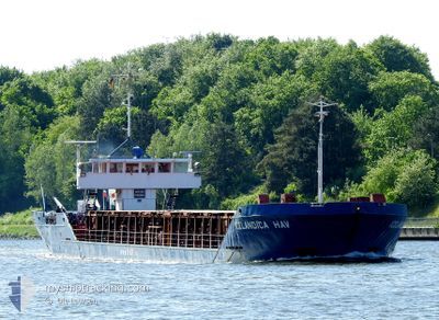
ICELANDICA HAV
General Cargo

Current Trip
| Time Travelled | 6 days |
|---|---|
| Remaining Time | --- |
| Distance Travelled | 953.73 nm |
| Remaining Distance | --- |
| AVG Speed | 5.3 Knots |
| MAX Speed | 11.1 Knots |
| AVG Wind | 18.8 knots |
| MAX Wind | 24.8 knots |
| MIN Temp | 7°C / 44.6°F |
| MAX Temp | 13.7°C / 56.66°F |
| Draught | 4.2 m |
| Position Received | 1 m ago |
Current Position
| Longitude | --- |
|---|---|
| Latitude | --- |
| Status | Under way using engine |
| Speed | 6.7 Knots |
| Course | 44.7° |
| Area | English Channel |
| Station | T-AIS |
| Position Received | 1 m ago |
Information
The current position of ICELANDICA HAV is in English Channel with coordinates 50.72402° / 0.64180° as reported on 2025-03-29 18:36 by AIS to our vessel tracker app. The vessel's current speed is 6.7 Knots and is heading at the port of RYE. The estimated time of arrival as calculated by MyShipTracking vessel tracking app is 2025-03-29 21:00 LT
The vessel ICELANDICA HAV (IMO: 8128884, MMSI: 309175000) is a General Cargo that was built in 1982 ( 43 years old ). It's sailing under the flag of [BS] Bahamas.
In this page you can find informations about the vessels current position, last detected port calls, and current voyage information. If the vessels is not in coverage by AIS you will find the latest position.
The current position of ICELANDICA HAV is detected by our AIS receivers and we are not responsible for the reliability of the data. The last position was recorded while the vessel was in Coverage by the Ais receivers of our vessel tracking app.
The current draught of ICELANDICA HAV as reported by AIS is 4.2 meters
Weather
| Temperature | 8.7°C / 47.66°F |
|---|---|
| Wind Speed | 16 knots |
| Direction | 246° WSW |
| Pressure | 1022.3 hPa |
| Humidity | 81.1 % |
| Cloud Coverage | 47 % |


Featured Company
Last Port Calls
| Port | Arrival | Departure | Time In Port |
|---|---|---|---|
| 2025-03-22 01:37 | 2025-03-23 16:47 | 1 d | |
| 2025-03-18 07:10 | 2025-03-18 20:12 | 13 h | |
| 2025-03-11 01:04 | 2025-03-14 16:31 | 3 d | |
| 2025-03-01 10:39 | 2025-03-03 18:18 | 2 d | |
| 2025-02-25 22:23 | 2025-02-26 20:43 | 22 h | |
| 2025-02-18 11:12 | 2025-02-18 11:16 | 3 m | |
| 2025-02-12 18:28 | 2025-02-14 18:32 | 2 d | |
| 2025-02-03 15:39 | 2025-02-07 16:09 | 4 d | |
| 2025-01-29 20:21 | 2025-01-29 21:52 | 1 h | |
| 2025-01-28 00:51 | 2025-01-28 02:22 | 1 h |
Last Trips
| Origin | Departure | Destination | Arrival | Distance | |
|---|---|---|---|---|---|
| 2025-03-18 20:12 | 2025-03-22 01:37 | 419.80 nm | |||
| 2025-03-14 16:31 | 2025-03-18 07:10 | 690.36 nm | |||
| 2025-03-03 18:18 | 2025-03-11 01:04 | 1547.83 nm | |||
| 2025-02-26 20:43 | 2025-03-01 10:39 | 174.93 nm | |||
| 2025-02-18 11:16 | 2025-02-25 22:23 | 892.57 nm | |||
| 2025-02-14 18:32 | 2025-02-18 11:12 | 271.49 nm | |||
| 2025-02-07 16:09 | 2025-02-12 18:28 | 920.06 nm | |||
| 2025-01-29 21:52 | 2025-02-03 15:39 | 794.56 nm | |||
| 2025-01-28 02:22 | 2025-01-29 20:21 | 16.69 nm | |||
| 2025-01-21 14:39 | 2025-01-28 00:51 | 597.17 nm |
Events
| Time | Event | Details | Position / Dest | Info |
|---|---|---|---|---|
| 2025-03-29 11:11 | ETA Changed | 2025/03/29 21:00 2025/03/30 09:00 |
50.51318 / -.57339
RYE
|
Speed: 8.3 kn Course: 68.2° |
| 2025-03-29 09:54 | ETA Changed | 2025/03/30 09:00 2025/03/28 23:00 |
50.43565 / -.83736
RYE
|
Speed: 9.2 kn Course: 63.1° |
| 2025-03-29 09:21 | Change Sea Area | United Kingdom part of the English Channel Portuguese part of the North Atlantic Ocean |
50.39834 / -.96048
English Channel
|
Speed: 10.4 kn Course: 64.5° |
| 2025-03-29 09:21 | Status Changed | Under way using engine Default |
50.39812 / -.96121
RYE
|
Speed: 10.4 kn Course: 65° |
| 2025-03-29 09:21 | IN Coverage |
50.39834 / -.96048
English Channel
|
Speed: 10.4 kn Course: 64.5° |
|
| 2025-03-24 06:28 | Status Changed | Default Under way using engine |
39.22469 / -9.83411
RYE
|
Speed: 4.1 kn Course: 2° |
| 2025-03-24 06:21 | OUT of Coverage |
39.21694 / -9.83429
North Atlantic Ocean
RYE
|
Speed: 4.1 kn Course: 356.2° |
|
| 2025-03-24 06:18 | Status Changed | Under way using engine Default |
39.21364 / -9.83441
RYE
|
Speed: 4.4 kn Course: 2° |
| 2025-03-24 06:08 | Status Changed | Default Under way using engine |
39.20074 / -9.83466
RYE
|
Speed: 4.9 kn Course: 3° |
| 2025-03-24 06:00 | Status Changed | Under way using engine Default |
39.19129 / -9.83493
RYE
|
Speed: 4.7 kn Course: 4° |