
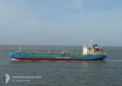
ICE HAWK
Oil/Chemical Tanker
Current Trip
| Time Travelled | 3 h, 7 mins |
|---|---|
| Remaining Time | 15 h, 23 mins |
| Distance Travelled | 35.48 nm |
| Remaining Distance | 196.48 nm |
| AVG Speed | 12.6 Knots |
| MAX Speed | 13.2 Knots |
| AVG Wind | 9.6 knots |
| MAX Wind | 13 knots |
| MIN Temp | 15.4°C / 59.72°F |
| MAX Temp | 17.3°C / 63.14°F |
| Draught | 8.6 m |
| Position Received | 1 m ago |
Current Position
| Longitude | 24.45891° |
|---|---|
| Latitude | 37.23350° |
| Status | Under way using engine |
| Speed | 12.3 Knots |
| Course | 97.5° |
| Area | Aegean Sea |
| Station | T-AIS |
| Position Received | 1 m ago |
Info
Information
The current position of ICE HAWK is in Aegean Sea with coordinates 37.23350° / 24.45891° as reported on 2024-05-14 06:48 by AIS to our vessel tracker app. The vessel's current speed is 12.3 Knots and is heading at the port of RHODES. The estimated time of arrival as calculated by MyShipTracking vessel tracking app is 2024-05-14 22:13 LT
The vessel ICE HAWK (IMO: 9169768, MMSI: 241610000) is a Oil/Chemical Tanker that was built in 1999 ( 25 years old ). It's sailing under the flag of [GR] Greece.
In this page you can find informations about the vessels current position, last detected port calls, and current voyage information. If the vessels is not in coverage by AIS you will find the latest position.
The current position of ICE HAWK is detected by our AIS receivers and we are not responsible for the reliability of the data. The last position was recorded while the vessel was in Coverage by the Ais receivers of our vessel tracking app.
The current draught of ICE HAWK as reported by AIS is 8.6 meters
Weather
| Temperature | 17.3°C / 63.14°F |
|---|---|
| Wind Speed | 6 knots |
| Direction | 48° NE |
| Pressure | 1015.7 hPa |
| Humidity | 69.4 % |
| Cloud Coverage | 80 % |
Featured Company
Last Port Calls
| Port | Arrival | Departure | Time In Port |
|---|---|---|---|
| 2024-05-12 06:55 | 2024-05-14 03:43 | 1 d | |
| 2024-04-28 04:28 | 2024-04-29 15:47 | 1 d | |
| 2024-04-24 04:36 | 2024-04-25 06:31 | 1 d | |
| 2024-04-14 04:34 | 2024-04-16 05:11 | 2 d | |
| 2024-04-10 05:52 | 2024-04-10 17:21 | 11 h | |
| 2024-04-01 05:15 | 2024-04-09 14:52 | 8 d | |
| 2024-03-24 05:50 | 2024-03-26 13:34 | 2 d | |
| 2024-03-20 04:52 | 2024-03-21 13:16 | 1 d | |
| 2024-03-14 09:40 | 2024-03-14 16:22 | 6 h | |
| 2024-03-09 06:06 | 2024-03-11 09:55 | 2 d |
Last Trips
| Origin | Departure | Destination | Arrival | Distance | |
|---|---|---|---|---|---|
| 2024-04-29 18:47 | 2024-05-12 09:55 | 177.59 nm | |||
| 2024-04-25 09:31 | 2024-04-28 07:28 | 159.21 nm | |||
| 2024-04-16 08:11 | 2024-04-24 07:36 | 460.30 nm | |||
| 2024-04-10 20:21 | 2024-04-14 07:34 | 9.92 nm | |||
| 2024-04-09 17:52 | 2024-04-10 08:52 | 58.94 nm | |||
| 2024-03-26 15:34 | 2024-04-01 08:15 | 276.56 nm | |||
| 2024-03-21 15:16 | 2024-03-24 07:50 | 158.34 nm | |||
| 2024-03-14 18:22 | 2024-03-20 06:52 | 9.33 nm | |||
| 2024-03-11 11:55 | 2024-03-14 11:40 | 385.62 nm | |||
| 2024-02-06 08:26 | 2024-03-09 08:06 | 629.58 nm |
Events
| Time | Event | Details | Position / Dest | Info |
|---|---|---|---|---|
| 2024-05-14 06:25 | Status Changed | Under way using engine Default |
37.24503 / 24.36276
RHODES
|
Speed: 11.9 kn Course: 116° |
| 2024-05-14 06:17 | Status Changed | Default Under way using engine |
37.25055 / 24.33074
RHODES
|
Speed: 12.1 kn Course: 133.4° |
| 2024-05-14 04:46 | ETA Changed | 2024/05/15 21:30 2024/05/15 22:00 |
37.53898 / 24.14988
RHODES
|
Speed: 12.6 kn Course: 153.9° |
| 2024-05-14 03:52 | Draught Changed | 8.6 6.2 |
37.72051 / 24.08181
RHODES
|
Speed: 11.3 kn Course: 176.9° |
| 2024-05-14 03:52 | Destination Changed | RHODES LAVRION |
37.72051 / 24.08181
RHODES
|
Speed: 11.3 kn Course: 176.9° |
| 2024-05-14 03:52 | ETA Changed | 2024/05/15 22:00 2025/04/30 04:30 |
37.72051 / 24.08181
RHODES
|
Speed: 11.3 kn Course: 176.9° |
| 2024-05-14 03:43 | PORT DEPARTURE |
|
37.73949 / 24.07624
LAVRION
|
Speed: 4.7 kn Course: 147° |
| 2024-05-14 03:43 | Status Changed | Under way using engine Default |
37.73984 / 24.07594
[GR] SYRI
|
Speed: 1.3 kn Course: 124° |
| 2024-05-14 03:43 | START Moving |
37.73984 / 24.07594
[GR] SYRI
|
Speed: 4.7 kn Course: 147° |
|
| 2024-05-14 03:32 | IN Coverage |
37.73908 / 24.07656
Aegean Sea
|
Speed: 5.1 kn Course: 148.4° |