
HUA YANG LONG
Cargo
Current Trip
| Time Travelled | 27 days |
|---|---|
| Remaining Time | --- |
| Distance Travelled | 1576.89 nm |
| Remaining Distance | --- |
| AVG Speed | 9.5 Knots |
| MAX Speed | 15.5 Knots |
| AVG Wind | 10.7 knots |
| MAX Wind | 14.5 knots |
| MIN Temp | 19.8°C / 67.64°F |
| MAX Temp | 28.7°C / 83.66°F |
| Draught | 9.5 m |
| Position Received | 4 d ago |
Current Position
| Longitude | --- |
|---|---|
| Latitude | --- |
| Status | Under way using engine |
| Speed | 11.3 Knots |
| Course | 309.6° |
| Area | Malacca Strait |
| Station | T-AIS |
| Position Received | 4 d ago |
Info
Information
The current position of HUA YANG LONG is in Malacca Strait with coordinates 2.13968° / 102.04958° as reported on 2025-12-30 16:08 by AIS to our vessel tracker app. The vessel's current speed is 11.3 Knots and is heading at the port of LEITH. The estimated time of arrival as calculated by MyShipTracking vessel tracking app is 2026-02-15 12:00 LT
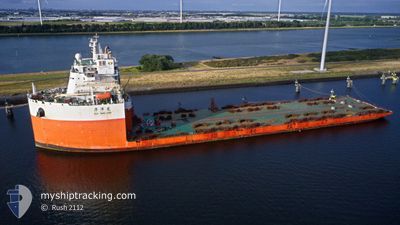
The vessel HUA YANG LONG (IMO: 9743710, MMSI: 414225000) is a Cargo It's sailing under the flag of [CN] China.
In this page you can find informations about the vessels current position, last detected port calls, and current voyage information. If the vessels is not in coverage by AIS you will find the latest position.
The current position of HUA YANG LONG is detected by our AIS receivers and we are not responsible for the reliability of the data. The last position was recorded while the vessel was in Coverage by the Ais receivers of our vessel tracking app.
The current draught of HUA YANG LONG as reported by AIS is 9.5 meters
Weather
| Temperature | 26.6°C / 79.88°F |
|---|---|
| Wind Speed | 5 knots |
| Direction | 50° NE |
| Pressure | 1010.1 hPa |
| Humidity | 79.1 % |
| Cloud Coverage | 100 % |
Featured Company
Most Visited Ports (Last year)
| Port | Arrivals | |
|---|---|---|
| 4 | ||
| 1 | ||
| 1 | ||
| 1 |
Last Trips
| Origin | Departure | Destination | Arrival | Distance |
|---|
Events
| Time | Event | Details | Position / Dest | Info |
|---|---|---|---|---|
| 2025-12-30 16:08 | OUT of Coverage |
2.13968 / 102.04958
Malacca Strait
|
Speed: 11.3 kn Course: 309.6° |
|
| 2025-12-30 14:00 | Change Sea Area | Malaysian part of the Malacca Strait Malaysian part of the Singapore Strait |
1.89174 / 102.39979
Malacca Strait
|
Speed: 12.2 kn Course: 295.3° |
| 2025-12-30 14:00 | IN Coverage |
1.89174 / 102.39979
Malacca Strait
|
Speed: 12.2 kn Course: 295.3° |
|
| 2025-12-30 07:17 | OUT of Coverage |
1.20291 / 103.50894
Singapore Strait
|
Speed: 12.4 kn Course: 288.5° |
|
| 2025-12-30 06:58 | Change Sea Area | Malaysian part of the Singapore Strait Indonesian part of the Singapore Strait |
1.18553 / 103.57038
Singapore Strait
|
Speed: 12.3 kn Course: 275.3° |
| 2025-12-30 06:25 | Change Sea Area | Indonesian part of the Singapore Strait Singaporean part of the Singapore Strait |
1.17469 / 103.67712
Singapore Strait
|
Speed: 11.8 kn Course: 301.1° |
| 2025-12-30 04:49 | Change Sea Area | Singaporean part of the Singapore Strait Indonesian part of the Singapore Strait |
1.23423 / 103.94088
Singapore Strait
|
Speed: 11 kn Course: 251.5° |
| 2025-12-30 04:05 | Change Sea Area | Indonesian part of the Singapore Strait Malaysian part of the Singapore Strait |
1.26371 / 104.06809
Singapore Strait
|
Speed: 10 kn Course: 258.2° |
| 2025-12-30 03:11 | START Moving | 2.99 nm, East of TANAH MERAH |
1.33057 / 104.06416
LEITH,UK
|
Speed: 3.1 kn Course: 103° |
| 2025-12-30 03:04 | Status Changed | Under way using engine At anchor |
1.33036 / 104.06137
LEITH,UK
|
Speed: 0.3 kn Course: 352° |