
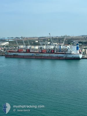
HSL NASSAU
Cargo
Current Trip
| Time Travelled | 23 days |
|---|---|
| Remaining Time | --- |
| Distance Travelled | 5252.09 nm |
| Remaining Distance | --- |
| AVG Speed | 9.9 Knots |
| MAX Speed | 15.5 Knots |
| AVG Wind | 18.6 knots |
| MAX Wind | 44 knots |
| MIN Temp | -3.2°C / 26.24°F |
| MAX Temp | 13.5°C / 56.3°F |
| Draught | 7 m |
| Position Received | 2 m ago |
Current Position
| Longitude | --- |
|---|---|
| Latitude | --- |
| Status | At anchor |
| Speed | |
| Course | 173° |
| Area | The Coastal Waters of Southeast Alaska and British Columbia |
| Station | T-AIS |
| Position Received | 2 m ago |
Info
Information
The current position of HSL NASSAU is in The Coastal Waters of Southeast Alaska and British Columbia with coordinates 49.20286° / -123.90501° as reported on 2025-01-21 11:32 by AIS to our vessel tracker app. The vessel's current speed is 0 Knots
The vessel HSL NASSAU (IMO: 9802310, MMSI: 351234000) is a Cargo It's sailing under the flag of [PA] Panama.
In this page you can find informations about the vessels current position, last detected port calls, and current voyage information. If the vessels is not in coverage by AIS you will find the latest position.
The current position of HSL NASSAU is detected by our AIS receivers and we are not responsible for the reliability of the data. The last position was recorded while the vessel was in Coverage by the Ais receivers of our vessel tracking app.
The current draught of HSL NASSAU as reported by AIS is 7 meters
Weather
| Temperature | 0.9°C / 33.62°F |
|---|---|
| Wind Speed | 6 knots |
| Direction | 264° W |
| Pressure | 1030.1 hPa |
| Humidity | 76.9 % |
| Cloud Coverage | 10 % |
Featured Company
Last Port Calls
| Port | Arrival | Departure | Time In Port |
|---|---|---|---|
| 2024-12-26 05:53 | 2024-12-28 14:49 | 2 d | |
| 2024-11-03 01:17 | 2024-11-03 02:58 | 1 h |
Most Visited Ports (Last year)
| Port | Arrivals | |
|---|---|---|
| 2 | ||
| 2 | ||
| 1 | ||
| 1 | ||
| 1 | ||
| 1 |
Last Trips
| Origin | Departure | Destination | Arrival | Distance | |
|---|---|---|---|---|---|
| 2024-11-02 21:58 | 2024-12-26 13:53 | 10971.63 nm | |||
| 2024-10-28 18:10 | 2024-11-02 20:17 | 58.76 nm |
Events
| Time | Event | Details | Position / Dest | Info |
|---|---|---|---|---|
| 2025-01-21 11:32 | Status Changed | At anchor Default |
49.20286 / -123.90501
CA_VAN
|
Speed: Course: 174° |
| 2025-01-21 11:29 | Status Changed | Default At anchor |
49.20287 / -123.90500
CA_VAN
|
Speed: Course: 174° |
| 2025-01-21 00:13 | Status Changed | At anchor Default |
49.20278 / -123.90605
CA_VAN
|
Speed: Course: 154° |
| 2025-01-21 00:10 | Status Changed | Default At anchor |
49.20277 / -123.90601
CA_VAN
|
Speed: 0.1 kn Course: 157° |
| 2025-01-20 15:52 | Status Changed | At anchor Default |
49.20286 / -123.90527
CA_VAN
|
Speed: 0.1 kn Course: 165° |
| 2025-01-20 15:46 | Status Changed | Default At anchor |
49.20282 / -123.90529
CA_VAN
|
Speed: 0.1 kn Course: 164° |
| 2025-01-19 18:16 | Status Changed | At anchor Default |
49.19960 / -123.90293
CA_VAN
|
Speed: 0.2 kn Course: 308° |
| 2025-01-19 18:13 | Status Changed | Default At anchor |
49.19969 / -123.90285
CA_VAN
|
Speed: 0.2 kn Course: 300° |
| 2025-01-19 11:28 | Status Changed | At anchor Default |
49.20134 / -123.90227
CA_VAN
|
Speed: Course: 258° |
| 2025-01-19 11:25 | Status Changed | Default At anchor |
49.20132 / -123.90228
CA_VAN
|
Speed: Course: 257° |