
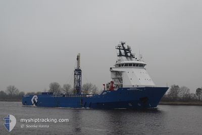
HORIZON GEODISCOVERY
Offshore Supply Ship
Current Trip
MIN CPA 0.5NM
| Time Travelled | 2 days |
|---|---|
| Remaining Time | --- |
| Distance Travelled | 116.83 nm |
| Remaining Distance | --- |
| AVG Speed | 10.2 Knots |
| MAX Speed | 11 Knots |
| AVG Wind | 7.5 knots |
| MAX Wind | 13.3 knots |
| MIN Temp | 11.1°C / 51.98°F |
| MAX Temp | 12.3°C / 54.14°F |
| Draught | 5.8 m |
| Position Received | 2 h, 53 m ago |
Current Position
| Longitude | -3.61912° |
|---|---|
| Latitude | 53.81607° |
| Status | Restricted manoeuverability |
| Speed | |
| Course | 100° |
| Area | Irish Sea and St. George's Channel |
| Station | T-AIS |
| Position Received | 2 h, 53 m ago |
Info
Information
The current position of HORIZON GEODISCOVERY is in Irish Sea and St. George's Channel with coordinates 53.81607° / -3.61912° as reported on 2024-05-04 09:47 by AIS to our vessel tracker app. The vessel's current speed is 0 Knots
The vessel HORIZON GEODISCOVERY (IMO: 9263514, MMSI: 355847000) is a Offshore Supply Ship that was built in 2002 ( 22 years old ). It's sailing under the flag of [PA] Panama.
In this page you can find informations about the vessels current position, last detected port calls, and current voyage information. If the vessels is not in coverage by AIS you will find the latest position.
The current position of HORIZON GEODISCOVERY is detected by our AIS receivers and we are not responsible for the reliability of the data. The last position was recorded while the vessel was in Coverage by the Ais receivers of our vessel tracking app.
The current draught of HORIZON GEODISCOVERY as reported by AIS is 5.8 meters
Weather
| Temperature | 10.2°C / 50.36°F |
|---|---|
| Wind Speed | 9 knots |
| Direction | 203° SSW |
| Pressure | 1008.8 hPa |
| Humidity | 94.4 % |
| Cloud Coverage | 100 % |
Featured Company
Last Port Calls
| Port | Arrival | Departure | Time In Port |
|---|---|---|---|
| 2024-04-30 18:25 | 2024-05-01 19:28 | 1 d | |
| 2024-03-15 06:58 | 2024-04-26 10:57 | ||
| 2024-03-13 00:41 | 2024-03-13 03:54 | 3 h | |
| 2024-03-10 18:47 | 2024-03-12 16:23 | 1 d |
Most Visited Ports (Last year)
| Port | Arrivals | |
|---|---|---|
| 10 | ||
| 6 | ||
| 1 | ||
| 1 | ||
| 1 | ||
| 1 |
Last Trips
| Origin | Departure | Destination | Arrival | Distance | |
|---|---|---|---|---|---|
| 2024-04-26 11:57 | 2024-04-30 19:25 | 613.87 nm | |||
| 2024-03-13 04:54 | 2024-03-15 06:58 | 484.29 nm | |||
| 2024-03-12 17:23 | 2024-03-13 01:41 | 50.44 nm | |||
| 2024-02-13 13:31 | 2024-03-10 19:47 | 394.50 nm |
Events
| Time | Event | Details | Position / Dest | Info |
|---|---|---|---|---|
| 2024-05-04 09:47 | OUT of Coverage |
53.81607 / -3.61912
Irish Sea and St. George's Channel
|
Speed: Course: 15.9° |
|
| 2024-05-04 09:47 | IN Coverage |
53.81607 / -3.61912
Irish Sea and St. George's Channel
|
Speed: Course: 15.9° |
|
| 2024-05-04 06:26 | OUT of Coverage |
53.81606 / -3.61913
Irish Sea and St. George's Channel
|
Speed: Course: 15.9° |
|
| 2024-05-03 14:23 | IN Coverage |
53.81609 / -3.61902
Irish Sea and St. George's Channel
|
Speed: Course: 15.9° |
|
| 2024-05-03 13:21 | OUT of Coverage |
53.81607 / -3.61914
Irish Sea and St. George's Channel
|
Speed: Course: 15.9° |
|
| 2024-05-03 13:05 | IN Coverage |
53.81605 / -3.61912
Irish Sea and St. George's Channel
|
Speed: Course: 15.9° |
|
| 2024-05-03 11:18 | OUT of Coverage |
53.81610 / -3.61915
Irish Sea and St. George's Channel
|
Speed: Course: 15.9° |
|
| 2024-05-03 07:05 | IN Coverage |
53.81607 / -3.61912
Irish Sea and St. George's Channel
|
Speed: Course: 15.9° |
|
| 2024-05-03 02:01 | OUT of Coverage |
53.81608 / -3.61915
Irish Sea and St. George's Channel
MIN CPA 0.5NM
|
Speed: Course: 15.9° |
|
| 2024-05-03 02:01 | IN Coverage |
53.81608 / -3.61915
Irish Sea and St. George's Channel
MIN CPA 0.5NM
|
Speed: Course: 15.9° |