

HON FA
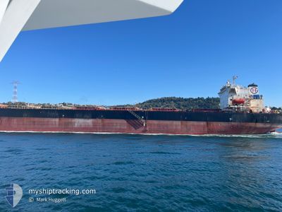
Bulk Carrier

Current Trip
| Time Travelled | --- |
|---|---|
| Remaining Time | --- |
| Distance Travelled | --- |
| Remaining Distance | --- |
| AVG Speed | --- |
| MAX Speed | --- |
| AVG Wind | --- |
| MAX Wind | --- |
| MIN Temp | --- |
| MAX Temp | --- |
| Draught | 14.5 m |
| Position Received | 5 d ago |
Current Position
| Longitude | --- |
|---|---|
| Latitude | --- |
| Status | Under way using engine |
| Speed | 11.5 Knots |
| Course | 48.6° |
| Area | Mediterranean Sea - Eastern Basin |
| Station | T-AIS |
| Position Received | 5 d ago |
Information
The current position of HON FA is in Mediterranean Sea - Eastern Basin with coordinates 36.49396° / 35.85269° as reported on 2025-03-21 09:42 by AIS to our vessel tracker app. The vessel's current speed is 11.5 Knots
The vessel HON FA (IMO: 9248899, MMSI: 352003954) is a Bulk Carrier that was built in 2001 ( 24 years old ). It's sailing under the flag of [PA] Panama.
In this page you can find informations about the vessels current position, last detected port calls, and current voyage information. If the vessels is not in coverage by AIS you will find the latest position.
The current position of HON FA is detected by our AIS receivers and we are not responsible for the reliability of the data. The last position was recorded while the vessel was in Coverage by the Ais receivers of our vessel tracking app.
The current draught of HON FA as reported by AIS is 14.5 meters
Weather
| Temperature | 10.5°C / 50.9°F |
|---|---|
| Wind Speed | 9 knots |
| Direction | 28° NNE |
| Pressure | 1018.6 hPa |
| Humidity | 40.4 % |
| Cloud Coverage | 98 % |


Featured Company
Last Port Calls
| Port | Arrival | Departure | Time In Port |
|---|---|---|---|
| 2025-03-19 08:39 |
Most Visited Ports (Last year)
| Port | Arrivals | |
|---|---|---|
| 5 | ||
| 1 | ||
| 1 | ||
| 1 |
Last Trips
| Origin | Departure | Destination | Arrival | Distance |
|---|
Events
| Time | Event | Details | Position / Dest | Info |
|---|---|---|---|---|
| 2025-03-21 09:42 | OUT of Coverage |
36.49396 / 35.85269
Mediterranean Sea - Eastern Basin
TR ISK
|
Speed: 11.5 kn Course: 48.6° |
|
| 2025-03-21 07:52 | ETA Changed | 2025/03/21 10:00 2025/03/20 23:00 |
36.22895 / 35.60268
TR ISK
|
Speed: 10.6 kn Course: 29° |
| 2025-03-21 07:21 | Change Sea Area | Turkish part of the Mediterranean Sea - Eastern Basin Syrian part of the Mediterranean Sea - Eastern Basin |
36.14777 / 35.54713
Mediterranean Sea - Eastern Basin
|
Speed: 10.7 kn Course: 29.7° |
| 2025-03-21 04:54 | Detected in Sea | Syrian part of the Mediterranean Sea - Eastern Basin |
35.76540 / 35.30463
Mediterranean Sea - Eastern Basin
|
Speed: 10.6 kn Course: 27.3° |
| 2025-03-21 04:54 | IN Coverage |
35.76540 / 35.30463
Mediterranean Sea - Eastern Basin
|
Speed: 10.6 kn Course: 27.3° |
|
| 2025-03-19 08:36 | OUT of Coverage |
30.20129 / 32.56533
Gulf of Suez
[EG] SUEZ CANAL
|
Speed: 9.4 kn Course: 339.7° |
|
| 2025-03-19 06:39 | PORT ARRIVAL |
|
29.94771 / 32.57916
[EG] SUEZ CANAL
|
Speed: 7.4 kn Course: 31.7° |
| 2025-03-19 05:58 | Status Changed | Under way using engine At anchor |
29.87968 / 32.54907
TR ISK
|
Speed: 10.4 kn Course: 350.8° |
| 2025-03-19 05:58 | Destination Changed | TR ISK SUEZ |
29.87781 / 32.54943
TR ISK
|
Speed: 10.4 kn Course: 350.8° |
| 2025-03-19 05:58 | ETA Changed | 2025/03/20 23:00 2025/03/18 08:00 |
29.87781 / 32.54943
TR ISK
|
Speed: 10.4 kn Course: 350.8° |