
HOHEPLATE
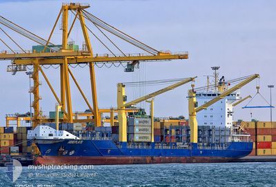
Container Ship
Current Trip
| Trip Time | 8 h, 42 mins |
|---|---|
| Trip Distance | 68.80 nm |
| AVG Speed | 8.4 Knots |
| MAX Speed | 12.9 Knots |
| Draught | 7.9 m |
| AVG Wind | 11.9 knots |
| MAX Wind | 21 knots |
| MIN Temp | 20.8°C / 69.44°F |
| MAX Temp | 25.1°C / 77.18°F |
| Position Received | 3 d ago |
Current Position
| Longitude | --- |
|---|---|
| Latitude | --- |
| Status | Under way using engine |
| Speed | 12.3 Knots |
| Course | 163.5° |
| Area | Caribbean Sea |
| Station | T-AIS |
| Position Received | 3 d ago |
Information
The current position of HOHEPLATE is in Caribbean Sea with coordinates 18.21641° / -69.95190° as reported on 2025-03-29 23:29 by AIS to our vessel tracker app. The vessel's current speed is 12.3 Knots and is currently inside the port of PUERTO CABELLO.
The vessel HOHEPLATE (IMO: 9366237, MMSI: 305236000) is a Container Ship that was built in 2007 ( 18 years old ). It's sailing under the flag of [AG] Antigua Barbuda.
In this page you can find informations about the vessels current position, last detected port calls, and current voyage information. If the vessels is not in coverage by AIS you will find the latest position.
The current position of HOHEPLATE is detected by our AIS receivers and we are not responsible for the reliability of the data. The last position was recorded while the vessel was in Coverage by the Ais receivers of our vessel tracking app.
The current draught of HOHEPLATE as reported by AIS is 7.9 meters
Weather
| Temperature | 24.1°C / 75.38°F |
|---|---|
| Wind Speed | 8 knots |
| Direction | 65° ENE |
| Pressure | 1012.3 hPa |
| Humidity | 86.8 % |
| Cloud Coverage | 95 % |
Featured Company
Last Port Calls
| Port | Arrival | Departure | Time In Port |
|---|---|---|---|
| 2025-04-02 05:11 | |||
| 2025-03-31 18:01 | 2025-04-01 20:29 | 1 d | |
| 2025-03-29 12:37 | 2025-03-29 22:31 | 9 h | |
| 2025-03-25 00:06 | 2025-03-26 08:44 | 1 d | |
| 2025-03-24 13:23 | 2025-03-25 00:03 | 10 h | |
| 2025-03-19 19:06 | 2025-03-20 19:58 | 1 d | |
| 2025-03-18 17:45 | 2025-03-19 09:07 | 15 h | |
| 2025-03-16 01:35 | 2025-03-16 17:08 | 15 h | |
| 2025-03-13 18:53 | 2025-03-14 09:57 | 15 h | |
| 2025-03-09 21:28 | 2025-03-10 07:53 | 10 h |
Most Visited Ports (Last year)
| Port | Arrivals | |
|---|---|---|
| 41 | ||
| 37 | ||
| 23 | ||
| 13 | ||
| 12 | ||
| 6 |
Last Trips
| Origin | Departure | Destination | Arrival | Distance | |
|---|---|---|---|---|---|
| 2025-04-01 16:29 | 2025-04-02 01:11 | 68.80 nm | |||
| 2025-03-29 18:31 | 2025-03-31 14:01 | 504.50 nm | |||
| 2025-03-26 04:44 | 2025-03-29 08:37 | 932.24 nm | |||
| 2025-03-24 20:03 | 2025-03-24 20:06 | 0.41 nm | |||
| 2025-03-20 14:58 | 2025-03-24 09:23 | 1098.84 nm | |||
| 2025-03-19 04:07 | 2025-03-19 14:06 | 96.17 nm | |||
| 2025-03-16 13:08 | 2025-03-18 12:45 | 593.49 nm | |||
| 2025-03-14 05:57 | 2025-03-15 21:35 | 502.01 nm | |||
| 2025-03-10 03:53 | 2025-03-13 14:53 | 957.75 nm | |||
| 2025-03-09 04:01 | 2025-03-09 17:28 | 9.98 nm |
Events
| Time | Event | Details | Position / Dest | Info |
|---|---|---|---|---|
| 2025-04-02 05:46 | STOP Moving |
10.46845 / -68.00210
[VE] PUERTO CABELLO
|
Speed: Course: -1° |
|
| 2025-04-02 05:11 | PORT ARRIVAL |
|
10.48211 / -68.00040
[VE] PUERTO CABELLO
|
Speed: 2.2 kn Course: -1° |
| 2025-04-01 20:29 | PORT DEPARTURE |
|
10.61412 / -66.96381
VE LAG
|
Speed: 1.5 kn Course: -1° |
| 2025-03-31 18:25 | STOP Moving |
10.60300 / -66.94752
[VE] LA GUAIRA
|
Speed: Course: -1° |
|
| 2025-03-31 18:01 | PORT ARRIVAL |
|
10.60419 / -66.94836
[VE] LA GUAIRA
|
Speed: 3.7 kn Course: -1° |
| 2025-03-29 23:51 | Status Changed | Default Under way using engine |
18.14700 / -69.92740
VE LAG
|
Speed: 12.3 kn Course: 163.5° |
| 2025-03-29 23:29 | OUT of Coverage |
18.21641 / -69.95190
Caribbean Sea
VE LAG
|
Speed: 12.3 kn Course: 163.5° |
|
| 2025-03-29 23:27 | Status Changed | Under way using engine Default |
18.22247 / -69.95382
VE LAG
|
Speed: 12.3 kn Course: 164° |
| 2025-03-29 23:22 | Status Changed | Default Under way using engine |
18.24116 / -69.95976
VE LAG
|
Speed: 12.2 kn Course: 163.5° |
| 2025-03-29 22:47 | Draught Changed | 7.9 8.5 |
18.35438 / -69.99831
VE LAG
|
Speed: 12.3 kn Course: 160.5° |