
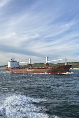
HEERENGRACHT
Heavy Load Carrier
Current Trip
| Time Travelled | 4 days |
|---|---|
| Remaining Time | --- |
| Distance Travelled | 1436.33 nm |
| Remaining Distance | --- |
| AVG Speed | 13.7 Knots |
| MAX Speed | 15.9 Knots |
| AVG Wind | 10.1 knots |
| MAX Wind | 27.8 knots |
| MIN Temp | 10.9°C / 51.62°F |
| MAX Temp | 17.8°C / 64.04°F |
| Draught | 7 m |
| Position Received | 1 d ago |
Current Position
| Longitude | --- |
|---|---|
| Latitude | --- |
| Status | Under way using engine |
| Speed | 14 Knots |
| Course | 234.8° |
| Area | North Atlantic Ocean |
| Station | T-AIS |
| Position Received | 1 d ago |
Info
Information
The current position of HEERENGRACHT is in North Atlantic Ocean with coordinates 34.28111° / -9.05787° as reported on 2025-02-15 16:45 by AIS to our vessel tracker app. The vessel's current speed is 14 Knots and is heading at the port of FREEPORT (BS). The estimated time of arrival as calculated by MyShipTracking vessel tracking app is 2025-02-27 22:00 LT
The vessel HEERENGRACHT (IMO: 9435753, MMSI: 244014000) is a Heavy Load Carrier that was built in 2009 ( 16 years old ). It's sailing under the flag of [NL] Netherlands.
In this page you can find informations about the vessels current position, last detected port calls, and current voyage information. If the vessels is not in coverage by AIS you will find the latest position.
The current position of HEERENGRACHT is detected by our AIS receivers and we are not responsible for the reliability of the data. The last position was recorded while the vessel was in Coverage by the Ais receivers of our vessel tracking app.
The current draught of HEERENGRACHT as reported by AIS is 7 meters
Weather
| Temperature | 17.3°C / 63.14°F |
|---|---|
| Wind Speed | 11 knots |
| Direction | 29° NNE |
| Pressure | 1019.6 hPa |
| Humidity | 62.5 % |
| Cloud Coverage | --- |
Featured Company
Last Port Calls
| Port | Arrival | Departure | Time In Port |
|---|---|---|---|
| 2025-02-08 16:31 | 2025-02-12 13:48 | 3 d | |
| 2025-02-07 23:31 | |||
| 2025-02-01 11:12 | 2025-02-03 12:21 | 2 d | |
| 2025-02-01 09:37 | |||
| 2025-02-01 09:12 | |||
| 2025-01-27 16:20 | 2025-01-31 22:22 | 4 d | |
| 2025-01-14 09:02 |
Most Visited Ports (Last year)
| Port | Arrivals | |
|---|---|---|
| 4 | ||
| 4 | ||
| 4 | ||
| 3 | ||
| 2 | ||
| 2 |
Last Trips
| Origin | Departure | Destination | Arrival | Distance | |
|---|---|---|---|---|---|
| 2025-02-08 00:31 | 2025-02-08 17:31 | 211.27 nm | |||
| 2025-02-01 10:12 | 2025-02-01 12:12 | 33.96 nm | |||
| 2025-01-31 23:22 | 2025-02-01 10:37 | 157.53 nm | |||
| 2025-01-14 10:02 | 2025-01-27 17:20 | 1937.19 nm |
Events
| Time | Event | Details | Position / Dest | Info |
|---|---|---|---|---|
| 2025-02-15 16:51 | Status Changed | Default Under way using engine |
34.26659 / -9.08362
BS FPO
|
Speed: 14 kn Course: 234.8° |
| 2025-02-15 16:45 | OUT of Coverage |
34.28111 / -9.05787
North Atlantic Ocean
BS FPO
|
Speed: 14 kn Course: 234.8° |
|
| 2025-02-15 16:27 | Status Changed | Under way using engine Default |
34.31905 / -8.98951
BS FPO
|
Speed: 13.8 kn Course: 240° |
| 2025-02-15 15:36 | Status Changed | Default Under way using engine |
34.42918 / -8.78791
BS FPO
|
Speed: 14.2 kn Course: 236.4° |
| 2025-02-15 15:33 | Status Changed | Under way using engine Default |
34.43509 / -8.77663
BS FPO
|
Speed: 14.1 kn Course: 239° |
| 2025-02-15 15:31 | IN Coverage |
34.43463 / -8.77749
North Atlantic Ocean
BS FPO
|
Speed: 14.2 kn Course: 236.4° |
|
| 2025-02-15 13:23 | Status Changed | Default Under way using engine |
34.70466 / -8.26145
BS FPO
|
Speed: 14.2 kn Course: 236.7° |
| 2025-02-15 13:16 | OUT of Coverage |
34.72039 / -8.23152
North Atlantic Ocean
BS FPO
|
Speed: 14.2 kn Course: 236.7° |
|
| 2025-02-15 13:08 | Status Changed | Under way using engine Default |
34.73712 / -8.19978
BS FPO
|
Speed: 14.1 kn Course: 237° |
| 2025-02-15 12:53 | Status Changed | Default Under way using engine |
34.76824 / -8.13992
BS FPO
|
Speed: 14.5 kn Course: 236.5° |