
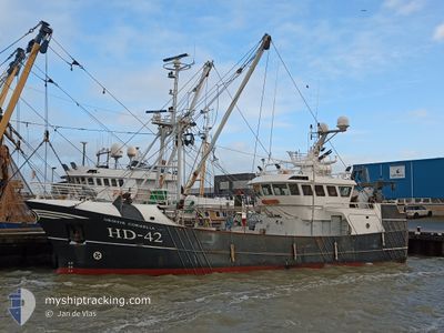
HD42 GRIETJECORNELIA
Fishing
Current Trip
| Time Travelled | 14 days |
|---|---|
| Remaining Time | --- |
| Distance Travelled | 309.89 nm |
| Remaining Distance | --- |
| AVG Speed | 5 Knots |
| MAX Speed | 9.9 Knots |
| AVG Wind | 16 knots |
| MAX Wind | 28.9 knots |
| MIN Temp | 4.9°C / 40.82°F |
| MAX Temp | 9.6°C / 49.28°F |
| Draught | 3.2 m |
| Position Received | 8 d ago |
Current Position
| Longitude | 8.04805° |
|---|---|
| Latitude | 54.76686° |
| Status | Engaged in Fishing |
| Speed | 3.3 Knots |
| Course | 300° |
| Area | North Sea |
| Station | T-AIS |
| Position Received | 8 d ago |
Info
Information
The current position of HD42 GRIETJECORNELIA is in North Sea with coordinates 54.76686° / 8.04805° as reported on 2024-04-21 06:35 by AIS to our vessel tracker app. The vessel's current speed is 3.3 Knots
The vessel HD42 GRIETJECORNELIA (IMO: 9860001, MMSI: 245795000) is a Fishing It's sailing under the flag of [NL] Netherlands.
In this page you can find informations about the vessels current position, last detected port calls, and current voyage information. If the vessels is not in coverage by AIS you will find the latest position.
The current position of HD42 GRIETJECORNELIA is detected by our AIS receivers and we are not responsible for the reliability of the data. The last position was recorded while the vessel was in Coverage by the Ais receivers of our vessel tracking app.
The current draught of HD42 GRIETJECORNELIA as reported by AIS is 3.2 meters
Weather
| Temperature | 5.5°C / 41.9°F |
|---|---|
| Wind Speed | 13 knots |
| Direction | 75° ENE |
| Pressure | 1025.1 hPa |
| Humidity | 75.9 % |
| Cloud Coverage | 53 % |
Featured Company
Last Port Calls
| Port | Arrival | Departure | Time In Port |
|---|---|---|---|
| 2024-04-11 08:29 | 2024-04-14 22:06 | 3 d | |
| 2024-04-02 07:57 | 2024-04-03 01:23 | 17 h | |
| 2024-03-28 08:24 | 2024-04-01 16:52 | 4 d | |
| 2024-03-21 21:25 | 2024-03-24 21:43 | 3 d | |
| 2024-03-01 03:21 | 2024-03-01 22:27 | 19 h | |
| 2024-02-15 19:56 | 2024-02-25 22:10 | 10 d | |
| 2024-02-14 09:51 | 2024-02-14 17:10 | 7 h | |
| 2024-02-09 21:33 | 2024-02-10 19:20 | 21 h | |
| 2024-02-07 08:19 |
Most Visited Ports (Last year)
| Port | Arrivals | |
|---|---|---|
| 16 | ||
| 6 | ||
| 1 | ||
| 1 |
Last Trips
| Origin | Departure | Destination | Arrival | Distance | |
|---|---|---|---|---|---|
| 2024-04-03 03:23 | 2024-04-11 10:29 | 421.91 nm | |||
| 2024-04-01 18:52 | 2024-04-02 09:57 | 22.87 nm | |||
| 2024-03-24 22:43 | 2024-03-28 09:24 | 95.86 nm | |||
| 2024-03-01 23:27 | 2024-03-21 22:25 | 240.58 nm | |||
| 2024-02-25 23:10 | 2024-03-01 04:21 | 222.37 nm | |||
| 2024-02-14 18:10 | 2024-02-15 20:56 | 212.90 nm | |||
| 2024-02-10 20:20 | 2024-02-14 10:51 | 161.58 nm | |||
| 2024-02-07 09:19 | 2024-02-09 22:33 | 98.21 nm |
Events
| Time | Event | Details | Position / Dest | Info |
|---|---|---|---|---|
| 2024-04-21 06:35 | OUT of Coverage |
54.76686 / 8.04805
North Sea
|
Speed: 3.3 kn Course: 296.2° |
|
| 2024-04-21 05:19 | IN Coverage |
54.73922 / 8.06022
North Sea
|
Speed: 3.5 kn Course: 165.7° |
|
| 2024-04-20 18:17 | OUT of Coverage |
55.07481 / 8.19529
North Sea
|
Speed: 2.8 kn Course: 316.3° |
|
| 2024-04-20 16:37 | Change Sea Area | German part of the North Sea Danish part of the North Sea |
55.07102 / 8.19818
North Sea
|
Speed: 3.5 kn Course: 139.8° |
| 2024-04-20 15:35 | Change Sea Area | Danish part of the North Sea German part of the North Sea |
55.06802 / 8.28965
North Sea
|
Speed: 3.6 kn Course: 329.6° |
| 2024-04-20 15:08 | IN Coverage |
55.05704 / 8.26138
North Sea
|
Speed: 3.4 kn Course: 92.9° |
|
| 2024-04-20 13:20 | OUT of Coverage |
55.04660 / 8.28563
North Sea
|
Speed: 3.4 kn Course: 142° |
|
| 2024-04-20 09:20 | Change Sea Area | German part of the North Sea Danish part of the North Sea |
55.06692 / 8.27586
North Sea
|
Speed: 3.3 kn Course: 114.9° |
| 2024-04-20 09:02 | Change Sea Area | Danish part of the North Sea German part of the North Sea |
55.07381 / 8.25061
North Sea
|
Speed: 3.3 kn Course: 113.1° |
| 2024-04-20 09:01 | IN Coverage |
55.07381 / 8.25061
North Sea
|
Speed: 3.3 kn Course: 113.1° |