
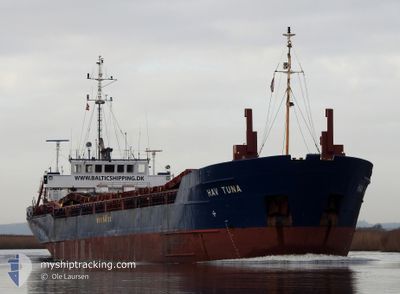
HAV TUNA
General Cargo
Current Trip
PLDAR
| Time Travelled | 18 h, 35 mins |
|---|---|
| Remaining Time | --- |
| Distance Travelled | 1.14 nm |
| Remaining Distance | --- |
| AVG Speed | --- |
| MAX Speed | --- |
| AVG Wind | 11.8 knots |
| MAX Wind | 12.8 knots |
| MIN Temp | -3.8°C / 25.16°F |
| MAX Temp | -2.8°C / 26.96°F |
| Draught | 4 m |
| Position Received | 2 d ago |
Current Position
| Longitude | --- |
|---|---|
| Latitude | --- |
| Status | Under way using engine |
| Speed | 9.5 Knots |
| Course | 111.2° |
| Area | Kattegat |
| Station | T-AIS |
| Position Received | 2 d ago |
Info
Information
The current position of HAV TUNA is in Kattegat with coordinates 54.91892° / 14.26858° as reported on 2026-01-06 20:11 by AIS to our vessel tracker app. The vessel's current speed is 9.5 Knots
The vessel HAV TUNA (IMO: 9084487, MMSI: 304717000) is a General Cargo that was built in 1993 ( 33 years old ). It's sailing under the flag of [AG] Antigua Barbuda.
In this page you can find informations about the vessels current position, last detected port calls, and current voyage information. If the vessels is not in coverage by AIS you will find the latest position.
The current position of HAV TUNA is detected by our AIS receivers and we are not responsible for the reliability of the data. The last position was recorded while the vessel was in Coverage by the Ais receivers of our vessel tracking app.
The current draught of HAV TUNA as reported by AIS is 4 meters
Weather
| Temperature | -3.3°C / 26.06°F |
|---|---|
| Wind Speed | 14 knots |
| Direction | 99° E |
| Pressure | 1009.6 hPa |
| Humidity | 81.5 % |
| Cloud Coverage | 8 % |
Featured Company
Last Port Calls
| Port | Arrival | Departure | Time In Port |
|---|---|---|---|
| 2026-01-07 08:19 | 2026-01-08 13:45 | 1 d | |
| 2026-01-06 10:23 | 2026-01-06 12:59 | 2 h | |
| 2026-01-02 13:51 | 2026-01-05 22:21 | 3 d | |
| 2025-12-24 14:49 | 2025-12-30 19:13 | 6 d | |
| 2025-12-21 19:14 | 2025-12-23 12:12 | 1 d | |
| 2025-12-15 05:25 | 2025-12-17 09:05 | 2 d | |
| 2025-12-12 01:16 | 2025-12-12 16:54 | 15 h | |
| 2025-12-10 23:18 | 2025-12-11 15:48 | 16 h | |
| 2025-12-09 04:44 | 2025-12-10 12:08 | 1 d | |
| 2025-12-07 09:57 | 2025-12-08 15:29 | 1 d |
Last Trips
| Origin | Departure | Destination | Arrival | Distance | |
|---|---|---|---|---|---|
| 2026-01-06 12:59 | 2026-01-07 08:19 | 164.01 nm | |||
| 2026-01-05 22:21 | 2026-01-06 10:23 | 115.40 nm | |||
| 2025-12-30 19:13 | 2026-01-02 13:51 | 80.58 nm | |||
| 2025-12-23 12:12 | 2025-12-24 14:49 | 266.18 nm | |||
| 2025-12-17 09:05 | 2025-12-21 19:14 | 785.05 nm | |||
| 2025-12-12 16:54 | 2025-12-15 05:25 | 339.72 nm | |||
| 2025-12-11 15:48 | 2025-12-12 01:16 | 100.74 nm | |||
| 2025-12-10 12:08 | 2025-12-10 23:18 | 114.14 nm | |||
| 2025-12-08 15:29 | 2025-12-09 04:44 | 114.98 nm | |||
| 2025-12-05 03:10 | 2025-12-07 09:57 | 314.57 nm |
Events
| Time | Event | Details | Position / Dest | Info |
|---|---|---|---|---|
| 2026-01-08 12:45 | PORT DEPARTURE |
|
54.45833 / 16.36167
PLDAR
|
Speed: 5 kn Course: -1° |
| 2026-01-08 07:55 | START Moving |
54.43667 / 16.38500
[PL] DARLOWO
|
Speed: 5 kn Course: -1° |
|
| 2026-01-07 07:44 | STOP Moving |
54.42333 / 16.39667
[PL] DARLOWO
|
Speed: Course: -1° |
|
| 2026-01-07 07:19 | PORT ARRIVAL |
|
54.42667 / 16.39500
[PL] DARLOWO
|
Speed: 2 kn Course: -1° |
| 2026-01-07 06:23 | START Moving | 2.53 nm, North West of DARLOWO |
54.45667 / 16.30833
PLDAR
|
Speed: 4 kn Course: -1° |
| 2026-01-07 06:07 | STOP Moving | 3.13 nm, North West of DARLOWO |
54.46167 / 16.29333
PLDAR
|
Speed: Course: -1° |
| 2026-01-06 20:17 | Status Changed | Default Under way using engine |
54.91378 / 14.29139
PLDAR
|
Speed: 9.5 kn Course: 111.2° |
| 2026-01-06 20:11 | OUT of Coverage |
54.91892 / 14.26858
Kattegat
PLDAR
|
Speed: 9.5 kn Course: 111.2° |
|
| 2026-01-06 20:09 | Status Changed | Under way using engine Default |
54.92070 / 14.26076
PLDAR
|
Speed: 9.5 kn Course: 111° |
| 2026-01-06 19:41 | Status Changed | Default Under way using engine |
54.94793 / 14.13718
PLDAR
|
Speed: 9.6 kn Course: 109.8° |