
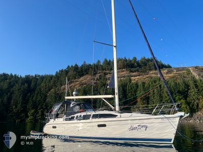
HARMONY
Sailing
Current Trip
| Trip Time | 7 h, 20 mins |
|---|---|
| Trip Distance | 39.08 nm |
| AVG Speed | 5.5 Knots |
| MAX Speed | 8.1 Knots |
| Draught | --- |
| AVG Wind | 9.2 knots |
| MAX Wind | 11 knots |
| MIN Temp | 12.8°C / 55.04°F |
| MAX Temp | 15.9°C / 60.62°F |
| Position Received | 5 d ago |
Current Position
| Longitude | -123.13161° |
|---|---|
| Latitude | 49.29605° |
| Status | Default |
| Speed | |
| Course | 55° |
| Area | The Coastal Waters of Southeast Alaska and British Columbia |
| Station | T-AIS |
| Position Received | 5 d ago |
Info
Information
The current position of HARMONY is in The Coastal Waters of Southeast Alaska and British Columbia with coordinates 49.29605° / -123.13161° as reported on 2024-09-13 23:20 by AIS to our vessel tracker app. The vessel's current speed is 0 Knots and is currently inside the port of VANCOUVER.
The vessel HARMONY (MMSI: 316046556) is a Sailing It's sailing under the flag of [CA] Canada.
In this page you can find informations about the vessels current position, last detected port calls, and current voyage information. If the vessels is not in coverage by AIS you will find the latest position.
The current position of HARMONY is detected by our AIS receivers and we are not responsible for the reliability of the data. The last position was recorded while the vessel was in Coverage by the Ais receivers of our vessel tracking app.
Weather
| Temperature | 15.2°C / 59.36°F |
|---|---|
| Wind Speed | 6 knots |
| Direction | 151° SSE |
| Pressure | 1013.7 hPa |
| Humidity | 78.8 % |
| Cloud Coverage | 100 % |
Featured Company
Most Visited Ports (Last year)
| Port | Arrivals | |
|---|---|---|
| 22 | ||
| 3 | ||
| 1 | ||
| 1 |
Last Trips
Events
| Time | Event | Details | Position / Dest | Info |
|---|---|---|---|---|
| 2024-09-13 23:20 | OUT of Coverage |
49.29605 / -123.13161
The Coastal Waters of Southeast Alaska and British Columbia
[CA] VANCOUVER
|
Speed: Course: 269.3° |
|
| 2024-09-13 20:48 | STOP Moving |
49.29504 / -123.13044
[CA] VANCOUVER
|
Speed: 0.3 kn Course: 298° |
|
| 2024-09-13 20:48 | PORT ARRIVAL |
|
49.29504 / -123.13044
[CA] VANCOUVER
|
Speed: 3.4 kn Course: 312° |
| 2024-09-13 16:46 | Detected in Sea | Canadian part of the The Coastal Waters of Southeast Alaska and British Columbia |
49.06960 / -123.34631
The Coastal Waters of Southeast Alaska and British Columbia
|
Speed: 6 kn Course: 336.3° |
| 2024-09-13 15:49 | Change Sea Area | United States part of the The Coastal Waters of Southeast Alaska and British Columbia Canadian part of the The Coastal Waters of Southeast Alaska and British Columbia |
48.99268 / -123.30715
The Coastal Waters of Southeast Alaska and British Columbia
|
Speed: 4.8 kn Course: 273.1° |
| 2024-09-13 13:28 | PORT DEPARTURE |
|
48.80160 / -123.32499
|
Speed: 5.1 kn Course: 271° |
| 2024-09-13 13:23 | IN Coverage |
48.79875 / -123.31549
The Coastal Waters of Southeast Alaska and British Columbia
[CA] OTTER BAY
|
Speed: 5.1 kn Course: 278.4° |