
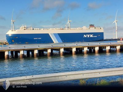
HARMONY LEADER
Cargo
Current Trip
| Time Travelled | 4 days |
|---|---|
| Remaining Time | --- |
| Distance Travelled | 1615.01 nm |
| Remaining Distance | --- |
| AVG Speed | 15.2 Knots |
| MAX Speed | 19.1 Knots |
| AVG Wind | 10.1 knots |
| MAX Wind | 29 knots |
| MIN Temp | 18.6°C / 65.48°F |
| MAX Temp | 30.1°C / 86.18°F |
| Draught | 8 m |
| Position Received | 3 d ago |
Current Position
| Longitude | -68.99153° |
|---|---|
| Latitude | 39.71625° |
| Status | Under way using engine |
| Speed | 17.7 Knots |
| Course | 180.3° |
| Area | North Atlantic Ocean |
| Station | T-AIS |
| Position Received | 3 d ago |
Info
Information
The current position of HARMONY LEADER is in North Atlantic Ocean with coordinates 39.71625° / -68.99153° as reported on 2024-09-14 09:00 by AIS to our vessel tracker app. The vessel's current speed is 17.7 Knots and is heading at the port of CRISTOBAL.
The vessel HARMONY LEADER (MMSI: 311040800) is a Cargo It's sailing under the flag of [BS] Bahamas.
In this page you can find informations about the vessels current position, last detected port calls, and current voyage information. If the vessels is not in coverage by AIS you will find the latest position.
The current position of HARMONY LEADER is detected by our AIS receivers and we are not responsible for the reliability of the data. The last position was recorded while the vessel was in Coverage by the Ais receivers of our vessel tracking app.
The current draught of HARMONY LEADER as reported by AIS is 8 meters
Weather
| Temperature | --- |
|---|---|
| Wind Speed | --- |
| Direction | --- |
| Pressure | --- |
| Humidity | --- |
| Cloud Coverage | --- |
Featured Company
Last Port Calls
| Port | Arrival | Departure | Time In Port |
|---|---|---|---|
| 2024-09-13 09:12 | 2024-09-13 21:07 | 11 h | |
| 2024-09-12 09:51 | 2024-09-12 21:22 | 11 h | |
| 2024-09-10 00:10 | 2024-09-10 19:56 | 19 h | |
| 2024-09-07 00:08 | 2024-09-07 17:26 | 17 h | |
| 2024-08-11 06:41 | |||
| 2024-08-08 22:42 | 2024-08-09 07:09 | 8 h | |
| 2024-08-07 21:53 | 2024-08-08 08:41 | 10 h | |
| 2024-07-25 12:15 | 2024-07-26 00:18 | 12 h | |
| 2024-07-24 11:42 | 2024-07-24 21:09 | 9 h | |
| 2024-07-23 13:32 | 2024-07-24 00:11 | 10 h |
Most Visited Ports (Last year)
| Port | Arrivals | |
|---|---|---|
| 4 | ||
| 3 | ||
| 3 | ||
| 3 | ||
| 3 | ||
| 2 |
Last Trips
| Origin | Departure | Destination | Arrival | Distance | |
|---|---|---|---|---|---|
| 2024-09-12 17:22 | 2024-09-13 05:12 | 117.75 nm | |||
| 2024-09-10 15:56 | 2024-09-12 05:51 | 379.62 nm | |||
| 2024-09-07 13:26 | 2024-09-09 20:10 | 695.68 nm | |||
| 2024-08-11 15:41 | 2024-09-06 20:08 | 9252.52 nm | |||
| 2024-08-08 17:41 | 2024-08-09 07:42 | 135.78 nm | |||
| 2024-07-25 17:18 | 2024-08-08 06:53 | 5144.07 nm | |||
| 2024-07-24 14:09 | 2024-07-25 05:15 | 92.17 nm | |||
| 2024-07-23 17:11 | 2024-07-24 04:42 | 80.92 nm | |||
| 2024-06-28 18:26 | 2024-07-23 06:32 | 7681.65 nm |
Events
| Time | Event | Details | Position / Dest | Info |
|---|---|---|---|---|
| 2024-09-14 09:04 | Status Changed | Default Under way using engine |
39.69655 / -68.99139
PA CTB
|
Speed: 17.7 kn Course: 180.3° |
| 2024-09-14 09:00 | Status Changed | Under way using engine Default |
39.71625 / -68.99153
PA CTB
|
Speed: 17.7 kn Course: 180° |
| 2024-09-14 09:00 | OUT of Coverage |
39.71625 / -68.99153
North Atlantic Ocean
|
Speed: 17.7 kn Course: 180.3° |
|
| 2024-09-14 08:44 | Status Changed | Default Under way using engine |
39.79481 / -68.99276
PA CTB
|
Speed: 17.7 kn Course: 177.3° |
| 2024-09-14 08:32 | Status Changed | Under way using engine Default |
39.85613 / -68.99595
PA CTB
|
Speed: 18.3 kn Course: 179° |
| 2024-09-14 08:31 | IN Coverage |
39.84199 / -68.99537
North Atlantic Ocean
|
Speed: 18 kn Course: 178° |
|
| 2024-09-14 07:30 | Status Changed | Default Under way using engine |
40.16758 / -68.99738
PA CTB
|
Speed: 17.8 kn Course: 181.3° |
| 2024-09-14 07:24 | OUT of Coverage |
40.19679 / -68.99675
North Atlantic Ocean
|
Speed: 17.8 kn Course: 181.3° |
|
| 2024-09-14 07:09 | Status Changed | Under way using engine Default |
40.27202 / -68.99517
PA CTB
|
Speed: 17.6 kn Course: 180° |
| 2024-09-14 06:55 | Status Changed | Default Under way using engine |
40.34064 / -68.99429
PA CTB
|
Speed: 17.8 kn Course: 178.4° |