
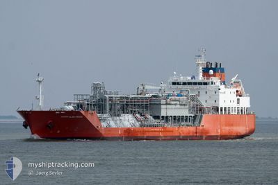
HAPPY ALBATROSS
Tanker D
Current Trip
| Time Travelled | 10 h, 15 mins |
|---|---|
| Remaining Time | --- |
| Distance Travelled | 41.89 nm |
| Remaining Distance | 2.17 nm |
| AVG Speed | 10.1 Knots |
| MAX Speed | 14.2 Knots |
| AVG Wind | 19.4 knots |
| MAX Wind | 21.8 knots |
| MIN Temp | 10.1°C / 50.18°F |
| MAX Temp | 13.4°C / 56.12°F |
| Draught | 5.8 m |
| Position Received | 3 m ago |
Current Position
| Longitude | 10.65584° |
|---|---|
| Latitude | 57.69927° |
| Status | At anchor |
| Speed | |
| Course | 74° |
| Area | Kattegat |
| Station | T-AIS |
| Position Received | 3 m ago |
Info
Information
The current position of HAPPY ALBATROSS is in Kattegat with coordinates 57.69927° / 10.65584° as reported on 2024-05-02 14:52 by AIS to our vessel tracker app. The vessel's current speed is 0 Knots and is heading at the port of SKAGEN. The estimated time of arrival as calculated by MyShipTracking vessel tracking app is 2024-05-02 11:30 LT
The vessel HAPPY ALBATROSS (IMO: 9675066, MMSI: 219287000) is a Tanker D It's sailing under the flag of [DK] Denmark.
In this page you can find informations about the vessels current position, last detected port calls, and current voyage information. If the vessels is not in coverage by AIS you will find the latest position.
The current position of HAPPY ALBATROSS is detected by our AIS receivers and we are not responsible for the reliability of the data. The last position was recorded while the vessel was in Coverage by the Ais receivers of our vessel tracking app.
The current draught of HAPPY ALBATROSS as reported by AIS is 5.8 meters
Weather
| Temperature | 13.4°C / 56.12°F |
|---|---|
| Wind Speed | 20 knots |
| Direction | 53° NE |
| Pressure | 1013.7 hPa |
| Humidity | 68.4 % |
| Cloud Coverage | 100 % |
Featured Company
Last Port Calls
| Port | Arrival | Departure | Time In Port |
|---|---|---|---|
| 2024-04-19 11:42 | 2024-05-02 04:40 | 12 d | |
| 2024-04-17 06:38 | 2024-04-18 13:50 | 1 d | |
| 2024-03-20 12:42 | 2024-03-21 08:20 | 19 h |
Most Visited Ports (Last year)
| Port | Arrivals | |
|---|---|---|
| 4 | ||
| 3 | ||
| 2 | ||
| 2 | ||
| 2 | ||
| 1 |
Last Trips
| Origin | Departure | Destination | Arrival | Distance | |
|---|---|---|---|---|---|
| 2024-04-18 15:50 | 2024-04-19 13:42 | 94.04 nm | |||
| 2024-03-21 04:20 | 2024-04-17 08:38 | 4341.83 nm | |||
| 2024-02-27 23:54 | 2024-03-20 08:42 | 5041.86 nm |
Events
| Time | Event | Details | Position / Dest | Info |
|---|---|---|---|---|
| 2024-05-02 11:00 | STOP Moving | 2.09 nm, South East of SKAGEN |
57.69977 / 10.65560
SKAW
|
Speed: 0.1 kn Course: 90° |
| 2024-05-02 10:58 | Status Changed | At anchor Under way using engine |
57.69964 / 10.65592
SKAW
|
Speed: 1.1 kn Course: 62° |
| 2024-05-02 06:53 | START Moving | 2.04 nm, East of FREDERIKSHAVN |
57.42307 / 10.60658
SKAW
|
Speed: 4.2 kn Course: 55° |
| 2024-05-02 06:50 | Status Changed | Under way using engine At anchor |
57.42135 / 10.60211
SKAW
|
Speed: 0.4 kn Course: 55° |
| 2024-05-02 05:10 | Status Changed | At anchor Under way using engine |
57.42193 / 10.60218
SKAW
|
Speed: 1 kn Course: 77° |
| 2024-05-02 05:05 | STOP Moving | 1.98 nm, South East of FREDERIKSHAVN |
57.42201 / 10.60383
SKAW
|
Speed: 0.2 kn Course: 67° |
| 2024-05-02 04:40 | PORT DEPARTURE |
|
57.43158 / 10.55621
SKAW
|
Speed: 5.6 kn Course: 134° |
| 2024-05-02 04:35 | START Moving |
57.43528 / 10.54698
[DK] FREDERIKSHAVN
|
Speed: 3.1 kn Course: 115° |
|
| 2024-05-02 04:20 | Status Changed | Under way using engine Moored |
57.43799 / 10.54507
[DK] FREDERIKSHAVN
|
Speed: Course: 316° |
| 2024-05-02 03:32 | Status Changed | Moored Default |
57.43850 / 10.54443
[DK] FREDERIKSHAVN
|
Speed: Course: 316° |