
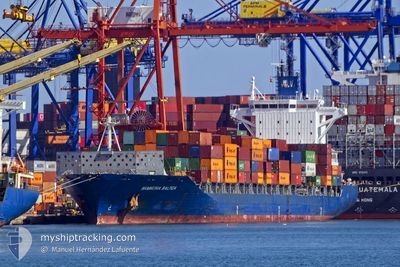
HAMMONIA BALTICA
Container Ship
Current Trip
| Time Travelled | 15 days |
|---|---|
| Remaining Time | --- |
| Distance Travelled | 5722.76 nm |
| Remaining Distance | --- |
| AVG Speed | 14.1 Knots |
| MAX Speed | 17.2 Knots |
| AVG Wind | 16.6 knots |
| MAX Wind | 36.5 knots |
| MIN Temp | 11.3°C / 52.34°F |
| MAX Temp | 25.1°C / 77.18°F |
| Draught | 8.9 m |
| Position Received | 4 h, 56 m ago |
Current Position
| Longitude | 31.65058° |
|---|---|
| Latitude | 31.67523° |
| Status | At anchor |
| Speed | |
| Course | 311° |
| Area | Mediterranean Sea - Eastern Basin |
| Station | T-AIS |
| Position Received | 4 h, 56 m ago |
Info
Information
The current position of HAMMONIA BALTICA is in Mediterranean Sea - Eastern Basin with coordinates 31.67523° / 31.65058° as reported on 2024-04-27 05:50 by AIS to our vessel tracker app. The vessel's current speed is 0 Knots
The vessel HAMMONIA BALTICA (IMO: 9481532, MMSI: 636092181) is a Container Ship that was built in 2011 ( 13 years old ). It's sailing under the flag of [LR] Liberia.
In this page you can find informations about the vessels current position, last detected port calls, and current voyage information. If the vessels is not in coverage by AIS you will find the latest position.
The current position of HAMMONIA BALTICA is detected by our AIS receivers and we are not responsible for the reliability of the data. The last position was recorded while the vessel was in Coverage by the Ais receivers of our vessel tracking app.
The current draught of HAMMONIA BALTICA as reported by AIS is 8.9 meters
Weather
| Temperature | 19.1°C / 66.38°F |
|---|---|
| Wind Speed | 14 knots |
| Direction | 319° NW |
| Pressure | 1012.1 hPa |
| Humidity | 73.3 % |
| Cloud Coverage | 61 % |
Featured Company
Last Port Calls
| Port | Arrival | Departure | Time In Port |
|---|---|---|---|
| 2024-04-10 11:53 | 2024-04-11 11:07 | 23 h | |
| 2024-04-08 07:53 | 2024-04-09 01:19 | 17 h | |
| 2024-04-06 08:39 | 2024-04-07 02:00 | 17 h | |
| 2024-03-25 09:28 | 2024-03-25 23:42 | 14 h | |
| 2024-03-20 16:16 | 2024-03-22 05:16 | 1 d | |
| 2024-03-17 06:06 | 2024-03-18 03:19 | 21 h | |
| 2024-03-15 19:12 | 2024-03-16 10:57 | 15 h | |
| 2024-03-12 08:03 | 2024-03-13 17:49 | 1 d | |
| 2024-02-19 00:32 | 2024-02-20 06:07 | 1 d | |
| 2024-02-15 08:05 | 2024-02-15 22:48 | 14 h |
Last Trips
| Origin | Departure | Destination | Arrival | Distance | |
|---|---|---|---|---|---|
| 2024-04-08 21:19 | 2024-04-10 07:53 | 489.33 nm | |||
| 2024-04-06 22:00 | 2024-04-08 03:53 | 289.87 nm | |||
| 2024-03-25 23:42 | 2024-04-06 04:39 | 3021.02 nm | |||
| 2024-03-22 06:16 | 2024-03-25 09:28 | 1316.51 nm | |||
| 2024-03-18 06:19 | 2024-03-20 17:16 | 820.45 nm | |||
| 2024-03-16 13:57 | 2024-03-17 09:06 | 303.65 nm | |||
| 2024-03-13 20:49 | 2024-03-15 22:12 | 839.67 nm | |||
| 2024-02-20 01:07 | 2024-03-12 11:03 | 6012.85 nm | |||
| 2024-02-15 17:48 | 2024-02-18 19:32 | 500.51 nm | |||
| 2024-02-12 23:40 | 2024-02-15 03:05 | 290.76 nm |
Events
| Time | Event | Details | Position / Dest | Info |
|---|---|---|---|---|
| 2024-04-27 05:53 | Status Changed | Default At anchor |
31.67514 / 31.65038
DAMIETTA
|
Speed: Course: 311° |
| 2024-04-27 05:50 | Status Changed | At anchor Default |
31.67523 / 31.65058
DAMIETTA
|
Speed: Course: 323° |
| 2024-04-27 05:50 | OUT of Coverage |
31.67523 / 31.65058
Mediterranean Sea - Eastern Basin
DAMIETTA
|
Speed: Course: 44.2° |
|
| 2024-04-27 05:32 | IN Coverage |
31.67523 / 31.65058
Mediterranean Sea - Eastern Basin
DAMIETTA
|
Speed: Course: 44.2° |
|
| 2024-04-27 04:19 | STOP Moving | 13.62 nm, North West of DAMIETTA |
31.67548 / 31.65089
DAMIETTA
|
Speed: 0.1 kn Course: 304° |
| 2024-04-26 22:12 | Status Changed | Default Under way using engine |
32.44664 / 30.50154
DAMIETTA
|
Speed: 15.4 kn Course: 111° |
| 2024-04-26 22:04 | OUT of Coverage |
32.46006 / 30.46153
Mediterranean Sea - Eastern Basin
DAMIETTA
|
Speed: 15.4 kn Course: 111° |
|
| 2024-04-26 21:33 | Status Changed | Under way using engine Default |
32.50890 / 30.31506
DAMIETTA
|
Speed: 15.3 kn Course: 111° |
| 2024-04-26 21:18 | IN Coverage |
32.50559 / 30.32499
Mediterranean Sea - Eastern Basin
DAMIETTA
|
Speed: 15.4 kn Course: 110.8° |
|
| 2024-04-26 19:35 | OUT of Coverage |
32.69042 / 29.75997
Mediterranean Sea - Eastern Basin
DAMIETTA
|
Speed: 15.4 kn Course: 107.8° |