
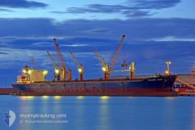
GULMAR
Bulk Carrier
Current Trip
EGALY
| Time Travelled | 1 day |
|---|---|
| Remaining Time | --- |
| Distance Travelled | 8.14 nm |
| Remaining Distance | --- |
| AVG Speed | 5 Knots |
| MAX Speed | 8.2 Knots |
| AVG Wind | 11.8 knots |
| MAX Wind | 18 knots |
| MIN Temp | 18.8°C / 65.84°F |
| MAX Temp | 20.1°C / 68.18°F |
| Draught | 11 m |
| Position Received | 1 h, 16 m ago |
Current Position
| Longitude | 29.75875° |
|---|---|
| Latitude | 31.21728° |
| Status | Under way using engine |
| Speed | |
| Course | 1° |
| Area | Mediterranean Sea - Eastern Basin |
| Station | T-AIS |
| Position Received | 1 h, 16 m ago |
Info
Information
The current position of GULMAR is in Mediterranean Sea - Eastern Basin with coordinates 31.21728° / 29.75875° as reported on 2024-05-08 01:16 by AIS to our vessel tracker app. The vessel's current speed is 0 Knots
The vessel GULMAR (IMO: 9146962, MMSI: 271045741) is a Bulk Carrier that was built in 1997 ( 27 years old ). It's sailing under the flag of [TR] Turkey.
In this page you can find informations about the vessels current position, last detected port calls, and current voyage information. If the vessels is not in coverage by AIS you will find the latest position.
The current position of GULMAR is detected by our AIS receivers and we are not responsible for the reliability of the data. The last position was recorded while the vessel was in Coverage by the Ais receivers of our vessel tracking app.
The current draught of GULMAR as reported by AIS is 11 meters
Weather
| Temperature | 19.3°C / 66.74°F |
|---|---|
| Wind Speed | 6 knots |
| Direction | 87° E |
| Pressure | 1015.8 hPa |
| Humidity | 55.8 % |
| Cloud Coverage | 9 % |
Featured Company
Last Port Calls
| Port | Arrival | Departure | Time In Port |
|---|---|---|---|
| 2024-05-05 20:29 | 2024-05-06 15:00 | 18 h | |
| 2024-05-02 17:47 | 2024-05-02 19:05 | 1 h | |
| 2024-04-26 13:14 | |||
| 2024-04-21 14:22 | 2024-04-21 15:48 | 1 h | |
| 2024-04-14 07:34 | 2024-04-17 12:16 | 3 d | |
| 2024-04-10 23:09 | 2024-04-11 00:21 | 1 h | |
| 2024-04-05 19:46 | |||
| 2024-04-05 07:16 | 2024-04-05 19:34 | 12 h | |
| 2024-04-03 04:17 | 2024-04-05 06:59 | 2 d | |
| 2024-03-28 08:47 | 2024-03-28 10:13 | 1 h |
Last Trips
| Origin | Departure | Destination | Arrival | Distance | |
|---|---|---|---|---|---|
| 2024-05-02 22:05 | 2024-05-05 22:29 | 742.85 nm | |||
| 2024-04-21 18:48 | 2024-04-26 16:14 | 372.43 nm | |||
| 2024-04-17 15:16 | 2024-04-21 17:22 | 899.95 nm | |||
| 2024-04-11 03:21 | 2024-04-14 10:34 | 844.79 nm | |||
| 2024-04-05 22:34 | 2024-04-05 22:46 | 0.52 nm | |||
| 2024-04-05 09:59 | 2024-04-05 10:16 | 6.74 nm | |||
| 2024-03-28 13:13 | 2024-04-03 07:17 | 500.76 nm | |||
| 2024-03-23 06:23 | 2024-03-28 11:47 | 912.46 nm | |||
| 2024-03-03 09:05 | 2024-03-18 23:54 | 3472.76 nm |
Events
| Time | Event | Details | Position / Dest | Info |
|---|---|---|---|---|
| 2024-05-08 01:36 | Status Changed | Default Under way using engine |
31.21703 / 29.75860
EGALY
|
Speed: Course: 1° |
| 2024-05-08 01:16 | OUT of Coverage |
31.21728 / 29.75875
Mediterranean Sea - Eastern Basin
|
Speed: Course: 287.5° |
|
| 2024-05-08 01:14 | Change Sea Area | Egyptian part of the Mediterranean Sea - Eastern Basin Greek part of the Mediterranean Sea - Eastern Basin |
31.21727 / 29.75880
Mediterranean Sea - Eastern Basin
|
Speed: 0.1 kn Course: 320.3° |
| 2024-05-08 01:14 | Status Changed | Under way using engine Default |
31.21727 / 29.75880
EGALY
|
Speed: Course: 355° |
| 2024-05-08 00:56 | IN Coverage |
31.21727 / 29.75880
Mediterranean Sea - Eastern Basin
|
Speed: 0.1 kn Course: 320.3° |
|
| 2024-05-06 17:07 | STOP Moving | 4.96 nm, North West of EL DEKHEILA |
31.21873 / 29.75904
EGALY
|
Speed: 0.2 kn Course: 312° |
| 2024-05-06 16:45 | START Moving | 3.73 nm, North West of EL DEKHEILA |
31.19567 / 29.76156
EGALY
|
Speed: 4.7 kn Course: 345° |
| 2024-05-06 16:11 | STOP Moving | 3.18 nm, North West of EL DEKHEILA |
31.18531 / 29.76414
EGALY
|
Speed: 0.3 kn Course: 288° |
| 2024-05-06 15:00 | PORT DEPARTURE |
|
31.16019 / 29.83781
EGALY
|
Speed: 7.1 kn Course: 214° |
| 2024-05-06 14:36 | START Moving |
31.19068 / 29.86991
[EG] ALEXANDRIA
|
Speed: 4 kn Course: 225° |